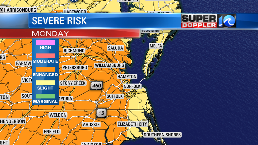
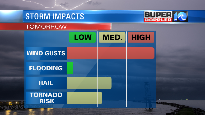
The Storm Prediction Center has much of our area in an Enhanced Risk for severe weather on Monday. What this means is that we have a fairly good chance not just to see thunderstorms, but ones that produce damaging wind gusts, hail and possibly tornadoes.
Now, the timing for these thunderstorms will be a little earlier in the day than we usually see when we have the chance to see stronger storms. The timing is in the late morning and in to the middle of the day. (The usual timing tends to be after 3 pm)
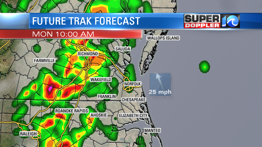
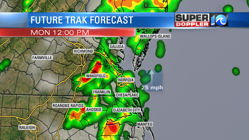
Our Future Trak has the biggest storms to our west at 10 AM, then right over us at Noon. However, we could also see a few T-Storms between 6 AM and 8 AM, so this won’t be the first chance of rain that we will see on Monday. Any individual cells that break away from the main grouping of rain have a better chance to be severe.
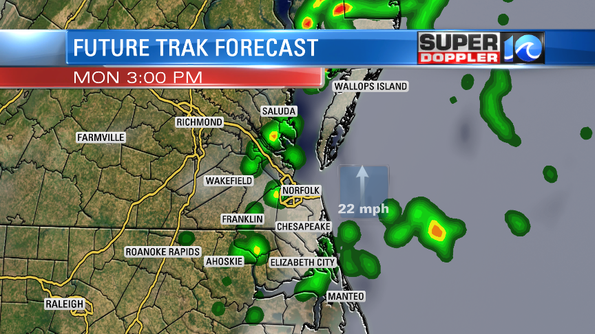
By 3 PM, these storms should be dissipating, and moving offshore. Right now, the models estimate a storm movement of close to 50 mph! So any storm that creates a wind gust ahead of it could be severe. There are also decent levels of spin that could be in the atmosphere tomorrow which gives us a slightly higher chance for tornadoes.
Even if we don’t see severe weather, we are all going to see very strong wind speeds Monday. Wind speeds will be between 20 and 30 MPH, but we could see gusts across Hampton Roads of 50 mph, and across the Eastern Shore of up to 60 mph! This could cause down trees and power outages. Charge up your smartphone tonight just in case you lose power tomorrow.
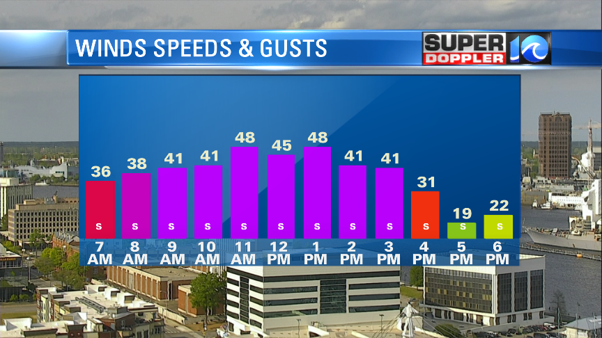
The strongest gusts should be around the middle of the day. As the storms move out, the wind should decrease in the afternoon and cooler air will return for Tuesday.
I’ll be in on our late newscasts at 10 & 11pm with the latest, Jeremy Wheeler will be tracking the storms tomorrow morning, and all of us will be working together to keep an eye as they develop and move in to our area.
Meteorologist Jeff Edmondson

