Yesterday was rough for a while. We had 2 big rounds of showers and storms in the area. The first round in the mid-late morning was pretty much just heavy rain.

Then we had quiet weather for a while. During the evening a second area of rain and storms formed and rolled over the region.
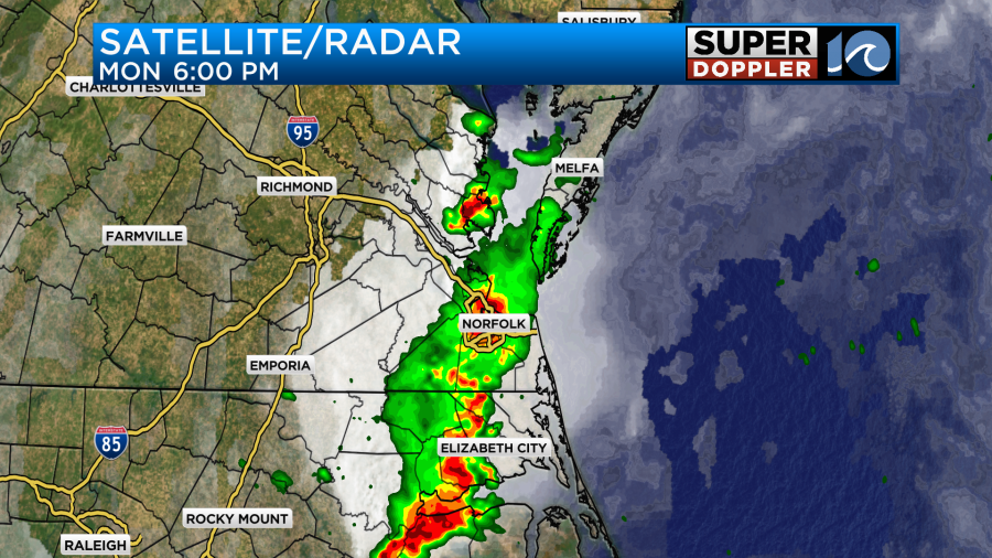
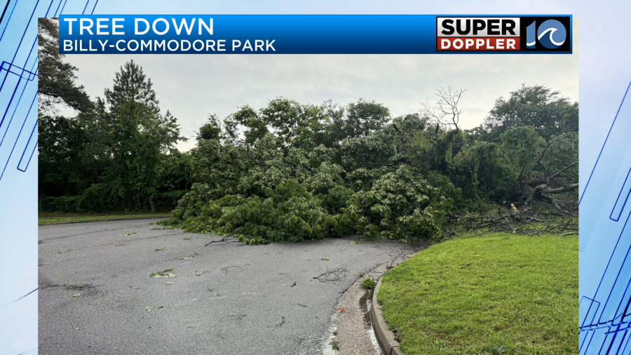
This time there was some strong damaging wind and some large hail. The hail size report was 1 inch in Gloucester. That’s big! There were also a lot of official wind damage reports around the region.
Most of the damage reports were from trees down. Here was one example sent in from William.
I didn’t see any official reports of a tornado, but I wouldn’t be surprised if the National Weather Service goes out to survey some of the damage for that possibility.
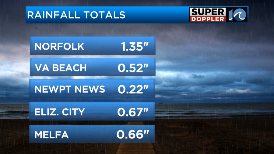
Rain was heavy in most places, but the rain was briefly heavy in some areas. It’s testament to that when you look at the rainfall totals. Here are the reports from the last 24 hours.
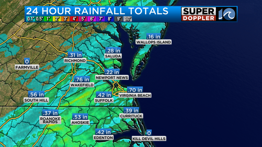
There was a strip of heavier rainfall between Southampton County and Norfolk. So Norfolk had about 1.3″.
The 48 hour rainfall was a little more impressive on the map.
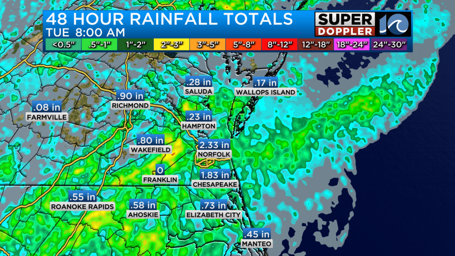
Notice the lack of rain on the Peninsula. My weather watcher in Yorktown, Scott, only had about a quarter of an inch as well. There was a small boundary near the region with a very small area of low pressure. Today both of those features have fallen apart. However, a cool front has moved in from the west. Course it is stalling out now as I write this.

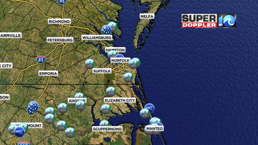
We are still going to be pretty warm and humid today, but the weather will be much quieter. We’ll be partly cloudy through the day with high temperatures rising into the mid 80s.

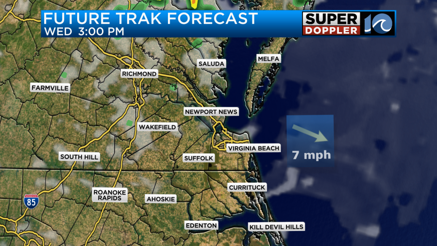
With the front in place and the humidity still up I am calling for some isolated showers or storms this afternoon. There may be an isolated strong storm over the Outer Banks or near coastal North Carolina. This area will be just south of the front. I will say that our model isn’t showing much rain today. It barely hints at anything.
It does have a little more by the evening.
Maybe a couple of the models are picking up on some drier air in the mid levels. However, I think there’s enough moisture for at least some isolated PM showers or storms.
Tomorrow the front should start to push more to the south. High temps will be more in the lower 80s. The humidity will go down just a bit more. However, an upper level low will drop in out of the Midwest tomorrow.

This feature is a large dip in the jetstream that is wrapping around the cooler air that will be moving into the area. This feature will probably cause some more isolated afternoon showers or storms.
The upper level low will be even closer on Thursday and Friday. However, by that time the temperatures will have cooled down some more. High temps will be in the 70s.

The humidity at the surface will also be dropping.
So hopefully, there won’t be much rain during that time. That is…unless, you are in an area where you still need some rain. Either way, the great news is that the weather looks really nice next weekend. It looks dry both days with seasonable temps. I’ll have more on the weekend forecast in tomorrow’s weather blog.
Meteorologist: Jeremy Wheeler


