
I stepped out the door this morning, and it was the steamiest that I’ve felt in a while. The dew point this morning was near 70 for a time. On my way into work I hit a few spotty showers. A few more areas of rain popped up later this morning. There were even a few thunderstorms and heavy downpours.
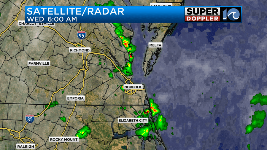
The only surface feature that was nearby was a warm front. It is currently lifting to the north.
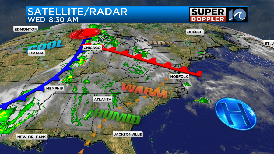
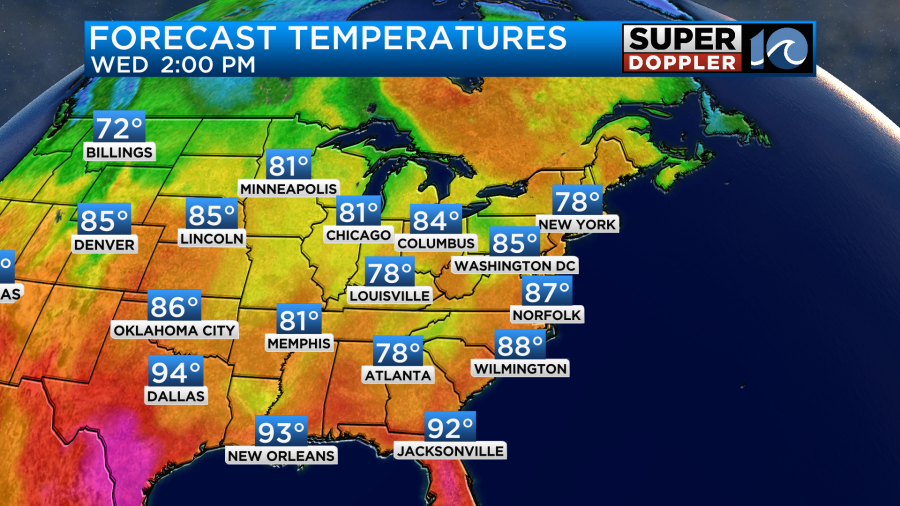
High pressure is offshore. There is a cold front far to the west. We are going to be very warm and humid through the day. High temps will rise to the mid-upper 80s.
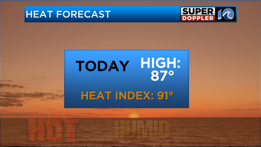
There will be a light southwest wind, but it will only run at 5-10mph. This will keep pulling in the heat and humidity. This combo will put the heat index in the low 90s this afternoon.
Be sure to stay hydrated, and make sure the kids do as well during afterschool sports.
Any showers that form between now and 1pm should be pretty isolated. However, scattered storms will form this afternoon. They will increase from the late afternoon into the evening.
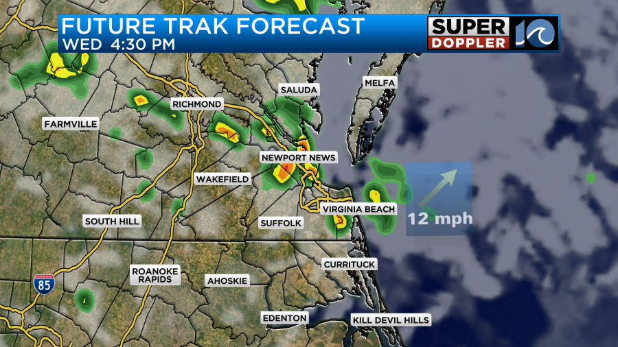
There could be a few heavy showers during the evening commute. Heavy rain will be possible in a few areas. These showers and storms should die down after about 9pm.
Tomorrow we’ll still be in the warm zone, but the cold front will steadily march in our direction. We’ll be partly cloudy with a couple of isolated showers for the first half of the day. Then clouds will increase during the afternoon. A few scattered showers and storms will form during the afternoon, but there may not be too many at first.
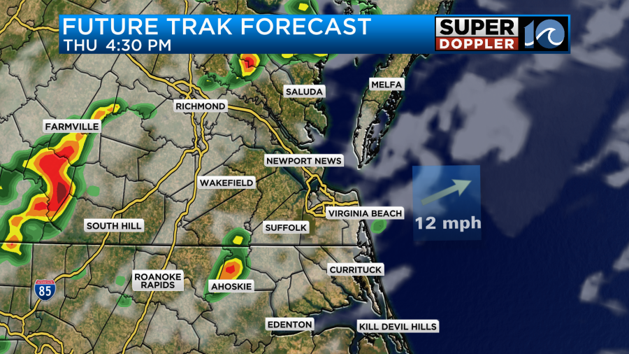
However, storms are expected to increase by the early evening as the cold front gets closer to the region.
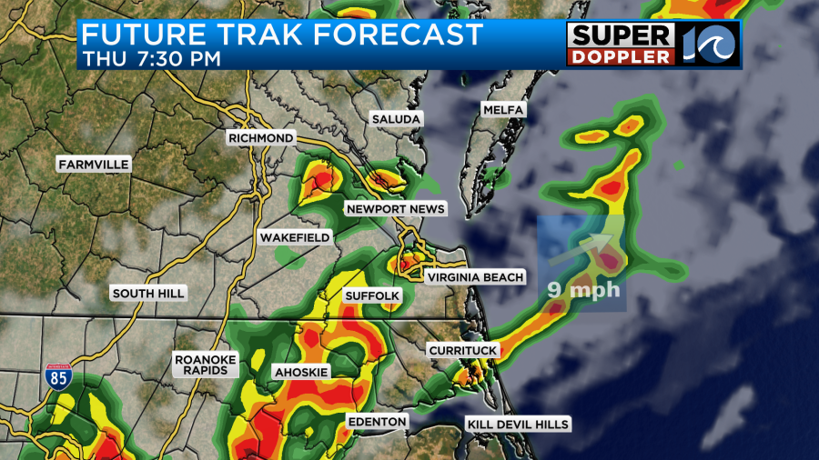
There may even be a broken line of thunderstorms during the evening along the front. Heavy rain will again be possible, but this time there may be some strong gusty winds as well. The general wind during the day will run out of the southwest at 10-15mph with gusts to 25mph. This will push the heat and humidity up some more. Dew points will be near 70. The high temps will be around 90 degrees.
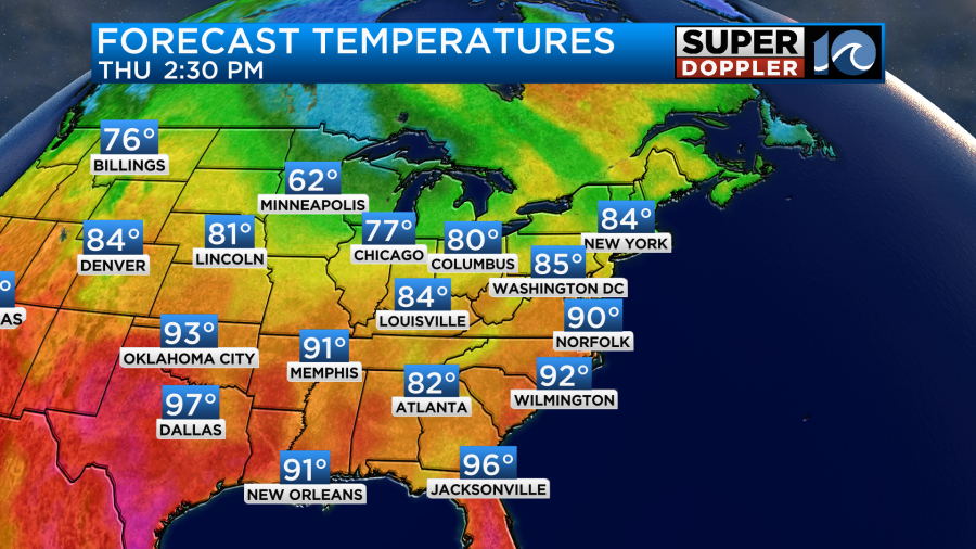
The heat index will be in the low-mid 90s Thursday. However, the stronger breeze should help a bit.
After the front swipes through we’ll have some pretty fast drying. It will still be a bit humid Friday morning, but the dew points will drop big-time during the day.
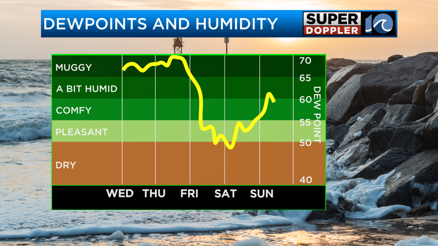
We’ll be partly cloudy on Friday. High temps will still be able to reach the mid 80s. Then we’ll be in the low 80s on Saturday with that much drier air. High temps will be in the low 80s. That should feel very nice!
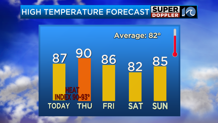
We’ll be in the mid 80s with fair skies on Sunday. The humidity will come up a bit, but it should still be comfortable.
Meteorologist: Jeremy Wheeler


