Over the next few days we’ll have fairly steady temperatures, but the humidity and rain chances will both bounce quite a bit. We started this morning with fair skies and cool temps.

We have a huge area of high pressure over the region, but now it has moved offshore.
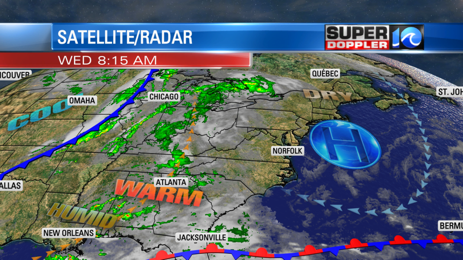
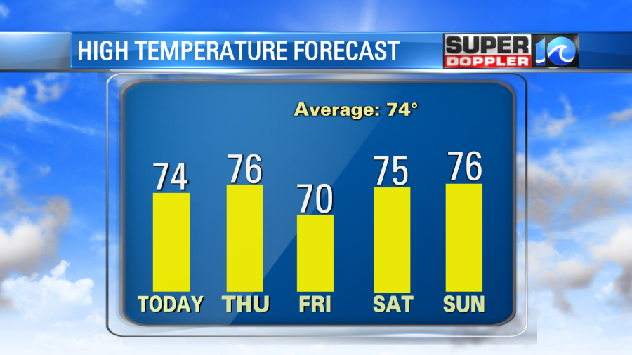
With the way the high is set up it will give us a light southeast wind today. We’ll be partly cloudy through most of the day with a little more clouds by the early evening. There may be an isolated shower or two by the evening, but it’s a low chance. High temps will rise to the mid 70s this afternoon. It should be pretty comfortable as we’ll still be dry.

By tonight the moisture will increase enough that we’ll have lots of clouds and a few spotty rain showers.
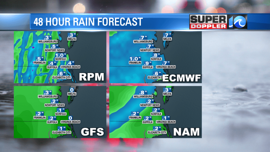
Tomorrow we’ll have mostly cloudy skies and some scattered rain showers. It doesn’t look like a washout, but the models have perked up a little on the coverage in this morning’s update. Here is what our latest Future Trak models shows for the midday and early afternoon.
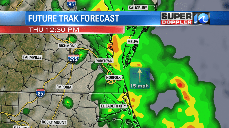
We’ll have at least scattered showers between the midday and late afternoon. It may even be a large swath of showers. There could be a few thunderstorms in the afternoon as well. High temps will be in the 70s. If we get a big area of rain, then it may be more in the low 70s or near 70. If the showers break up some then we’ll probably hit the mid 70s.
There will be a strong breeze out of the south through the day. Some of the gusts could be up to 25mph. The wind will turn out of the north behind a cold front that will swoop in by tomorrow evening. After a few more showers Thursday night, then we’ll dry out sharply.
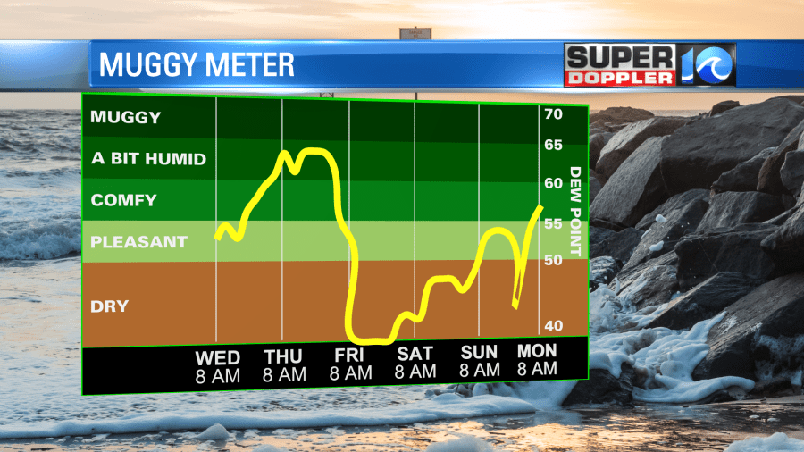
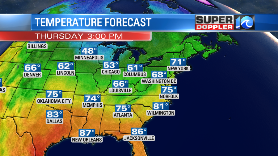
Then we’ll be mild and dry for the whole weekend. High temps will be mainly in the 70s.
We do still need some rain. The latest models are calling for about a quarter to three quarters of an inch of rainfall.
There will be another shot at a few showers early next week.
Yesterday, tropical storm Karl formed over the Bay of Campeche.
It is the only system that we are tracking in the Atlantic Basin. It is moving generally north this morning, but it will get pushed to the south by a large area of high pressure over the next couple of days. It will move towards the Vera Cruz region of Mexico in about 2-3 days.
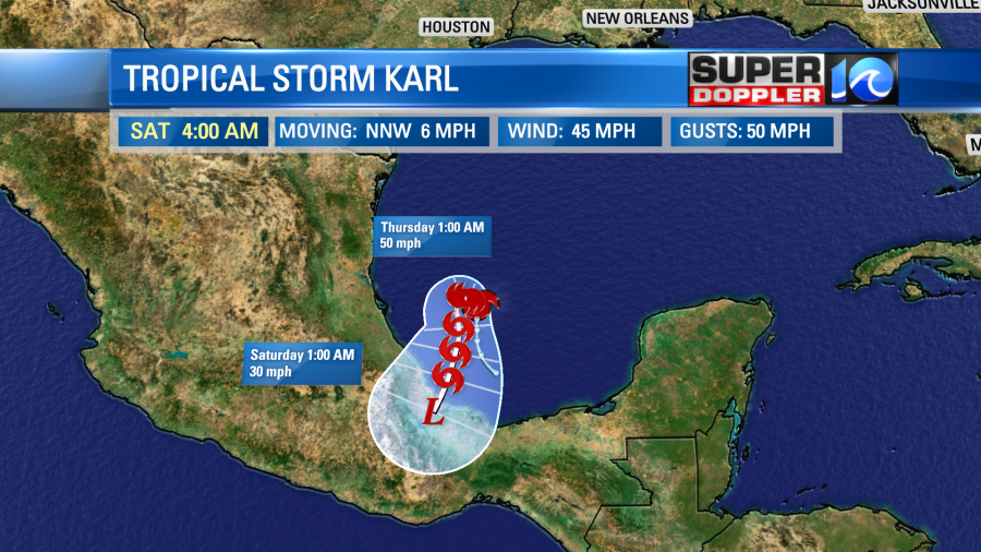
They will have some heavy rain and gusty winds over that area. Unfortunately, there may also be some mudslides down that way as the rain hits the higher terrain. It will stay south of the U.S.
Meteorologist: Jeremy Wheeler