Today we are going to transition to some warmer temperatures. These unseasonably warm temps are going to last for a few days. We still have a big area of high pressure overhead, but it is going to slide just offshore during the day.

This will let the wind turn out of the southwest, and that will be a warming wind. Though it will be light at 5-10mph. That will push our high temps up to the mid 70s this afternoon.
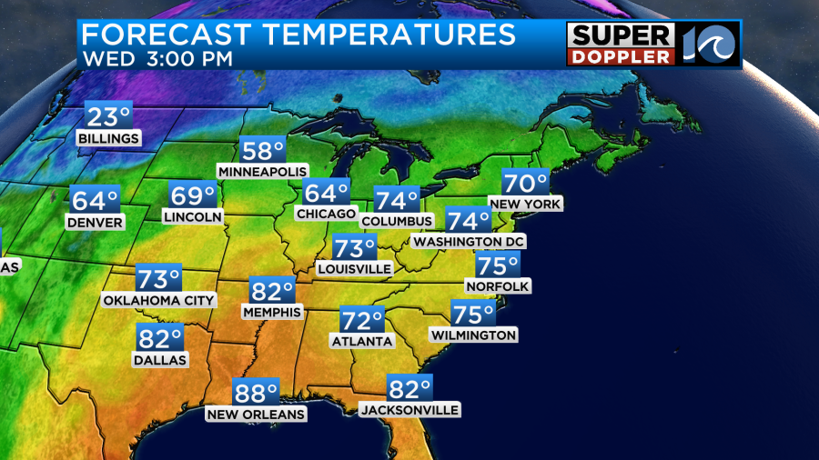
We’ll be mostly to partly sunny, and the humidity will stay low. So it is going to be a very nice day!
Tomorrow we’ll warm it up some more. We’ll have a lot of sunshine with a steady/light southwest breeze. So high temps will rise to the upper 70s to near 80.
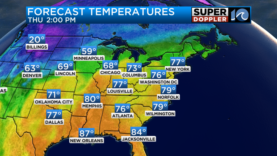
The humidity will rise a little more, but it will basically stay comfortable over the next few days.
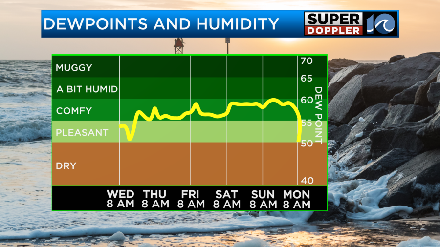
High temps will stay in the upper 70s to near 80 through the weekend. We’ll have a lot of sunshine through that time.

We’ll finally cool down early next week. Early indications are that a strong cold front will sweep through the area Monday night, and it will pull down some much cooler air for Tuesday which is Halloween. For now I have high temps in the low 60s for the holiday, but it is still early. The wind looks like it could also be pretty strong. An early guess… Gusts to 30mph. We’ll see. I’ll update you on that part of the forecast in tomorrow’s weather blog.
In the tropics…Hurricane Tammy is not only still going. It has gained some strength.
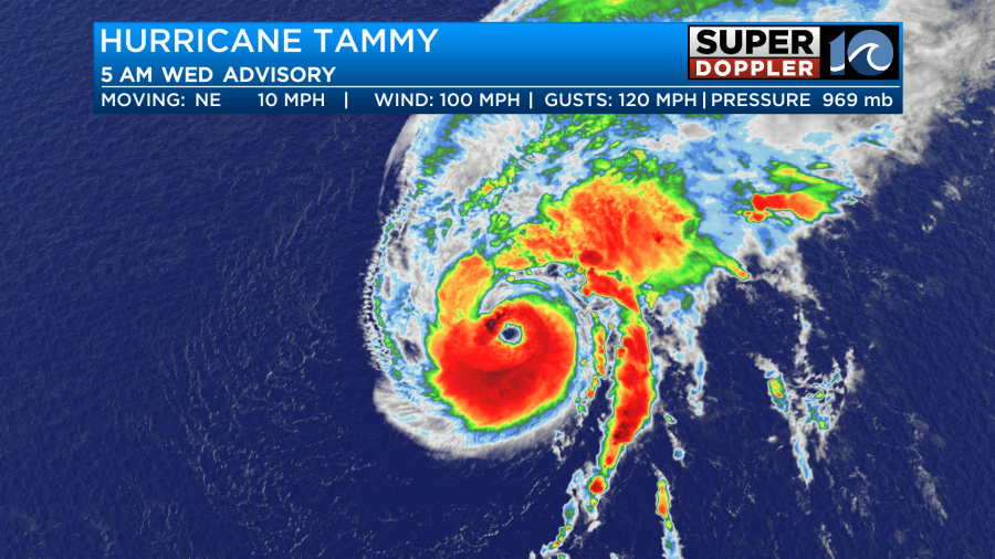
It became a category 2 early this morning. The eye has become more prominent on satellite. It is over some pretty warm water, and the wind shear has decreased since yesterday. The storm is forecast to move north and then probably to the northwest.
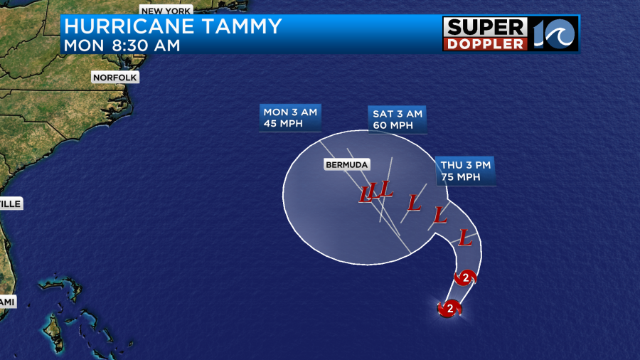
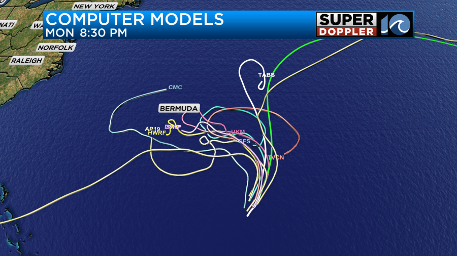
This will finally run it over cooler water, and that should gradually weaken the storm. Wind shear should also increase. However, it will interact with some cooler/drier air as well. So it is forecast to become post-tropical in a a day or two. Basically, the forecast calls for Tammy to be a nor’easter-LIKE storm by the time it moves towards Bermuda. However, the models are really still all over the place as far as the track goes.
Either way it should stay well east of the U.S. We will continue to get some 2-4 foot waves along our coast. However, there may be some 4-6 footers as we go into the weekend. That would be more for the Outer Banks. Stay tuned for updates.
I don’t normally talk about the Pacific Ocean. However, today I had to. Yesterday morning tropical storm Otis was forecast to become a minor hurricane within 24 hours and hit near Acapulco. Well…It ended up becoming a category 5 hurricane.
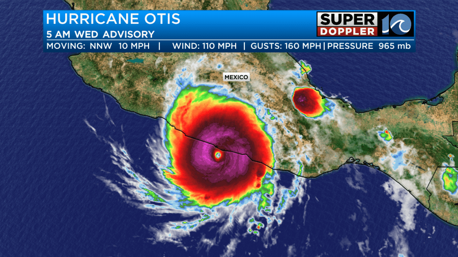
It hit the popular tourist destination with powerful damaging winds. It became a category 3 as it moved inland just a bit. It should weaken about as rapidly as it strengthened.
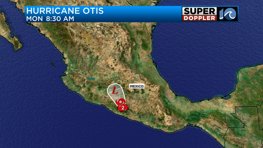
We’ll get the damage reports out of there once the storm has passed.
Meteorologist: Jeremy Wheeler