In terms of weather, today is not going to feel like January 4th. There is a lot of unseasonably warm and humid air over the eastern third of the country. High temperatures are going to be 20-30 degrees above average for many (including us).
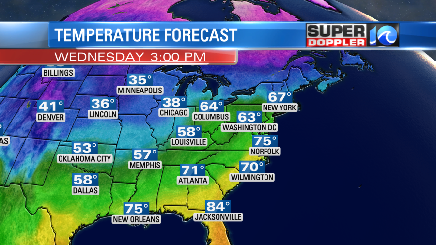
Locally, our average high temperatures for this time of year are in the low 50s. However, our forecast temperatures are in the mid 70s. The record for today is 78 degrees (2004). We will have an increasing wind out of the southwest. Some of the gusts could be up to 20mph. There is a warm front to our north with a cold front to the west.
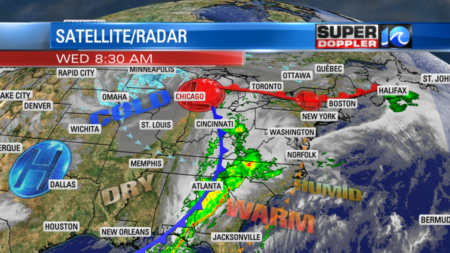
The humidity has really gone up. Dew points are in the 60s. Skies are mostly cloudy, and they will stay mostly cloudy for a while. The sun will pop out a little, but clouds will thicken up this afternoon. All of this warm and humid air is going to create an increasing chance for rain showers today. They will be spotty this morning through midday. Then as we go into the afternoon there will be some scattered rain showers with a few thunderstorms.
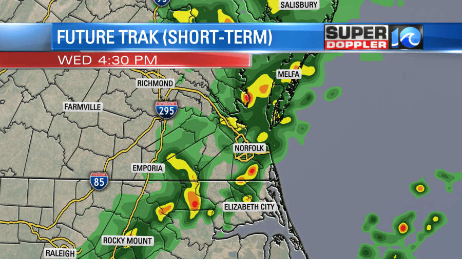
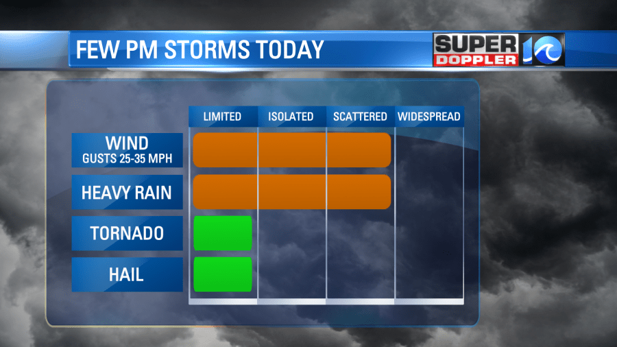
There may be a few strong to severe storms later today ahead of the cold front. Between the warm temps and the humidity there will be a decent amount of instability forming. Wind shear (upper level wind support for storms) won’t be off the charts, but it will be moderate. So at the very least we’ll have a few heavy rainers with some gusty winds. The threat for hail and isolated tornadoes is much lower, but not zero.
The scattered showers and storms will go into the early evening. So that could impact the first hour or two of the evening commute. However, the rest of the evening and overnight will just be some spotty showers. Tomorrow after a couple of spotty showers in the morning we’ll dry out through the rest of the day.
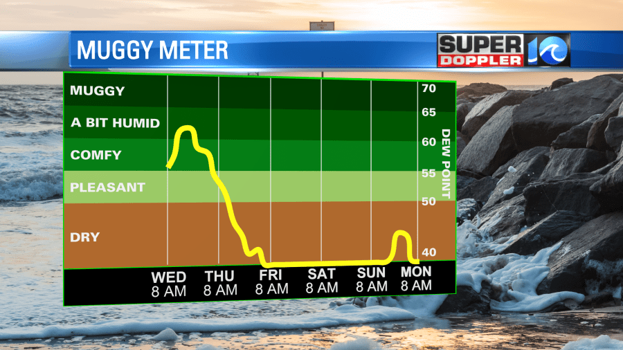
The cold front will move offshore, and we’ll have a west wind behind it. It should be a pretty nice day overall. High temps will be in the 60s.
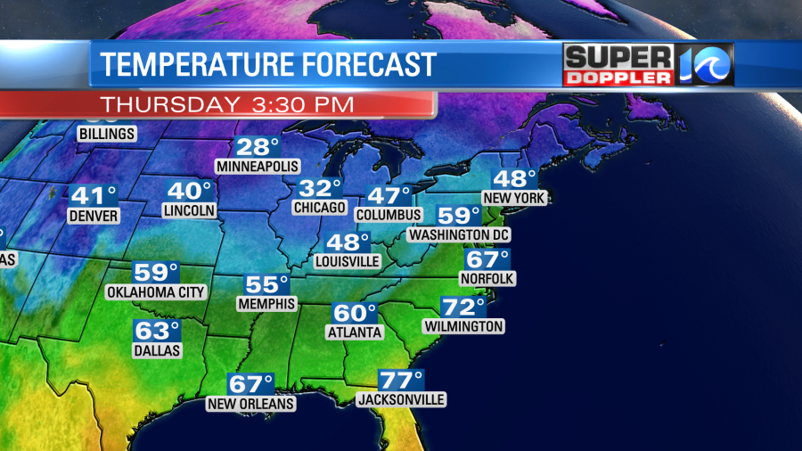
We’ll be dry on Friday with highs in the 50s. We’ll be mostly dry over the weekend, but another weak front might give us some spotty showers Saturday evening. Stay tuned. High temps will be in the upper 40s to low 50s.
We are technically still in a long-term drought, even though I don’t think last weekend’s rain made it into the most recent U.S. Drought Monitor update.
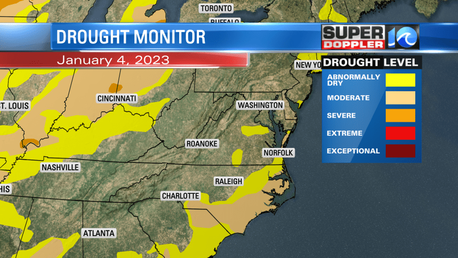
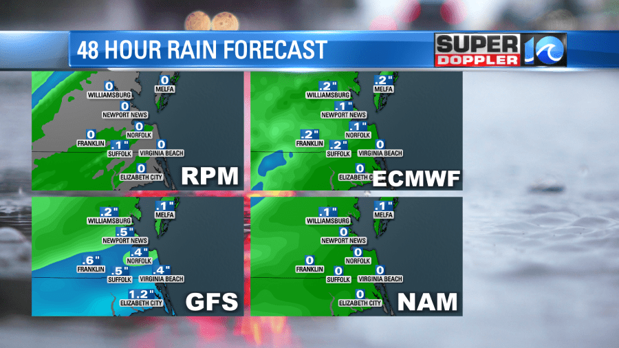
We won’t get too much help with the drought today, but there will be a decent chance for rain. I think most of us are looking at a meager 0.1″ to 0.25″, but some locations could see a half an inch up to three quarters of an inch.
At least it’s not the growing season. Stay tuned for updates.
Meteorologist: Jeremy Wheeler


