We had a great weather day yesterday. High temps did make it into the 70s over much of the region as forecast.
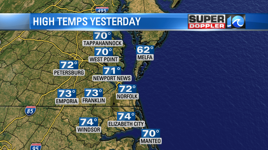
A cool front actually moved through yesterday afternoon, but the temps didn’t drop too much. Now today the front has stalled out to our south.
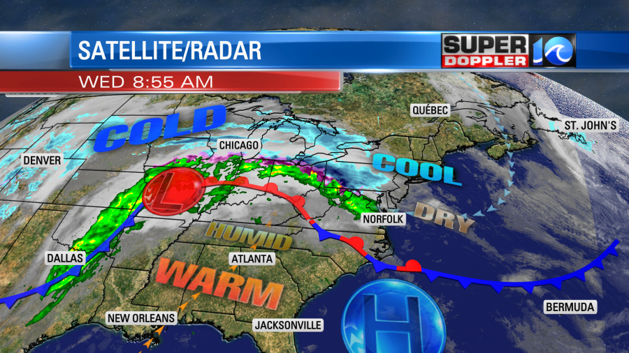
We’ll have some nice weather for a while. We had a good amount of sunshine on our tower cams this morning. Temps started warming up fast.

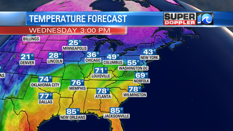
Even though we will be a little cooler today, it will still be well above average. The forecast has been trending upward since yesterday. High temps are now aiming for the mid-upper 60s with a few 70s inland/south.
Unfortunately, we will have increasing clouds. An isolated shower may fall north of the metro this morning through midday, but most of the area should stay dry. Dew points are in the 30s. Winds are out of the east, and they will turn out of the southeast today. They will even be southerly by the end of the day. They will run at 5-15mph. This will help to increase the moisture through the day.
Overnight we’ll have partly cloudy skies with a steady south breeze. This will keep the temps mild. Low temperatures will only be near 60 or even in the low 60s. We’ll leap frog off of this mild morning to launch our temps to near 80 tomorrow afternoon.
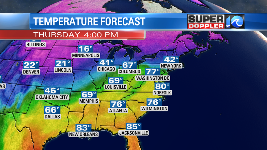
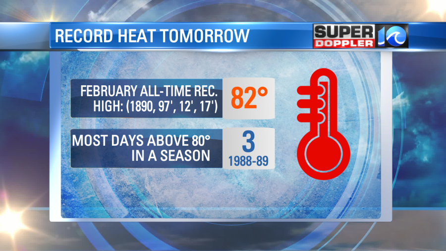
The warm front will pass well to our north. We’ll be partly cloudy with a stronger southwest breeze. It will gust up to 25mph. The standing record high for tomorrow is 79 degrees (1975). The all-time record high in February is 82 which was reached during several years.
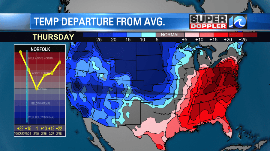
The average high is in the mid 50s. It will be about 20-25 degrees above average in the east, and it will be about 25 degrees below average in the central U.S.
It’s been a very warm January and February. I noticed even more trees budding yesterday on my walk. Nature seems very confused as to what time of year it is. This in includes the wildlife. I’ve seen a lot of deer out in the mornings on my way to work.
By Friday temperatures will start to head into correction territory. We’ll still be mild in the morning with temps in the 60s.
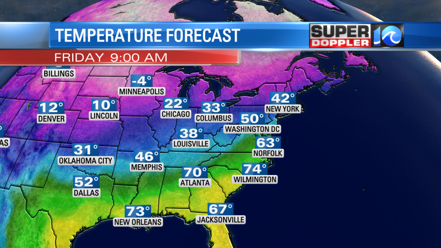
A strong cold front will move through by the late morning. This will drop temperatures into the 50s during the afternoon.
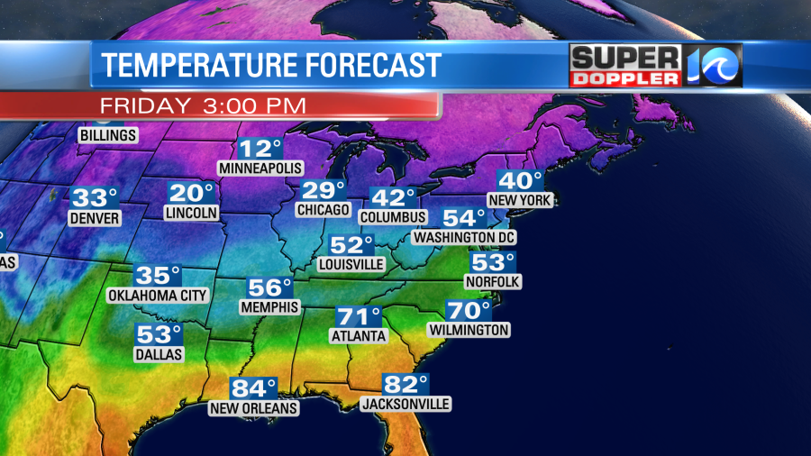
We’ll have a mix of sun and clouds but only a couple of stray showers. On Saturday the front will stall out to our south. We’ll have mostly cloudy skies with an increasing chance for showers.
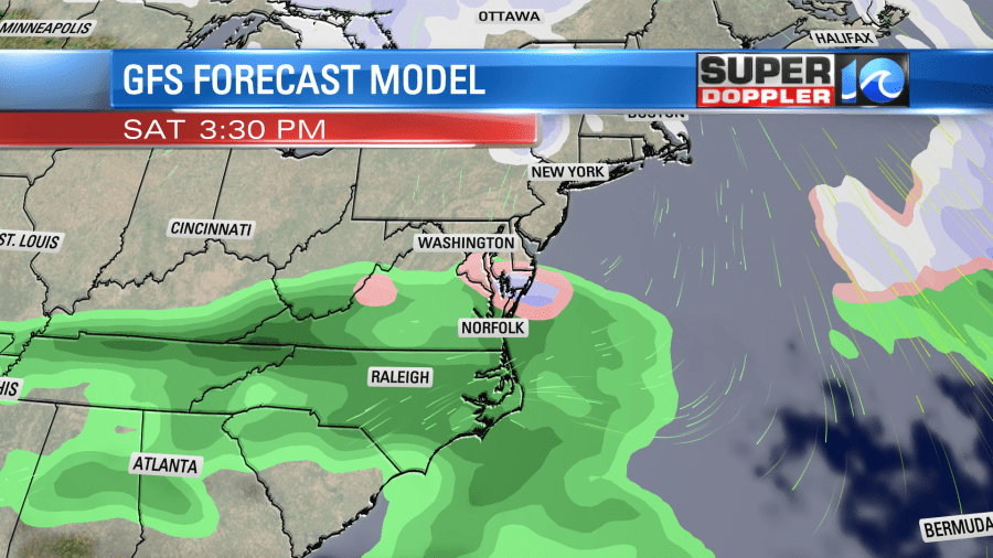
The GFS Model even shows a little wintry mix near the area. The high temps will only be in the mid-upper 40s. Plus, it will be breezy. The bottom line…Saturday looks pretty nasty out. Sunday looks a lot better with a mix of sun and clouds with high temps in the upper 50s. There is only a 20% chance for some isolated showers, but that could change. Stay tuned for updates.
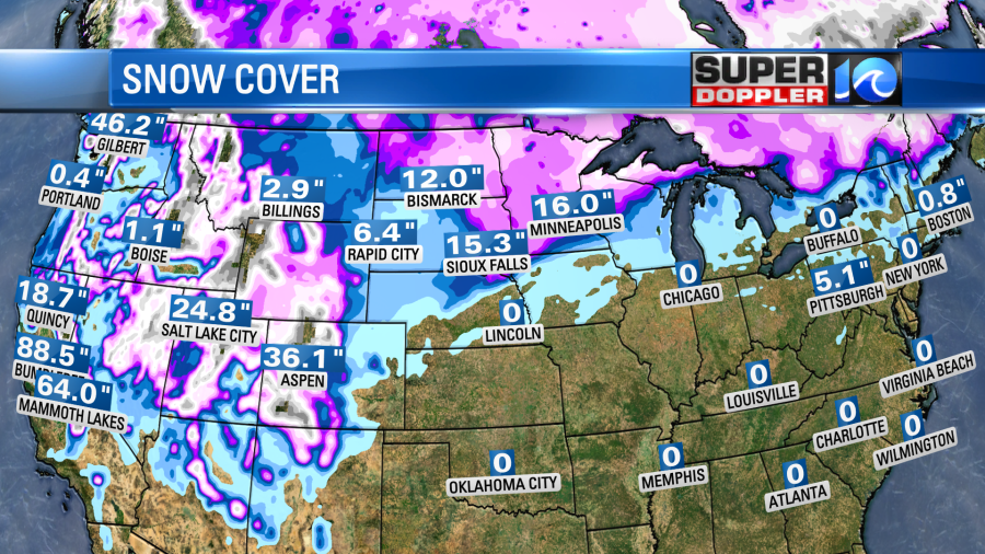
A lot of snow has fallen over the northern states. More snow is expected today, but recently over a foot of snow has fallen over parts of the Dakotas and Minnesota.
Meteorologist: Jeremy Wheeler


