This morning we actually started off with temps above freezing in some places. Temps were in the upper 20s to mid 30s. We did have some nice shots of the sun shining through the clouds.
High pressure is sliding offshore today. We still have a dry airmass, but more humid air is chipping away at the dryness.
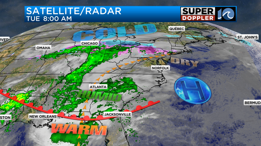
There is a warm front developing to our south. It won’t reach us today, but it will move in tomorrow. We’ll be partly to mostly cloudy through the day. The moisture may increase enough to squeeze out some isolated showers or sprinkles from midday through the evening. We’ll have a light/steady southwest wind through the day. So high temps will stretch up to the upper 40s to near 50 degrees.

It will be more in the mid 40s north of the metro.
Tomorrow the warm front will lift up from the south. It will move through during the day. We’ll have a light south wind. So high temps will definitely warm to the 60s. I’m thinking we’ll get to the low-mid 60s, but some models are going higher.
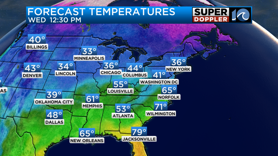
We’ll have more a of a mix of sun and clouds Wednesday. There could be some isolated showers as the front passes, but overall I think it will be a nice day. We’ll warm up even more on Thursday. Despite a good amount of clouds, high temps are going to aim for near 70 degrees. Our model even has low 70s, but we’ll see.

There may be some spotty showers in the area, but I’m not seeing a lot on the models.

Friday, however, looks to be pretty wet. At least for the first half of the day.

There may be some letup in the afternoon. We’ll see. High temps will be in the upper 60s. We’ll cool down on Saturday with a few more showers. However, temps may warm again to near 60s by Sunday.
Meteorologist: Jeremy Wheeler