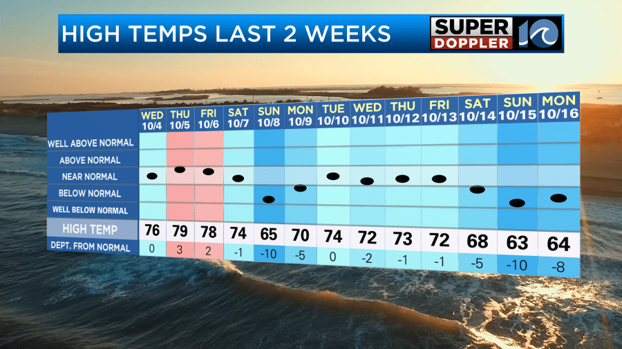
If you love Fall weather, then this is your time. So far in October we’ve had a lot of high temps in the 70s, and over the last 3 days we’ve had highs in the 60s.
It’s also been pretty dry. Apart from three-quarters of an inch last Saturday there’s been hardly any rainfall in the region.
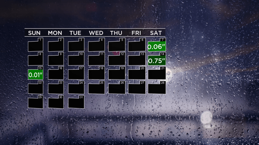
We are down 1.38″ for the month, but we are still fairly close to average for the year.
We won’t have any rain today, but there may be a few sprinkles in the region. High pressure is far to the west, and there is still a strong low over coastal Canada.
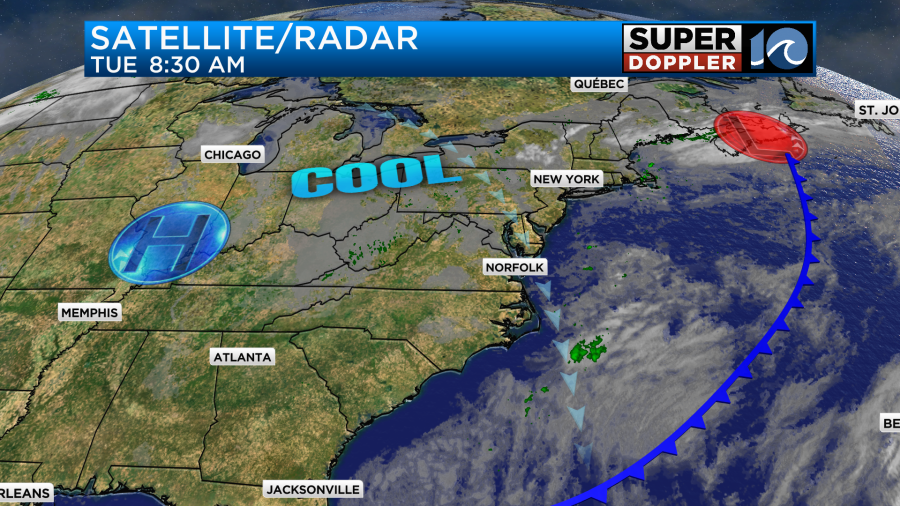
However, there is a large upper level trough over the East Coast.
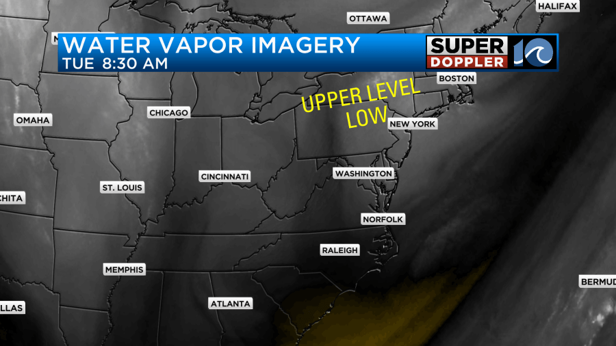
The southern part of this feature has fallen apart, but the northern one is still going a bit, and that could impact us. As I mentioned yesterday…It’s pretty dry at the surface. Dew points are in the 40s.
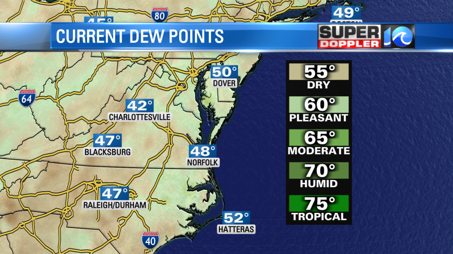
So we wont’ get anything more than a couple of sprinkles if anything falls at all.
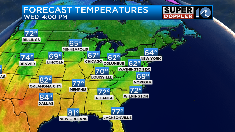
We’ll continue to have a steady breeze out of the north/northwest. That will keep high temps in the mid-upper 60s here.

By tomorrow the surface high will build east, and the upper level low will move out. So we’ll have flat-out dry conditions with partly sunny skies. Winds will be lighter but still out of the north. That will let temps warm to the upper 60s to low 70s.
It will be a very nice day. We’ll be even better on Thursday with dry air, fair skies, and highs in the low 70s. The moisture will increase on Friday. There may also be a weak area of low pressure that forms along the coast Friday. The models differ on this a little bit. The Euro has the low around more Thursday night. Whereas the GFS has it more during the day Friday.
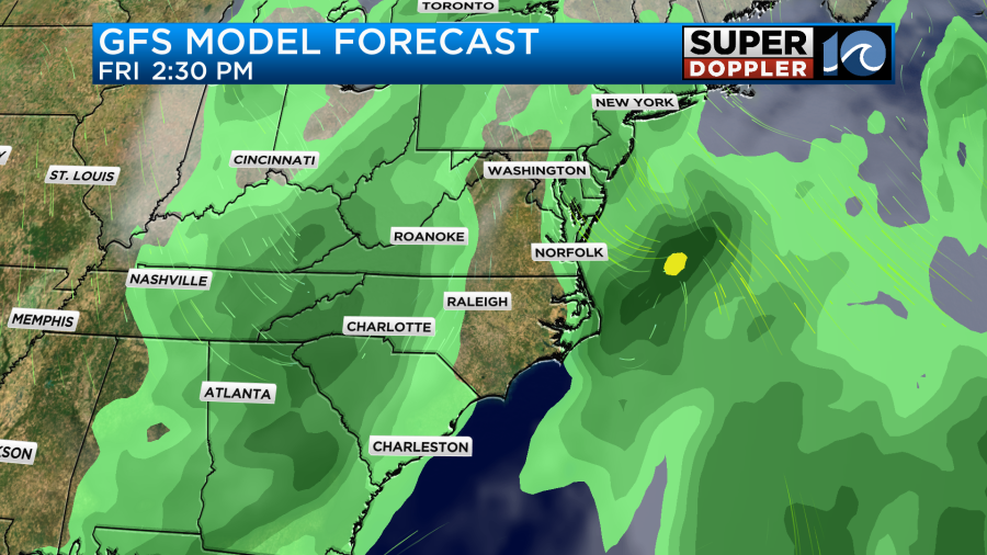
I will say that it’s latest model run was a bit more to the east compared to yesterday.
The NAM model has the low just a smidge more offshore than the GFS, but close enough for some rain. I’ll be able to track it better by tomorrow. Then it will also be in range of our Future Trak model. For now I’ve got a 50% chance for rain on Friday. I also have a 50% chance on Saturday. That will be as a cold front moves into the region. However, the latest models are breaking up that rain. Maybe they have some dry air coming in along the front. It looks to me that at least some drizzle will linger on Saturday. The trend is still dry for Sunday. Stay tuned for updates.
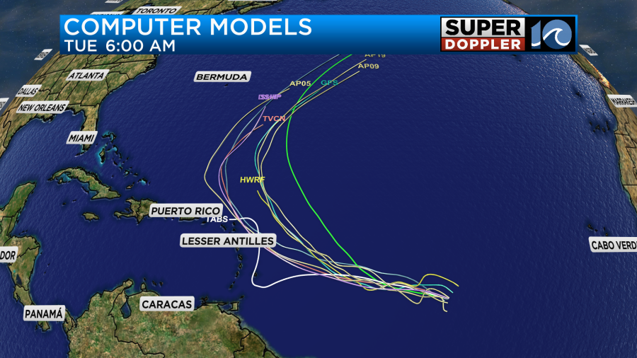
The update in the tropics hasn’t changed too much. There is still a tropical disturbance east of the Lesser Antilles that has a high chance of formation. It is moving to the west.
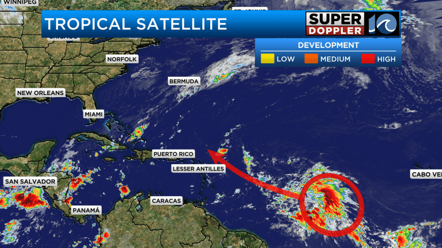
The latest models have it hooking to the north (and now even to the northeast) which would keep the feature east of Bermuda.
With all of the cold fronts swinging through our area this would be a good bet. We’ll track it and bring you the latest.
Meteorologist: Jeremy Wheeler


