We asked for the heat for a long time. Didn’t we? Many folks wanted warmer weather in May and early June so that we could go to the beaches and the pools. That’s fine. Well… The real heat has finally arrived. Today we are aiming for the low 90s for high temperatures.
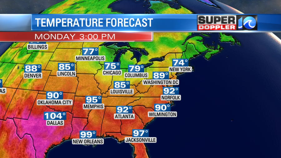
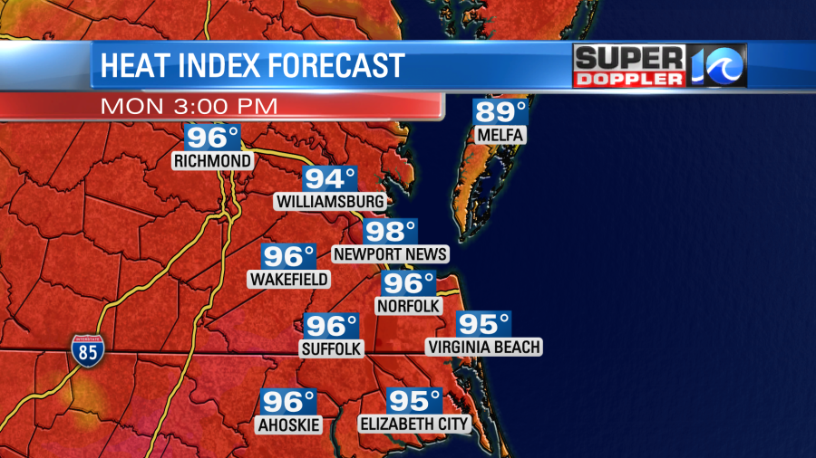
If we hit that temperature, then it will be the first time we hit 90 or higher so far this year. Adding to that, the humidity is also high today. Dew points are in the low 70s. So our heat indices this afternoon will likely rise to the mid-upper 90s.
This is going to be fuel for some strong to severe storms later today. There will be a pretty high amount of instability. There will also be a minimal amount of wind shear (increasing wind speed with height). The thing about today is that we are water loaded. So heavy rain will probably be the main threat. Things could kick off as early as the mid-afternoon.

However, the models don’t show much during that time. That may be because there is a cold front far off to our west, and it seems to be slowing down.
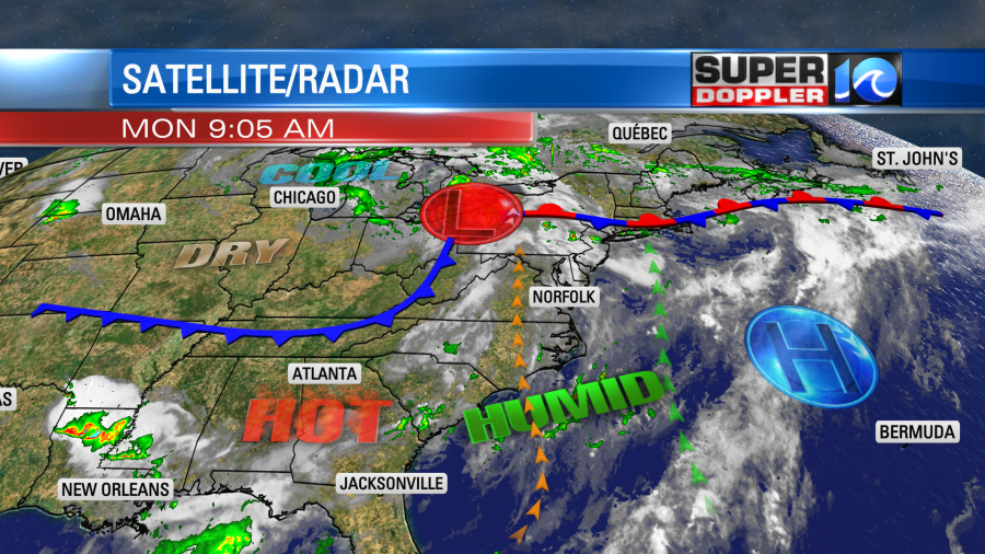
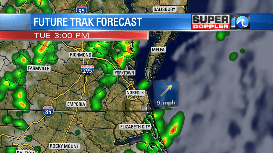
High pressure is moving farther offshore. Winds are out of the south. They will run at 10-15mph with gusts to 20mph. That’s the general wind, but gusts will be much higher in any of the storms later today. Again, the bulk of the models show most of the storms forming this evening. They have several clusters of showers and storms rolling through the region.
We are under an “Enhanced Risk” for severe weather. This is level 3 out of 5. So it’s significant.
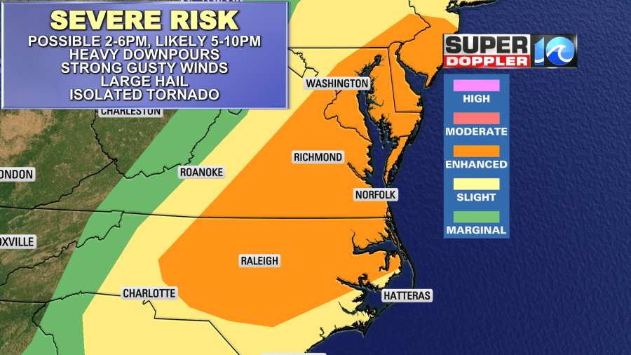
There could be some large hail along with the heavy rain, strong winds, and lightning. The threat for tornadoes is low, but not zero.
This next part may be a little thick reading FYI. I’ve seen patterns when it doesn’t rain all day, and then the storms arrive in the late evening. This just doesn’t look that way to me today. The front will stay to our west. So, yes, that is a factor. However, the front won’t be oriented from north to south. High pressure isn’t that strong offshore, and there is not upper level ridge overhead. It’s actually a weak trough. Also, I wonder if the models are taking yesterday’s downpours into account. Not only is there a lot of moisture leftover from that rain near the surface. There is also likely some leftover boundaries leftover as well. These are like mini cold fronts that have died off. However, due to the different moisture on either side of said leftover boundary they heat up differently through the day. So those could theoretically help to kick off some storms themselves. The bottom line… I agree that the higher chance for rain will be in the evening, but I do think at least a few storms will fire up this afternoon. We’ll see. It’s a bit of man vs. machine today.
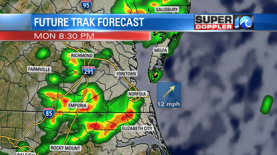
Either way there will be some scattered storms this evening, and they should wrap up by around midnight. We’ll start off tomorrow with quiet weather. The cool front will be very slow moving. So it won’t even move through until late tomorrow. We’ll still be warm and humid, but less than today.
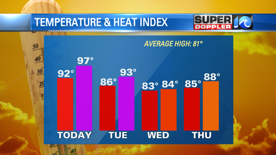
It will still feel like the 90s with the heat index, but highs will be in the 80s. As we heat up tomorrow and the front moves through we will have more scattered showers and storms in the afternoon.
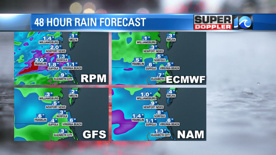
The chance for severe weather will be lower, but there still could be a few strong storms. There could also be some more heavy downpours. In the next 48 hours we could see a half inch to three quarters of an inch. Some isolated locations could get 1-2″ of rainfall.
We should dry out some on Wednesday with highs in the low-mid 80s. Other than an isolated shower or storm it should be pretty nice out. We’ll have quiet weather for the rest of the week.
The tropics are quieter now too. Tropical storm Cindy has fallen apart. It is now a remnant low.
There is a low chance that is could redevelop north of Bermuda, but it will be over cooler water at that time. The rest of the Atlantic is quiet for now.
Meteorologist: Jeremy Wheeler