
Yesterday’s weather wasn’t too bad. In fact, the weather yesterday evening was so nice that I decided to do some ahead-of-schedule yard work to take advantage of the comfortable conditions. However, as I headed out the door this morning, I realized that the muggies were back (not muggles).
Today is going to be a hot and humid day. Temperatures will rise up to the mid-upper 90s this afternoon.

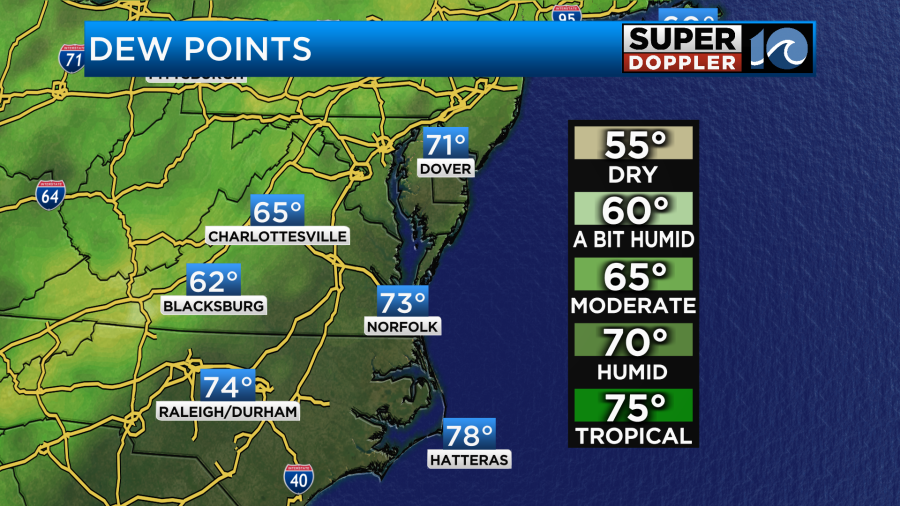
The heat index will rise up to 100-105 degrees during the afternoon and evening. Dew points have risen into the 70s.
We have weak high pressure to our north and a stronger one offshore. There is a warm front lifting up from the south, but it is weakening.
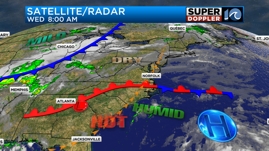
There is a cool front over the Midwest, but that won’t arrive here until tomorrow. We’ll have a southwest wind today. It will run at 5-15mph. It’s good that we’ll have a breeze in terms of trying to keep cool, but that same wind is also pulling up the heat and humidity. So it’s give-and-take. There will be some isolated showers or storms this afternoon, but don’t bet on that to cool you down. If you are going to cool down at the local beaches, then the weather should be good. There is a low threat for rip currents from Virginia Beach down to Oregon Inlet, but there is a moderate threat down towards Rodanthe.
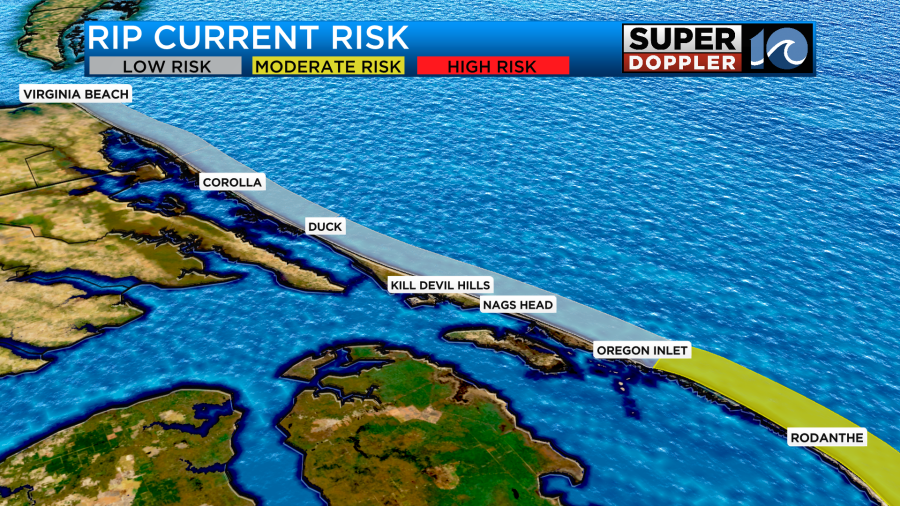
Water temps are near 70 around Virginia Beach, but in the mid-upper 70s over the Outer Banks. Its in the upper 70s on the Bay.
Tomorrow the cool front will move into the region. We’ll have a few showers and storms ahead of it late tonight into tomorrow morning.

There may be a few heavy downpours during tomorrow morning. They will slowly sink south as the front slides through. This will be into Thursday afternoon.
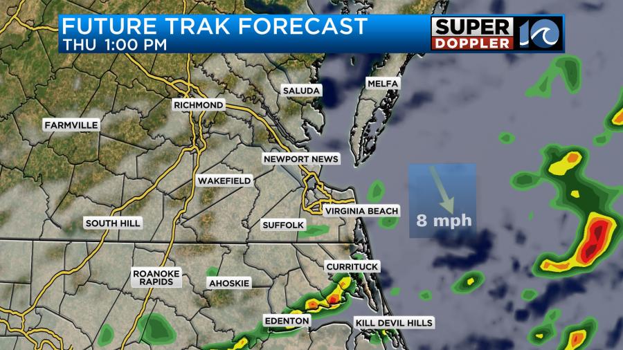
The wind will turn from southwest to northwest. It will run at about 8-12mph. This will help to cool us down along with more clouds and some rain. High temps will be in the upper 80s.

However, it will still be pretty humid. So the heat index will still be in the low 90s.
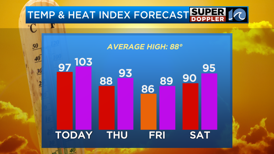
We will be cooler and slightly drier on Friday. High temps will be in the mid 80s, but the heat and humidity will come back a bit by the weekend. High temps will be near 90 on Saturday and in the low-mid 90s on Sunday. There may be some isolated showers or storms on Saturday, but otherwise it should be a decent day. As of right now the models show a higher chance for rain on Sunday. High temps will be in the low-mid 90s.
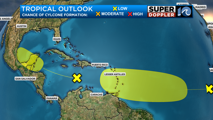
The tropics are still quiet in the short-term, but there may be some development over the next few days. There is one disturbance in the central Atlantic moving west. There is another disturbance central Caribbean moving west/northwest. Both have a low chance of formation for now.
Meteorologist: Jeremy Wheeler


