Today we have more ingredients for rain across the region. The deep moisture started to push into the area yesterday. So now it is solidly in place. Dew points are in the mid 70s. On top of that a stationary front has drifted north a bit. Now it sits over our region.
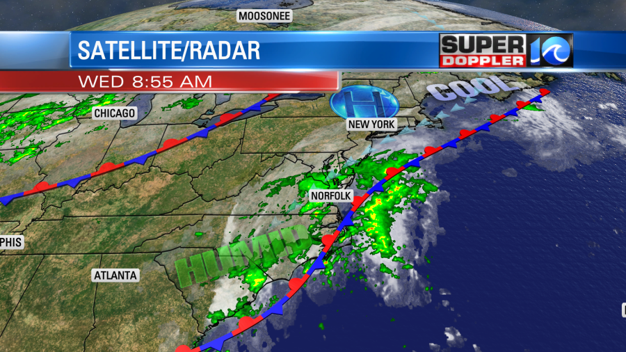
We have already had some heavy rain in the area. This morning there were a couple of Flash Flood Warnings for Isle of Wight and Surry counties.

There were even a couple of reports of submerged vehicles and rescues. Rain showers will fall on-and-off through the day. It may be heavy at times. There will also be a few thunderstorms.
We’ll be cloudy through most of the day with a northeast breeze. It will run at 10-15mph with a few gusts to 20mph. Mainly near the shore. High temps will be in the lower 80s, but it will be muggy.
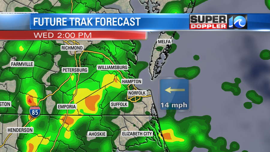
Rain showers will continue on and off overnight. Then we’ll have more rain tomorrow as the front hangs out across the region. Heavy rain and a few thunderstorms will be possible again.
Hopefully, there will be some peeks of sun tomorrow. Winds will be more out of the southeast. So high temps will rise to the mid 80s. Humidity levels will be the same.
We could see about a half inch up to and inch and a half between today and tomorrow. However, some isolated locations could see up to 2-3″. The rain this morning over Surry county was over 4″, but that was over an isolated area.
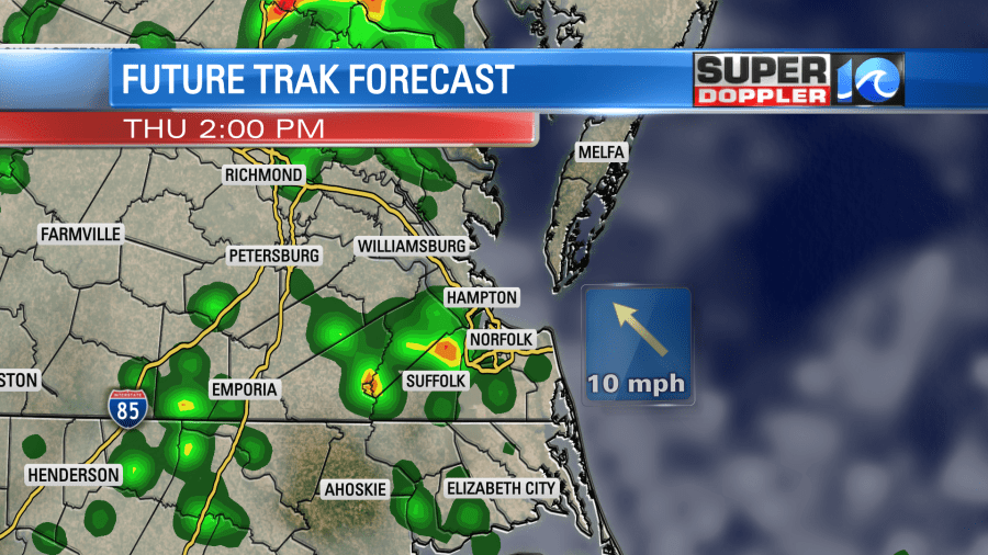
We’ll have more scattered rain showers and storms Friday into Saturday. The front will possibly hang out through that time. We’ll probably have an injection of more tropical moisture, OR we’ll have an area of low pressure coming in from the southeast. There’s a low chance that it will become a tropical depression, but I think the effect will be the same. (More Rain and not much wind). The rain will continue into at least Saturday. Hopefully, it will let up some by the weekend.
I’m tracking a few things in the tropics. I mentioned that area of low pressure in the tropics that could bring us rain. Right now it’s about 300-400 miles southeast of North Carolina, but it is moving west/northwest.
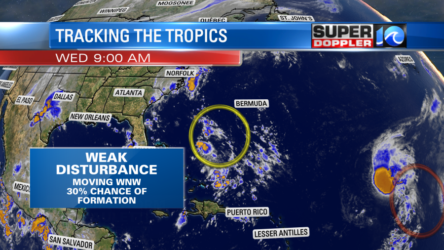
This area isn’t organized right now, and it only has a 30% chance of formation. We’ll track it over the next 24 hours.
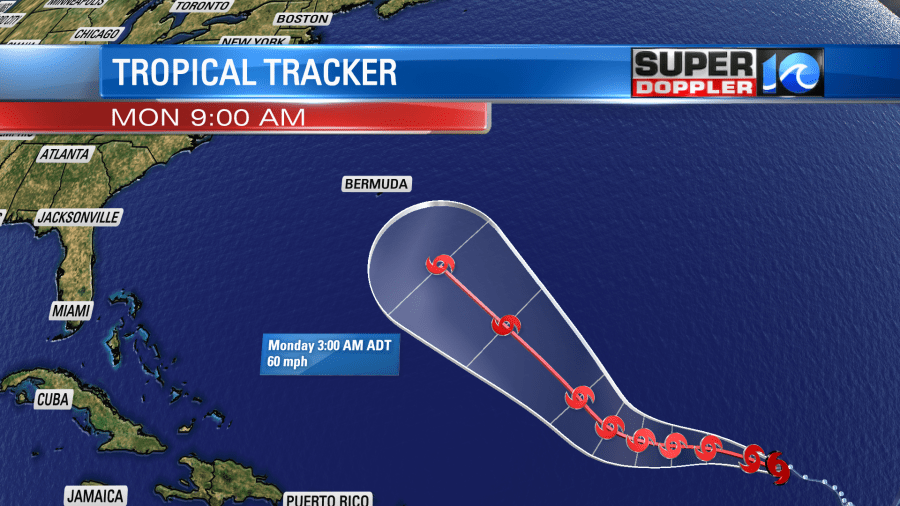
Meanwhile tropical storm Paulette is over the central Atlantic. It is moving to the west, but is forecast to turn more to the northwest over the next couple of days.
It will probably stay offshore, but it’s still not a 100% guarantee. Here are the latest models for the tropical disturbance and Paulette.
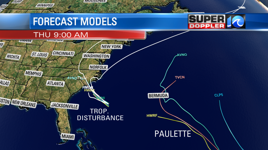
Paulette is forecast to remain a tropical storm. It is fighting some wind shear, and that should help to limit its strength.
In the mean time Rene weakened to a tropical depression last night. However, it is forecast to become a tropical storm again soon. It is moving to the west/northwest, but it will definitely take more of a northwest track over the next few days. It will definitely stay out to sea. However, it is still forecast to briefly become a hurricane

As I mentioned yesterday, the waves will build and move west from these tropical systems. So we’ll have some higher waves along the east coast later this week. If the rain lets up for a time, then it might be some great swells for surfers. However, the rip current threat would likely also increase.
There is another tropical disturbance that is over Africa that is likely to become another system in a few days, but it still hasn’t moved off of land yet.
Stay tuned for updates.
Meteorologist: Jeremy Wheeler


