Update Thursday Afternoon:
The rain so far today has solidified March in the record books for one of the wettest on record. With nearly 10″ of rain for the month so far, this years’ March sits as the 2nd wettest on record.
But it’s still raining outside!
Fortunately, we should be done with the stubborn heavy rain from the morning hours. So the rest of our afternoon should feature light to occasionally moderate rainfall – on & off in nature. Temperatures are pinned in the upper 40s as well, locking in this raw & gloomy day. Rain is set to move out after sunset as the northerly breeze kicks in.
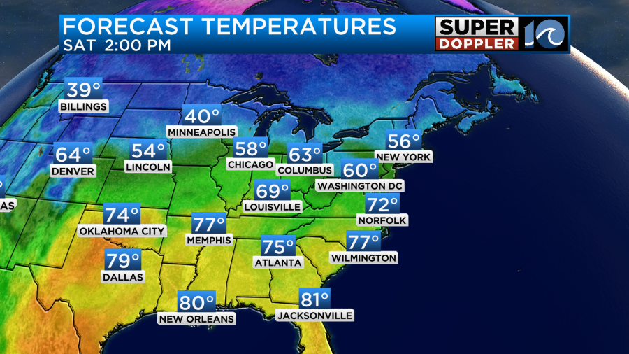
Drier weather is on top for the weekend – thank goodness! The fresh breeze Friday will throw some passing clouds our way in the afternoon as highs will be around 60°. Sunshine holds through Saturday and Sunday as our afternoon temperatures climb to the 70° mark. Enjoy it – because the soggy pattern brings in more rain for the first few days of April next week.
So sit back, enjoy this rainy day best you can, be careful driving on the roads as standing water may be an issue, and we’ll see if we can top the list of wettest March’s on record.
-Steve
_____________________________________________________________________________________________________
As predicted, we had some heavy downpours during the morning commute. It started up early this morning, and it continued through the mid morning.
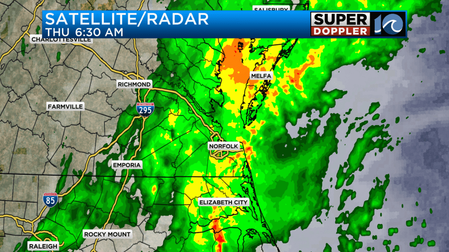
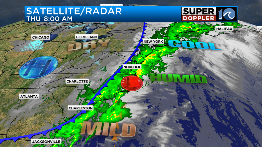
There were even some scattered thunderstorms early on. The heavy rain created a lot of problems on the roads. Luckily the heavy rain backed off for a while by 8am. There are a few things working together to create this large area of rain along the east coast. First off, there is a large area of deep moisture all along the coast. It has been funneling into the region since yesterday. There is also a slow moving cool front and an area of low pressure.
Today rain will be pretty widespread, and it will last for most of the day.
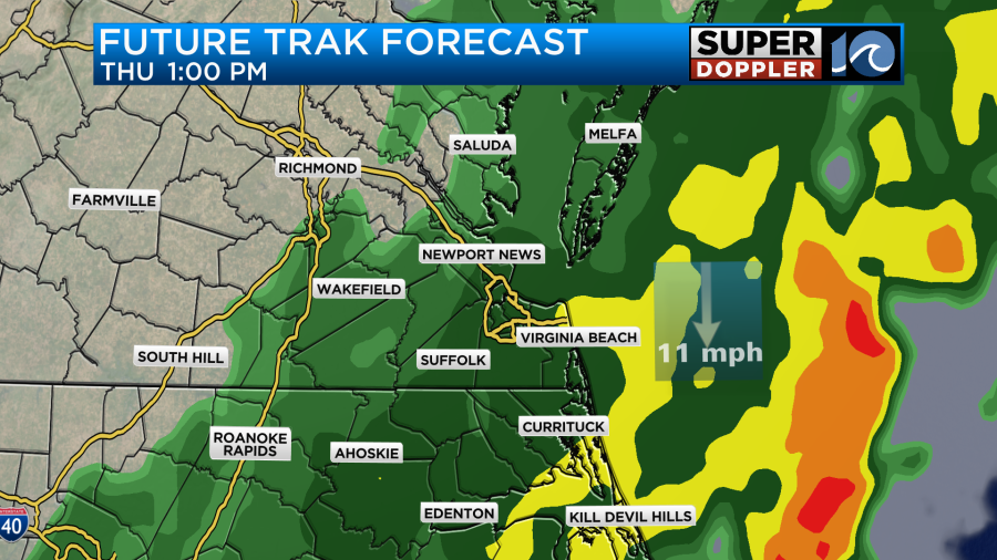
The widespread rain will be light, but pockets of heavy rain will move through as well. This will continue into the evening. However, by the time we hit the evening commute the rain should be lighter and more scattered.
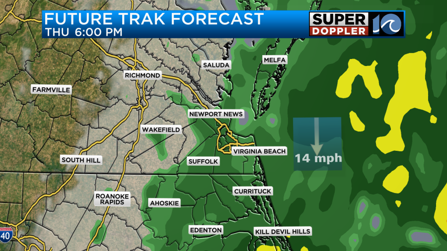
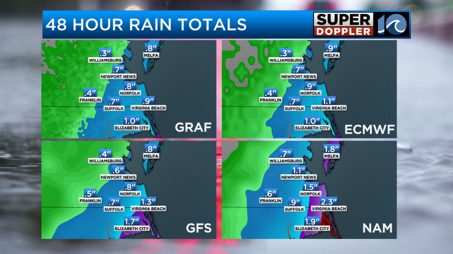
The rain should shut down by about 7-8pm. Then we’ll dry out. As of 8am a lot of the area has had about 1-2 inches of rainfall.
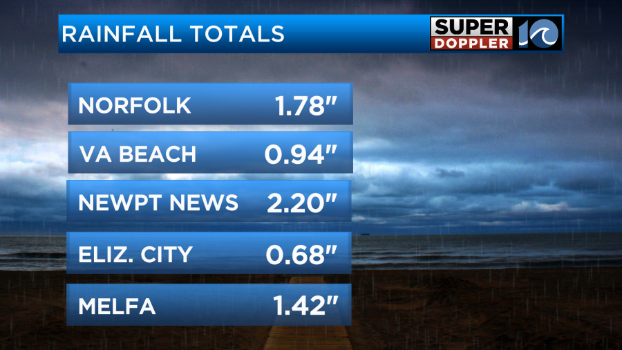
We still have a Flood Watch in effect for most of the region through the evening. Going forward we’ll probably have another half inch to an inch-and-a-half of rainfall.
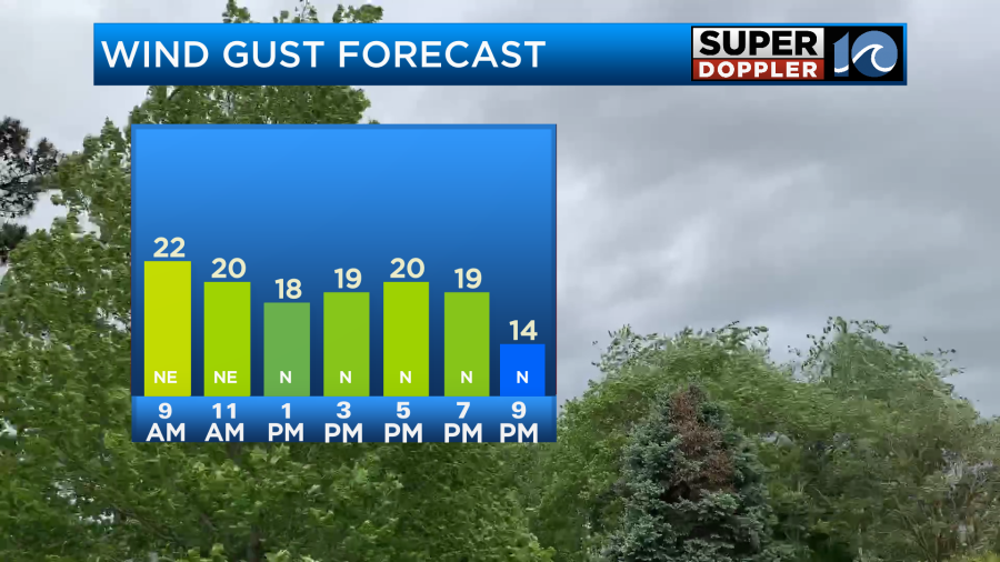
We’ll be cloudy all day. Plus winds will pick up out of the north/northeast. They will gust up to 20-25mph.
High temps will only be in the low 50s this afternoon.

This is after starting in the upper 40s.
There is a little bit of good news. I think we are looking at more rain totals in the 2-3 inch range compared to the 3-4″ totals. This may limit the flooding potential a bit as we go into the afternoon and evening. We’ll see. Tidal flooding should not be an issue.
Tomorrow the weather finally clears up. We’ll have partly cloudy skies Friday with high temps in the low 60s.
It will be a little breezy. Winds will be out of the west/northwest at 10-15mph with gusts to 20mph. That will be pulling in the drier air. It will get even better on Saturday. We’ll be partly cloudy with high temps in the low 70s.
We’ll finally have very light winds as well. There may be an isolated shower in the evening, but it’s a low chance. The weather still looks good for Easter Sunday. We’ll be partly cloudy through the day. High temps will be in the low 70s. There may be some isolated showers late in the day, but we’ll see. This will be ahead of a cool front that will impact us more on Monday. High temps will drop to the low 60s, and we’ll have some scattered rain showers. I don’t even want to think about more rain right now. So I’ll do like many will do. I’ll focus on the nice weekend.
Meteorologist: Jeremy Wheeler


