Update Tuesday Afternoon:
March will go down in the record books for rainfall – as it sits 8th on the list of top ten wettest March’s on record. Currently, we’ve developed 7.08″ of rain so far this month… an additional round of soaking rain this week could accelerate us to the top of that list.
Cloudy & gloomy through the night with temperatures in the 40s. Tomorrow should warm up slightly as the big cold front approaches the region. Scattered showers develop by the afternoon, becoming a bit more widespread by the evening and late night hours.
Rain develops overnight and lasts throughout the majority of Thursday. Rain, heavy at times, could total 2-3″, with potentially more in spots!
The stalled front finally moves out Thursday night and sunshine returns Friday and for most of the weekend. Temperatures should climb close to 70° for the weekend as well.
-Steve
______________________________________________________________________________________________________
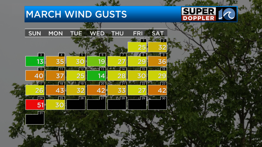
I’ve mentioned several times lately that March has been very windy. We even just had some gusts to 50mph last weekend.
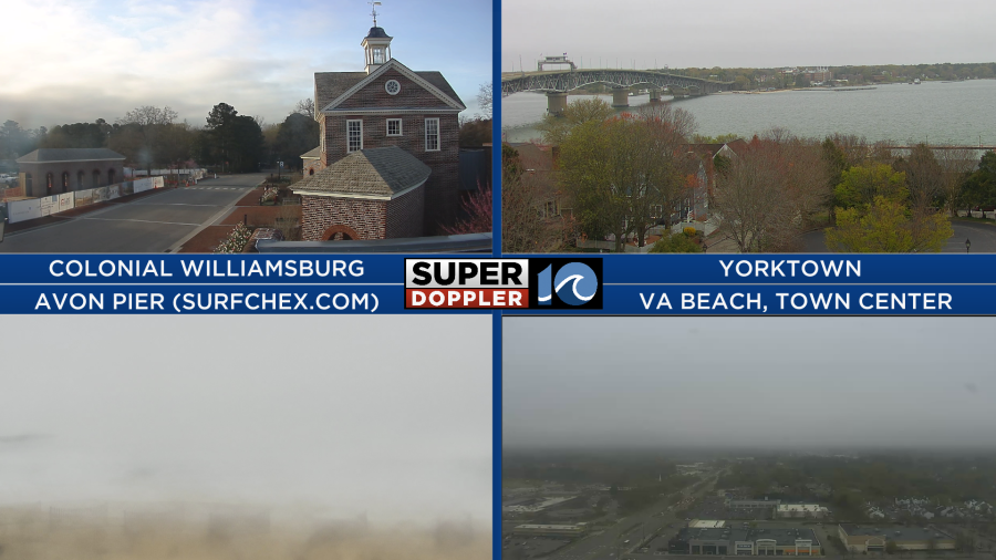
Today we are going to finally have less wind, but we are trading it out for lots of clouds. We started this morning with a deck of clouds moving in from the east.
We still have a large area of low pressure offshore with an area of high pressure overhead.
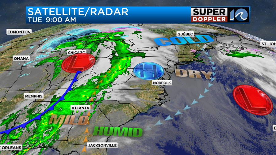
There is another area of low pressure and a cold front to the west. These will play a big part in the Wednesday and Thursday forecast. More on that in a moment.
Today we will have lots of clouds in the region with a little more sunshine inland/west. There will be a few sprinkles and a little drizzle, but there shouldn’t be any rain showers. The wind will be out of the northeast at about 10mph. Temperatures will probably end up in the low-mid 50s with some upper 50s possible west of the metro.
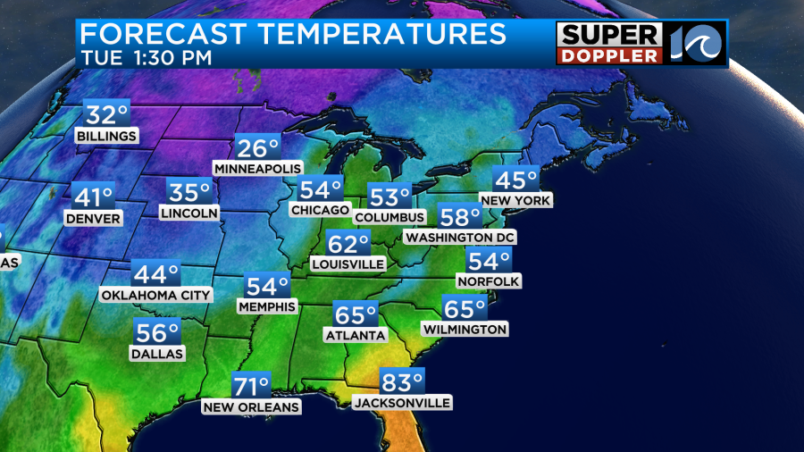
Tomorrow we’ll have even more moisture in the area. Plus, the front and the low will be creeping closer from the west. This combo will bring us cloudy skies, but we’ll also have some scattered rain showers. They will mainly be in the afternoon.
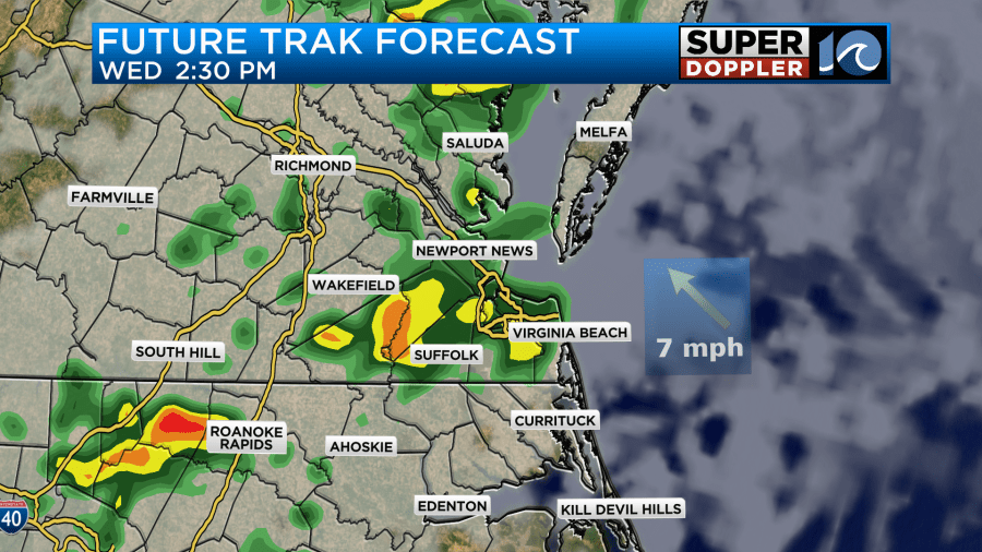
We’ll have a light east wind. High temps will be in the mid-upper 50s. By Thursday the front and the low will be steadily sliding east through the region. This will bring us a lot of rain. It will be on and off through the day.
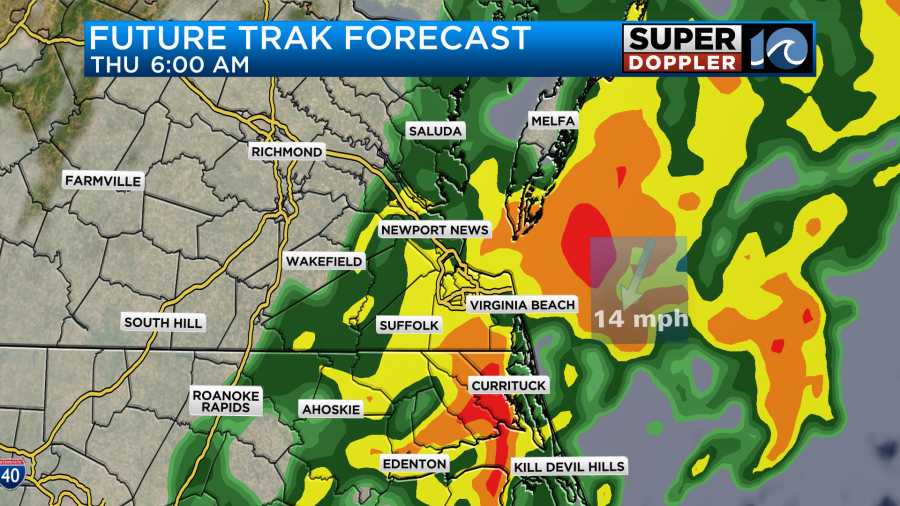
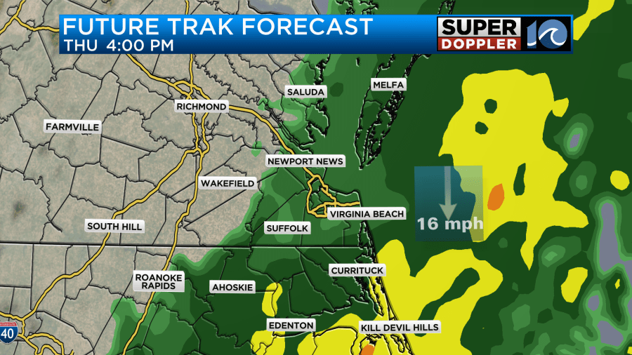
The rain may also be heavy at times. This will impact both the morning and evening commutes. The wind will pick up out of the north. It could gust up to 30mph. That, the clouds, and the rain will keep high temps in the 50s. We should wrap up the rain by later Thursday evening.
Before the rain ends we could end up with 2-3 inches solid in the rain gauges. Some of the models are even suggesting 3-4 inches in some places.
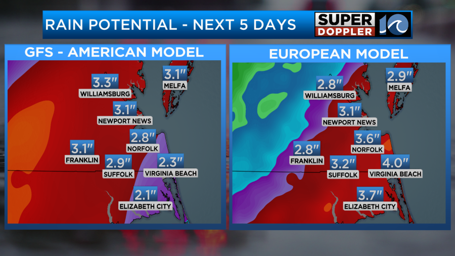
Since we’ve had so much rain recently the ground is still fairly saturated. This means that we are looking as some possible flooding on Thursday. Stay tuned for updates on that.
Speaking of recent rainfall. We have had a lot of rain. We have had about 7 inches of rainfall in the area. This is over 4 inches above average. We are now also about 4 inches above average for the year so far.
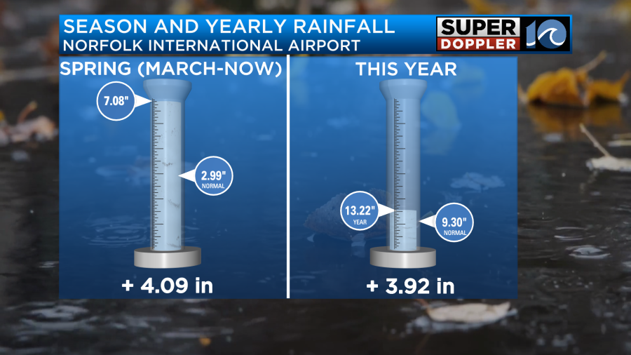
This puts us at the 8th wettest March on record.
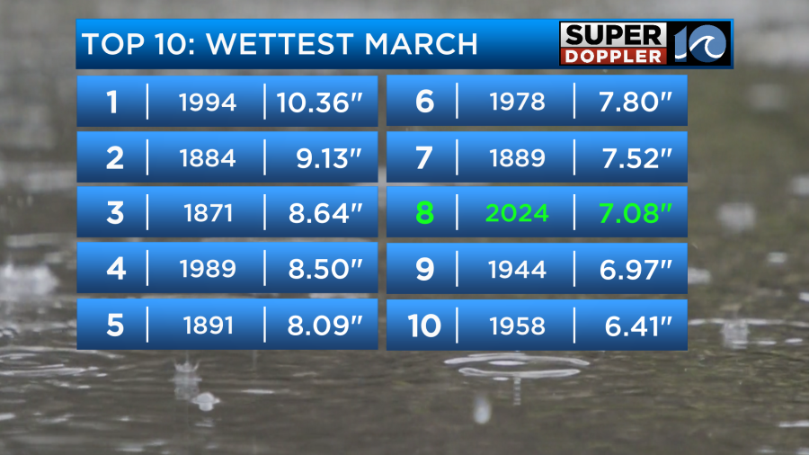
With the current rainfall forecast it is possible that we could jump to number one spot by the end of the month. Again…stay tuned.
The good news is that we are looking at some dry and warmer weather on Friday. Highs will be in the 60s. Then we’ll likely have some great weather on Saturday. High temps will be near 70 with partly cloudy skies. Unfortunately, the chance for a few rain showers has gone up on Eastern Sunday. Mainly in the afternoon. I’ll have more detail on that part of the forecast in tomorrow’s weather blog.
One last thing. There will be some minor tidal flooding today, but it shouldn’t be too bad.
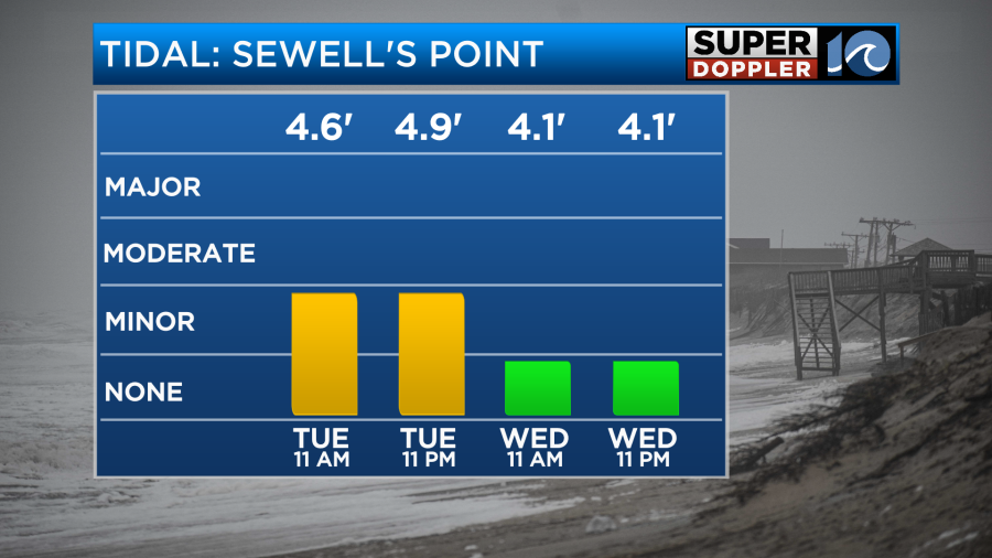
There was some ocean overwash down along parts of highway 12 this morning. The waves decreased a little, but the tide increased a little. So that must have made the difference.
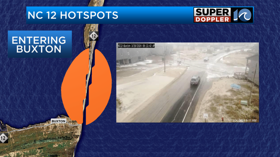
There may be a little more of that this evening, but it should be limited on Wednesday.
Meteorologist: Jeremy Wheeler


