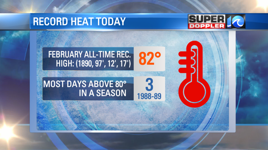
WE BROKE A RECORD HIGH!
The National Weather Service confirms it hit 80 degrees at 1 p.m. at Norfolk International Airport Thursday, which breaks the previous record high temperature for February 23, set back in 1975.
Thursday morning blog post:
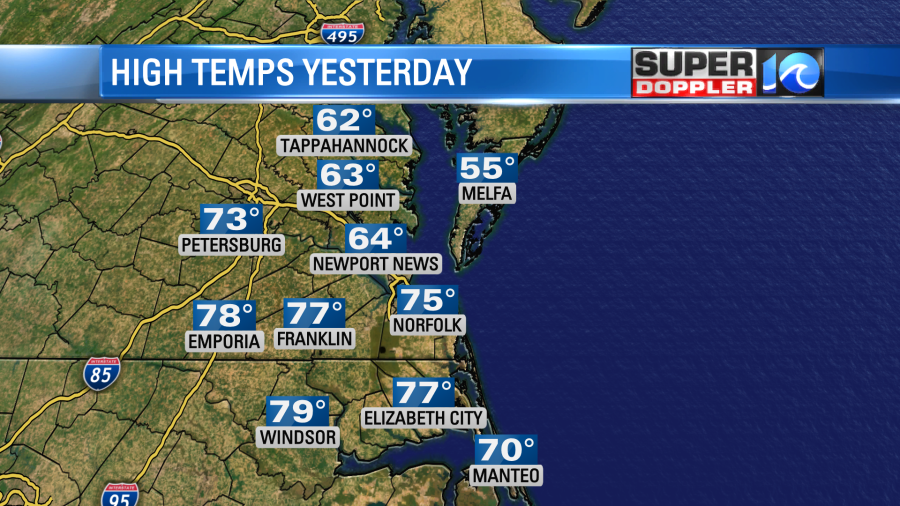
I’ll admit….Yesterday….I was (partly) wrong. I did get it right that it would be a warm day. However, the warm front moved in a little earlier than forecast, and so it made it a bit more north than forecast. Hence… We were solidly in the 70s over the Southside and northeast North Carolina, but temps were in the 60s (as forecast) from the Peninsula north with 50s on the Eastern Shore.
I did mention in yesterday’s blog that it was a bit tricky. Anyway, today’s forecast is much easier. The warm front is slowly moving to our north. There is already a strong southwest breeze. Temps started in the 60s this morning. It was already unseasonably warm. However, temps will aim for the low 80s later today.
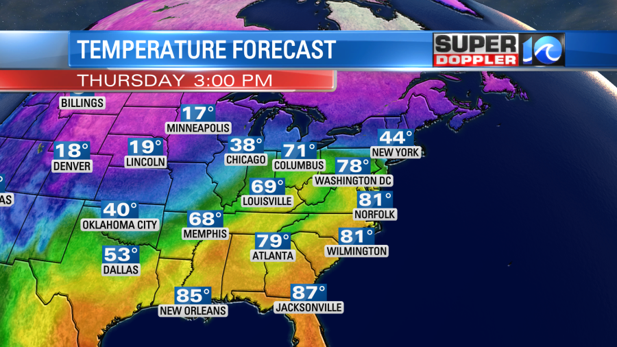
I think some locations will even make it to the low-mid 80s like Williamsburg, VA. The standing record in Norfolk is 79 degrees. The all-time record high in February is 82. However, this was reached a few times in the past.
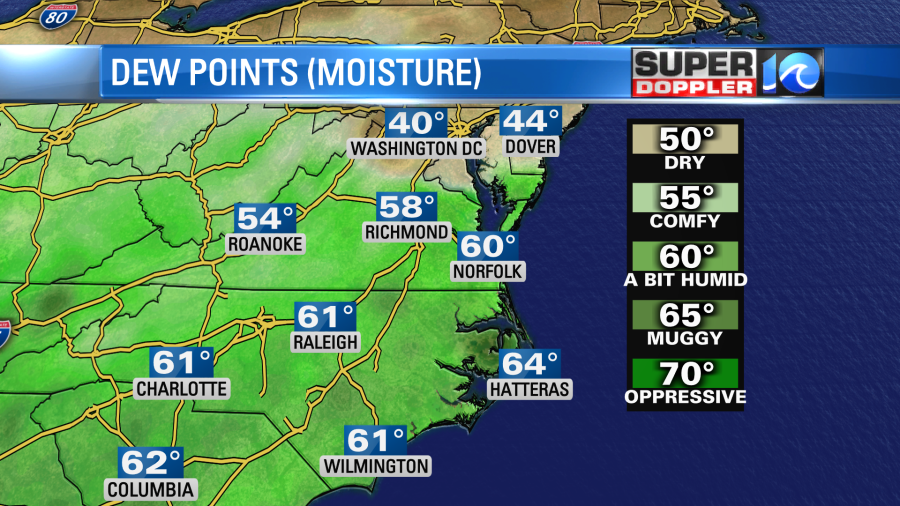
Along with the heat today comes some moderate humidity. Dew points are now at 60, and they may climb a bit more.
Luckily there is a nice breeze out of the southwest. So that will help with how it feels outside. Otherwise, it would probably be a bit muggy. However, the wind may be a little too strong at times with gusts up to 30mph. I don’t expect rain today other than a sprinkle north.
While the warm front is slowly sliding north, there is a also a strong cold front to the west.
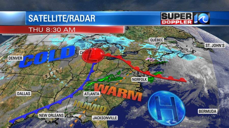
We’ll stay in the large warm zone today. However, that cold front will move in by tomorrow morning. Temps will start off in the 60s early. Then temps will fall to the 50s by the afternoon.
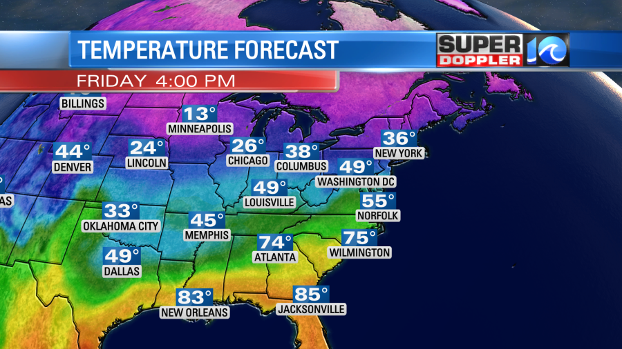
We’ll be partly cloudy Friday. Other than a stray shower we should stay pretty dry. Winds will turn out of the northwest, and they will gust up to 25mph.
The front will stall out to our south on Saturday. This will allow for the colder air to sink into the region. Low temps will be in the 30s. High temps will only be in the mid-upper 40s.
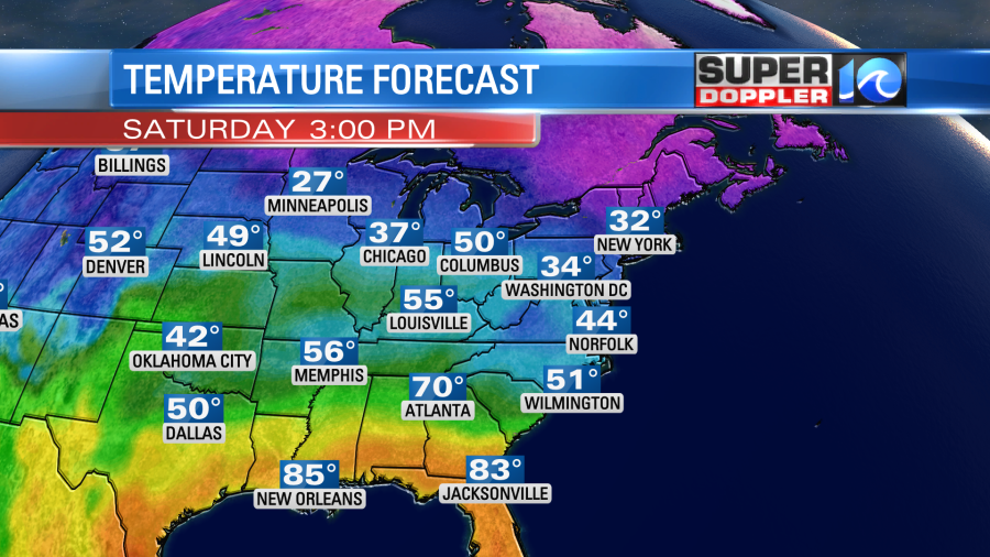
Moisture will push up north of the front into our region. Plus, a weak area of low pressure will form along the boundary. This will create a lot of clouds over the area. Also, we’ll have scattered rain showers at times. It might even start as a brief wintry mix north of the metro.

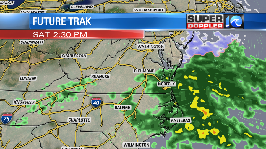
The bottom line…It is going to be a pretty nasty day. However…Sunday is looking pretty good. There may be some clouds and isolated showers early Sunday morning, but it looks like we’ll have some nice weather for the bulk of the day. High temps will rise back up to the upper 50s. We’ll be mild next week with temps mainly in the 50s and 60s.
Some folks may want to head to the beach today. That’s fine. Just keep in mind that the wind will be blowing the sand around a bit. Plus…water temps are only in the 50s.
Meanwhile more snow is falling and causing problems in the northern states. Schools that don’t normally close for snow were closing. Over 1,000 flights have been cancelled. It’s not just up north either. Blizzard warnings were recently issued in L.A. California. Here is an article with more information: Snow problems in the northern and western U.S.
Meteorologist: Jeremy Wheeler


