We just had 2 warm days recently. We didn’t break a record, but high temps were in the low 80s Tuesday and Wednesday.
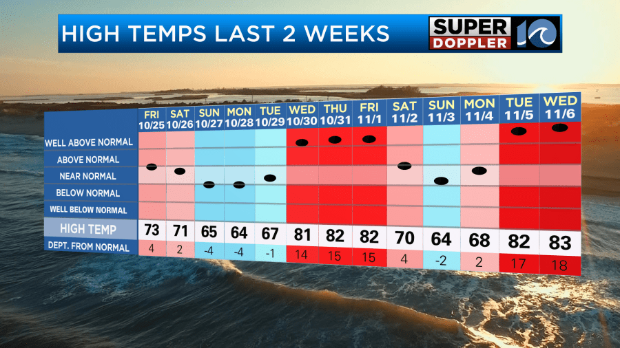
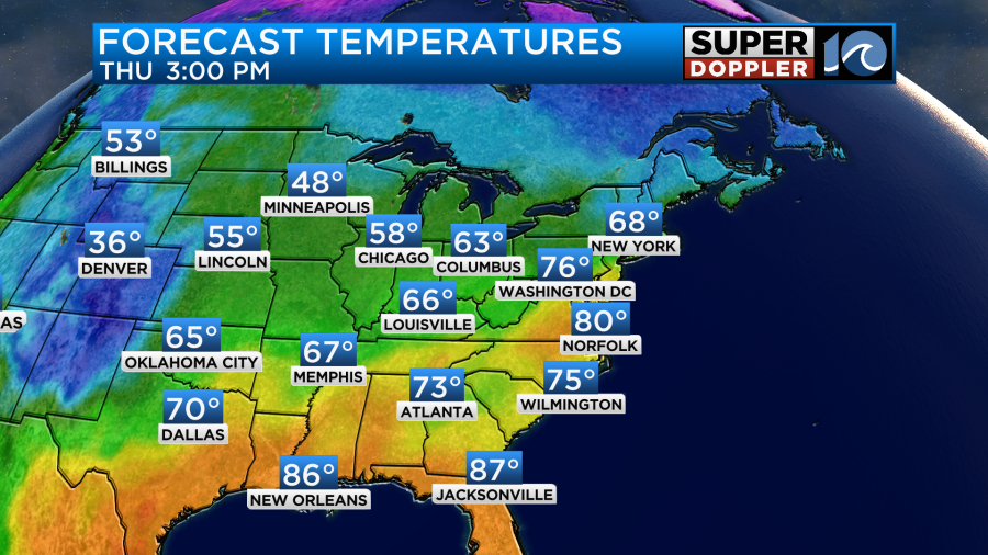
We are going to have one more warm day, and with the way the records are, we may actually break the record. High temps are aiming for near 80 degrees this afternoon.
The current record is 79 (2022). A cold front is moving into the region, but it is very slow moving. It was still off to our west this morning.
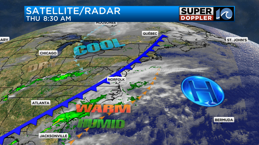
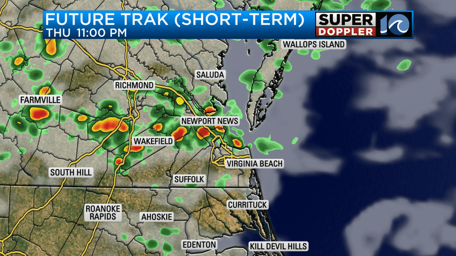
The front will arrive later this afternoon. Winds will turn from southwest to northwest. It may kick off some isolated showers later today, but it will hopefully create some scattered rain showers tonight.
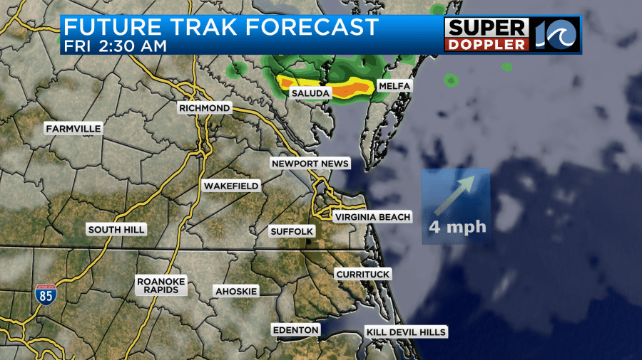
Our Future Trak model keeps that batch of showers to the north of the metro, but I think some of them will get closer to the region. The HRRR model does have quite a bit of rain.
The front will slowly sink to the south tomorrow. There will be some clouds and isolated showers in the morning. Then we’ll dry out and clear out as we head into the afternoon. High temps tomorrow will be in the upper 60s to near 70.
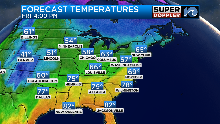
We’ll then have some nice weather over the weekend. Highs will be in the 60s, and we’ll be much drier.
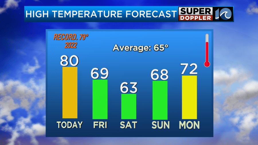
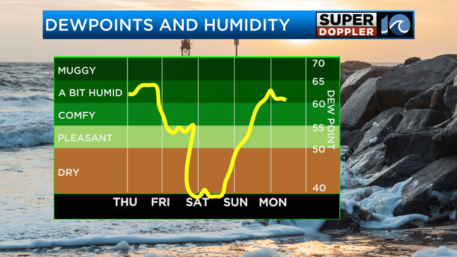
The weather looks good for most of the weekend, but that increasing moisture late Sunday could lead to some spotty showers. Then the rain chances will go up Sunday night into Monday as deeper moisture arrives. Temps will warm back up to the low 70s on Monday.
As far as rainfall goes… There will only be some light and scattered rain showers over the next 24 hours. Some models have zero precip, but at least a couple have a tenth of an inch or two.
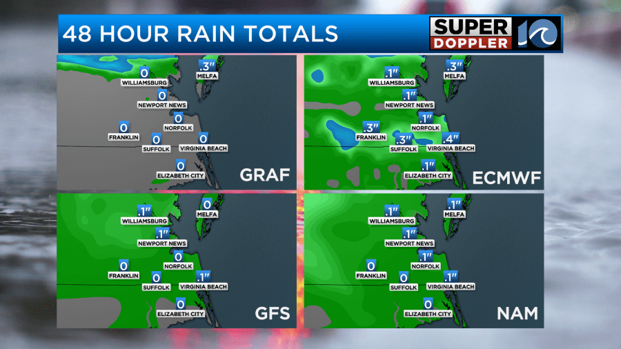
We have already broken the record number of days without rainfall. By the end of today it will be 36 days. It’s possible that by tomorrow that streak will have ended.
Meanwhile in the tropics… Hurricane Rafael is moving away from Cuba.
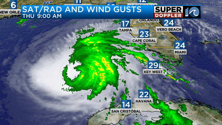
It lashed western Cuba yesterday as a brief major hurricane. There was damage, and there were more power outages to the island. The storm is now forecast to move more to the west than the northwest. The official track has it travelling mainly to the west and weakening. This as it hits some drier air and stronger wind shear.
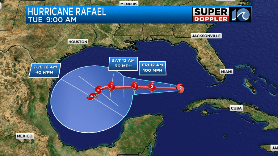
However, being on a more westerly track it won’t go over the slightly cooler water that is closer to the coast. In fact some models have it moving back to the south.
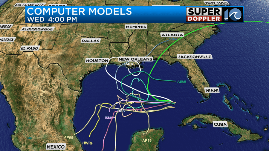
The GFS does take it closer to the coast compared to other models.
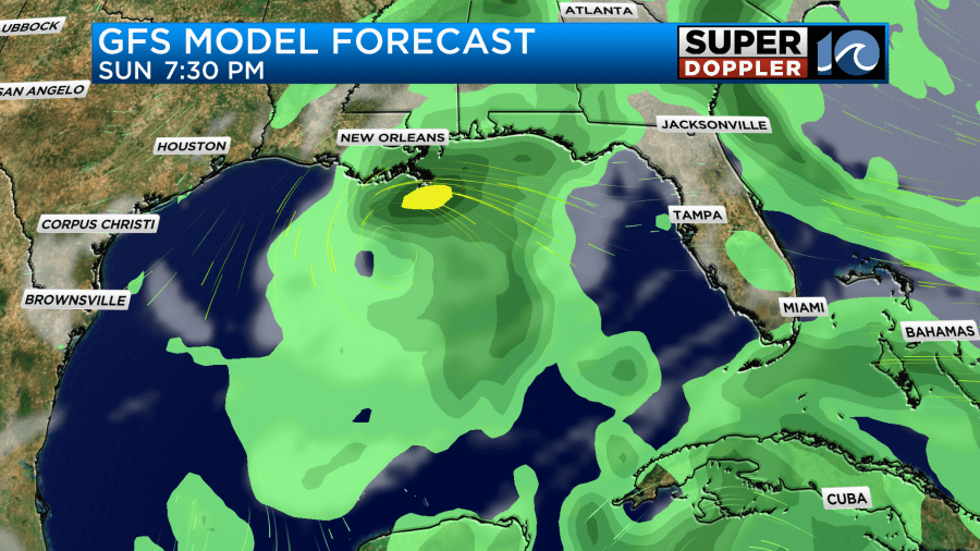
Luckily, it has the system pretty weak between days 3 and 5 as most of the other models have.
We’ll be tracking it over the next few days.
Meteorologist: Jeremy Wheeler


