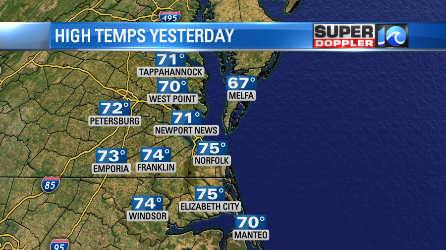
Yesterday we ended up a little bit warmer than expected, but only by a few degrees. We ended up in the low-mid 70s instead of the upper 60s to low 70s.
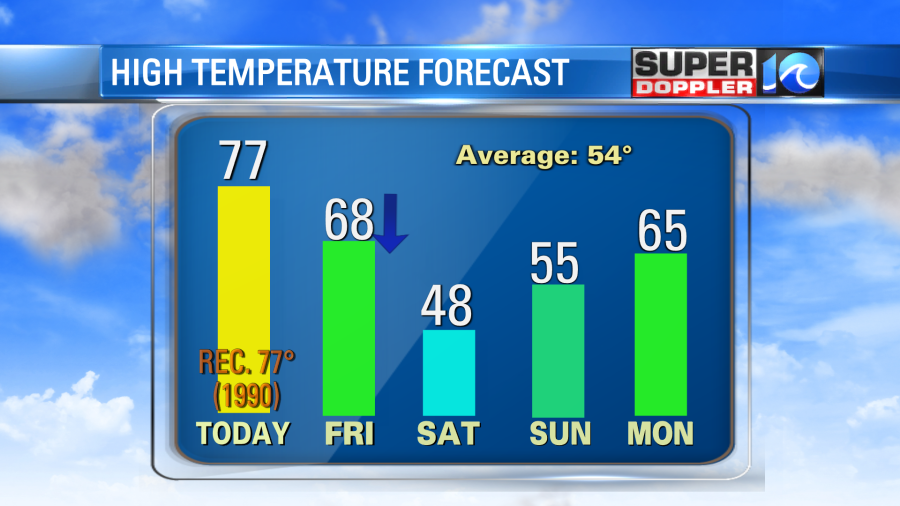
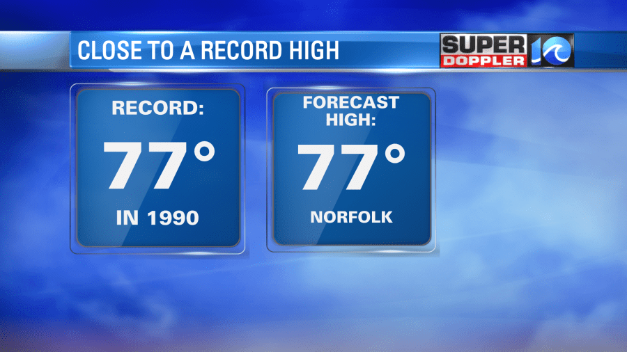
The interesting thing about that is that we started off in the 40s in the morning. It was a sharp rise in temps (which was predicted). Today will be another unseasonably warm day. THIS morning we started off in the upper 50s to near 60. So it’s likely then that we’ll be even warmer this afternoon. High temps are aiming for the upper 70s. In fact I am currently calling to tie or break the standing record of 77 degrees (1990).
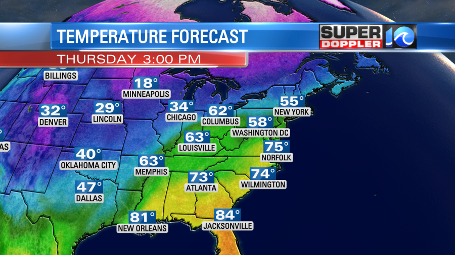
It won’t just be warm here. Temps will be challenging records over much of the eastern third of the country.
We’ll be partly cloudy with a few more clouds at times. Winds will be out of the southwest at 10-15mph with gusts to 25mph. Moisture will be increasing quite a bit. The dew points are going to climb into the 50s today. That’s pretty comfortable in the Spring and early Summer, but it’s actually fairly high for Wintertime. There may be enough moisture for some isolated showers this afternoon, but the chance is low (20%).
We have a warm front to our north, and there is a strong cold front to our west. High pressure is just offshore.
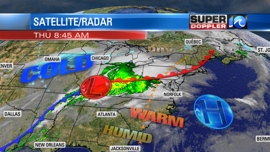
They are expecting strong storms over the Tennessee River Valley this afternoon and evening.
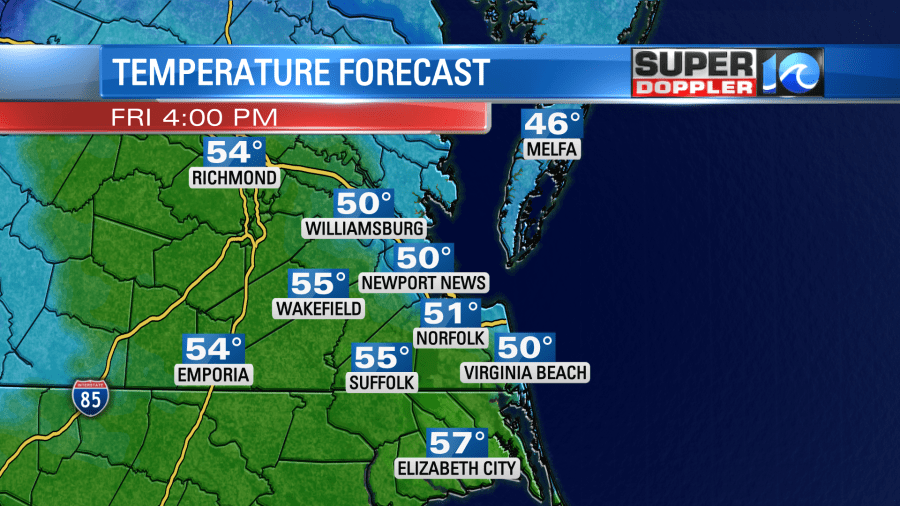
The cold front will move in tomorrow, but it will take a little while to slide through. Temps will rise to the upper 60s to near 70 around midday.

Winds will be out of the southwest through that time. Gusts could be up to 30mph.
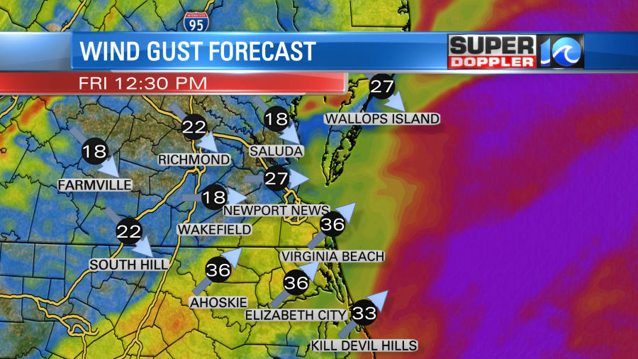
As the winds turn out of the northwest in the afternoon, temps will fall to near 50.
Even though the front is expected more towards the early afternoon, the rain will arrive much sooner. We’ll have a large area of rain moving in by the mid-morning.
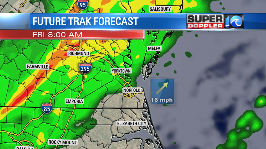
It could speed up or slow down a bit, but right now it looks like the best chance for rain will be from the late morning until the mid afternoon.
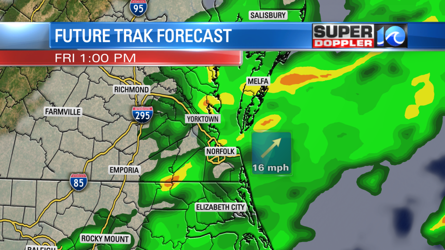
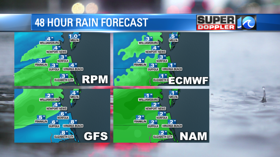
The models are calling for most of the rain to head out by the evening commute. They are forecasting about a quarter to a half an inch of rain. So that will be much less than the last rain that we had.
Temps will drop to the low 30s going into Saturday morning as we dry things out. Skies will clear. Then we’ll have fair skies on Saturday, but the high temps will only be in the upper 40s. We’ll be dry on Sunday with high temps returning to the 50s. Then we’ll be dry and warmer on President’s Day with highs in the 60s. We are definitely spoiled this year.
Meteorologist: Jeremy Wheeler