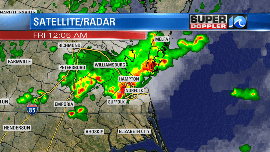
Last night was a wake up call…literally. I woke up to a large severe thunderstorm warning for the area a little before midnight. That was after 2 hours of sleep.
I decided to go into work early to help out meteorologist Don Slater. Luckily, the storms weakened after I got in. (I did snooze for a bit at work then). However, they were strong enough to produce some damage reports before that happened.
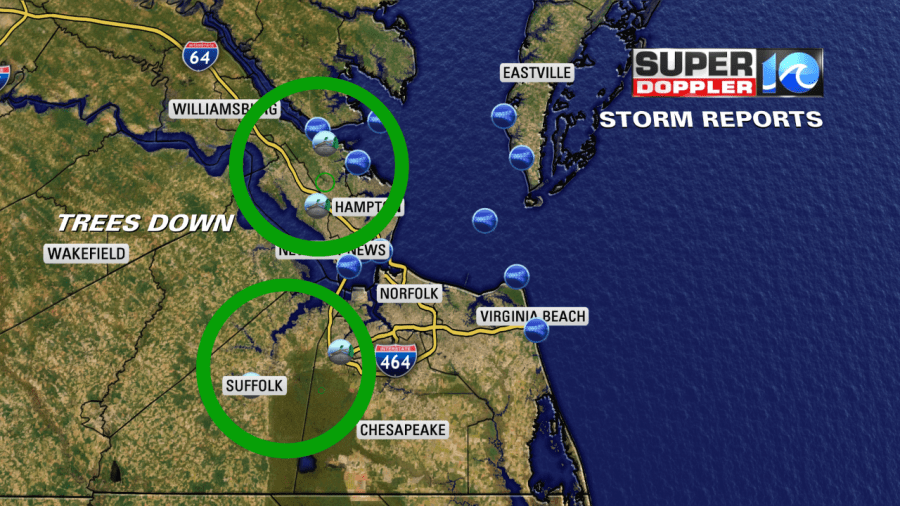
There were a few reports of trees down in the region (lighter small circles within the green circles). There were also many wind gusts reports over 40 mph (blue circles).
On a positive note, we did get some much needed rain over parts of the area.
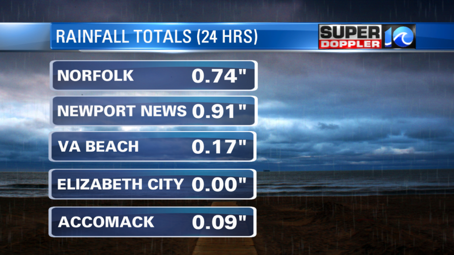
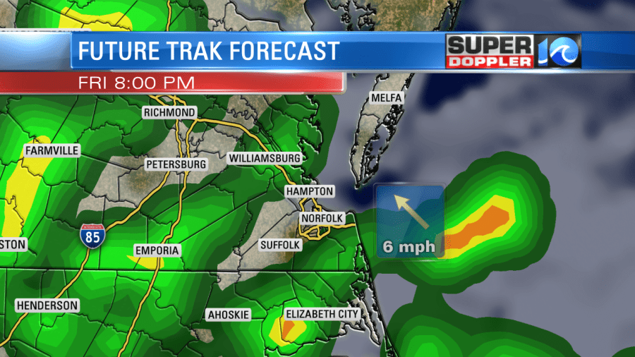
Sorry Elizabeth City…you missed out this round. The storms formed along a subtle wind-shift that entered the region.
While the boundary was subtle, there was a lot of heat and humidity for the storms to feed off of. These moved out through the mid morning, and became a few spotty/light showers. There is a bigger system off to our west that will move in later this morning into the afternoon. That is a cold front.
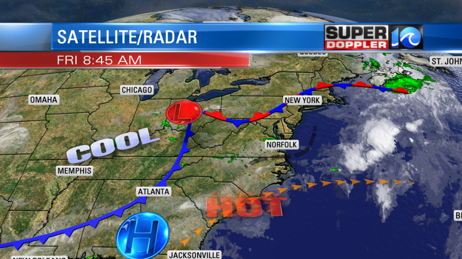
This front will bring in some much cooler air (relatively). Yesterday, high temps were in the upper 90s to near 100. Today, we will be in the mid-upper 80s. However, the front will also create some more scattered showers and storms. These could be strong to severe later today. There was even a slight risk (level 2 out of 5) for severe weather as of writing this blog.
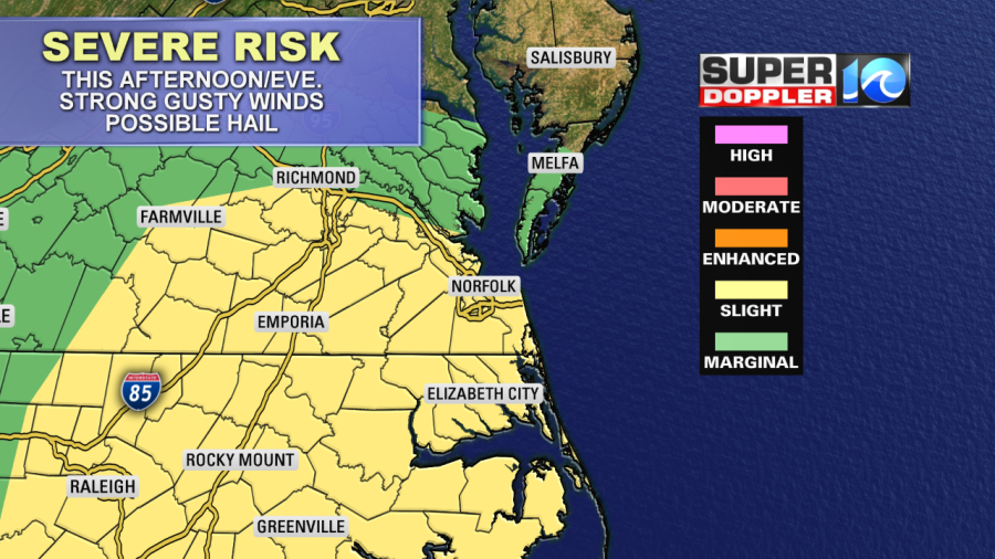
Strong, gusty winds and possible hail will be the main threats with these storms. Heavy rain will also be possible. The highest chance for this is from the late afternoon into the mid evening hours.
Parts of this may stem from the front briefly stalling out over the area. Tomorrow, the front will sink to our south. We’ll be even cooler with highs in the low 80s. That will lower our chance for thunderstorms, but there will still be some scattered rain showers moving in from the ocean to the west/southwest.
I think they will mainly be for the first half of the day. Then we’ll dry out later in the afternoon. At least we’ll get some more rain in the region. There should still be some time to head to some of the local events like the Patriotic Festival in Virginia Beach and the Blackbeard Pirate Festival in Hampton.
We should dry out by Sunday. There might be an isolated showers, but I don’t expect much. Highs will be in the 80s with partly cloudy skies. Then we’ll be dry and mild for the first half of next week. High temps will be in the upper 70s Monday and Tuesday. Nice!
Meteorologist: Jeremy Wheeler