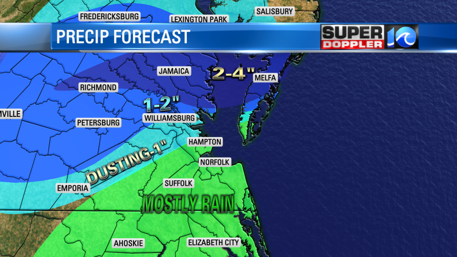
The forecast went about as expected this morning. Many of us in Hampton Roads woke up to a cold rain. However, there was a wintry mix just northwest of the metro. There was also accumulating snow north/northeast of Hampton Roads.

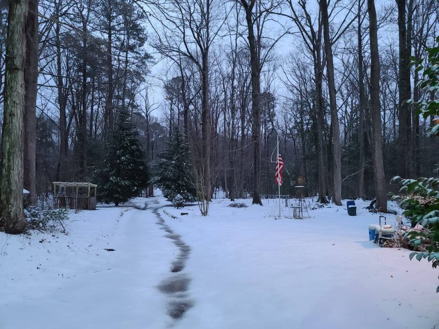
My weather watcher Barry had about 3″ of snow. He said that it was an icy snow as some mixed precip had also fallen. Here is how his back yard looked:
The wintry weather has been tapering off from north to south as I write this. I think we got pretty close to what I called for as far as wintry weather. There was definitely 2-4″ over parts of the Middle Peninsula and Eastern Shore. There wasn’t much snow, but there was some iciness between northern Newport News and Williamsburg.
We still have a stationary front to our south with a couple of areas of low pressure near the boundary.

They will move east/northeast today, and a couple more will form over the weekend. A large upper level trough will also sit overhead. So while the big area of precip will move out by midday there will be clouds and drizzle holing on through the afternoon.

High temps will only be in the upper 30s. However, the wind will be out of the north at 10-15mph with gusts to 25mph. This will put the wind chills in the upper 20s to low 30s. Be careful if you are working outside for a long period of time (shipyard or construction for instance?). If you get wet with wind chills near 30, then you could get hypothermia. Even though actual air temps are above freezing. One of the coldest times I’ve ever been in my life was up in Illinois when I was snowblowing walks in about 34 degrees. I got wet, and the wind was pretty strong. The wind cut right through my winter coat. I had a bit of frostbite on my hands, and I had to run them under mild water for a while to warm them up.
Tonight the rain showers will return to the region with a wintry mix to the northwest.
Lows will be in the mid 30s with low 30s northwest. Unfortunately, the rain will continue tomorrow for most of the area, but that wintry mix could be on and off between I-95, Wakefield, Williamsburg, and Gloucester county. In fact late tomorrow and tomorrow night there could be a big problem towards I-95 with ice accumulating on the roads over there.

The good news is that a lot of this ends early Sunday morning. Then we should dry out a bit through the day. There may just be some isolated showers. High temps will be in the 40s this weekend, but there will be some upper 30s north/northwest.
We’ll have more rain on Monday and Tuesday. There could be a mix again to the northwest of the metro. By that time we could be talking about some localized flooding. Some nuisance to very minor tidal flooding could happen today during high tide, but the rain itself could cause some isolated flooding during the weekend into early next week. Especially after some of that snow melts. Stay tuned for updates on that.
Meteorologist: Jeremy Wheeler


