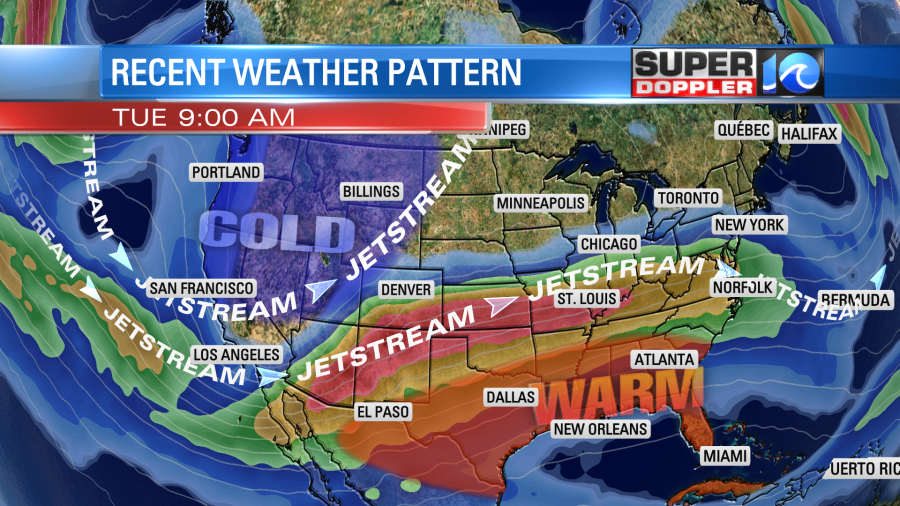
Over the next several days we are going to see some periodic rain showers with some nice weather in-between. At the moment California is experiencing a brief break between systems.
The storms that just hit there are forecast to move northeast and cause a lot of snow through the Rockies and the Plains. The jetstream is still dipping over the western U.S. Meanwhile it is ridging in the east.
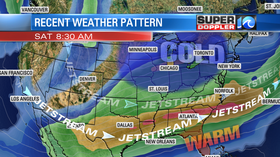
There will be one more system affecting California over the next couple of days, but then they should get a much longer break. The jetstream pattern will change later this week into next weekend.
When things settle down California will be able to focus on one good piece of news…The Drought has really been dented out there.
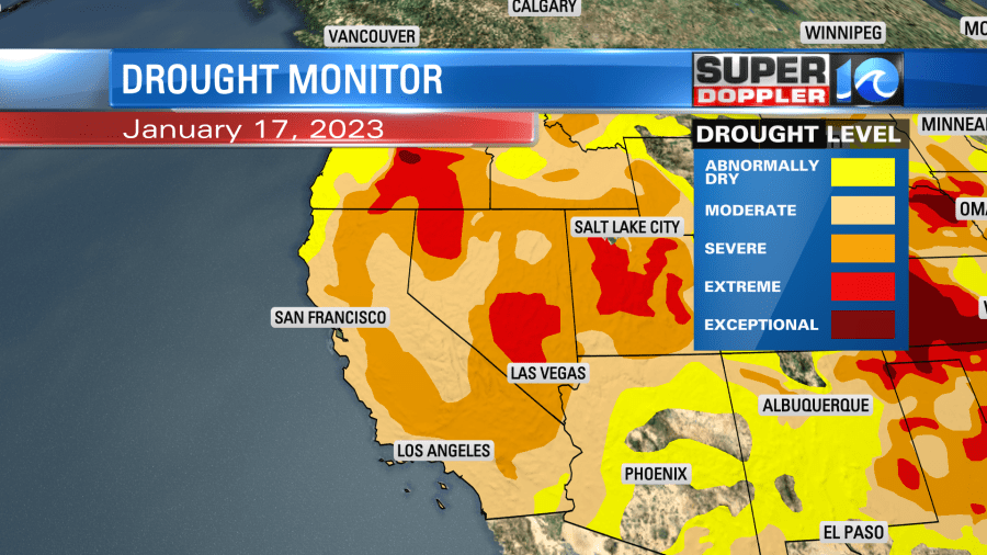
Remember, much of the state has been in an extreme or exceptional drought for the last couple few years. They will still need more rain and snow melt to be able to get back to normal, but at least the recent rain has helped that problem in the short term.
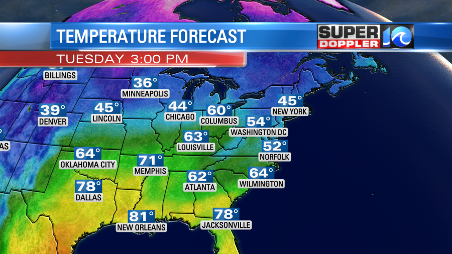
Meanwhile farther east things are pretty mild. Temps are in the 60s and 70s over a large portion of the eastern third of the country. We won’t be too warm here today, but it will be seasonable.
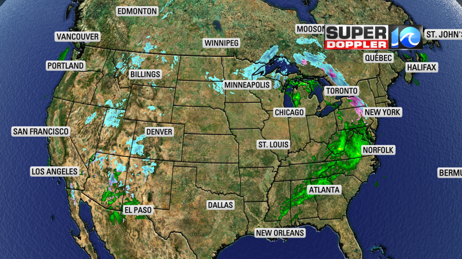
We have a lot of moisture moving in from the west. There is an area of low pressure over the Midwest. It is attached to a couple of fronts.
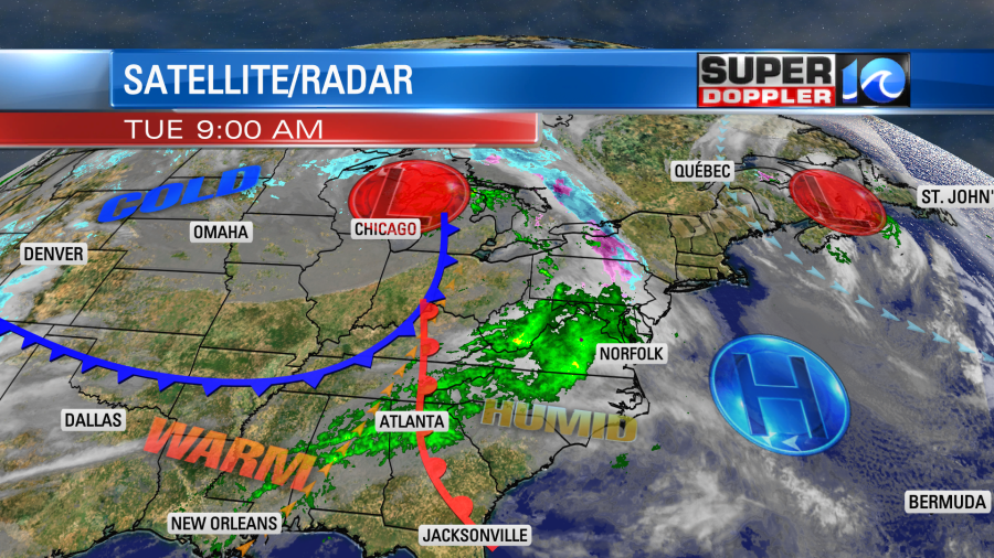
We’ll have lots of clouds through the day with scattered rain showers moving in from the west. The highest chance for rain will be between the late morning and the mid-afternoon hours.
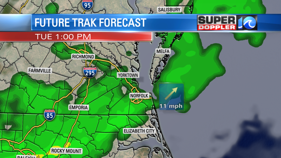
The rain should mostly be light. It could be moderate in a few spots. However, I don’t expect any thunderstorms. Winds will be out of the southwest. Some of the gusts could be up to 20mph.
Tomorrow looks great! There may be a little patchy fog with a few clouds early in the morning. However, the rest of the day looks mostly sunny and mild. High temps will be in the 60s.
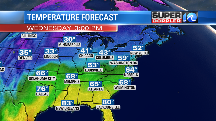
Another system will move in on Thursday that will bring us some rain showers. They look even more scattered than the showers today, but it could pick up by the evening.
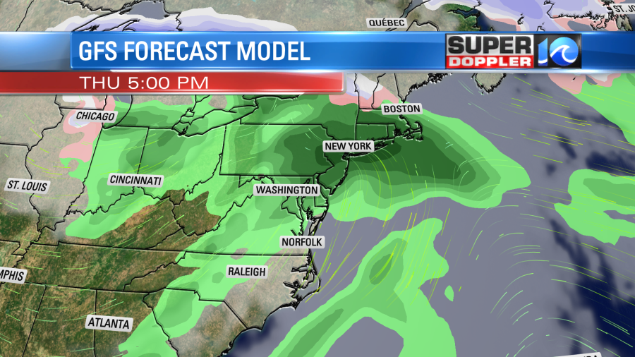
High temps will really warm up on Thursday. I’m seeing different numbers, but I’m putting our highs up to the upper 60s for that day.
Friday looks good again. We’ll have clear skies with high temps in the upper 50s to low 60s. Then we’ll be dry and a bit cooler on Saturday. Highs will be in the 50s. Some more rain is possible from Sunday into Monday, but I’ll talk more about that in tomorrow’s weather blog.
Before I go… I found a neat article that talks about a recent milestone for humanity. In 2021 scientists successfully tested a laser that apparently guided where lightning traveled. While this could potentially change the future of lightning safety, it will be a while before it is used for the masses as it is very expensive. Here is the article with more information: Lightning guided by lasers.
Meteorologist: Jeremy Wheeler


