Update as of Wednesday evening:
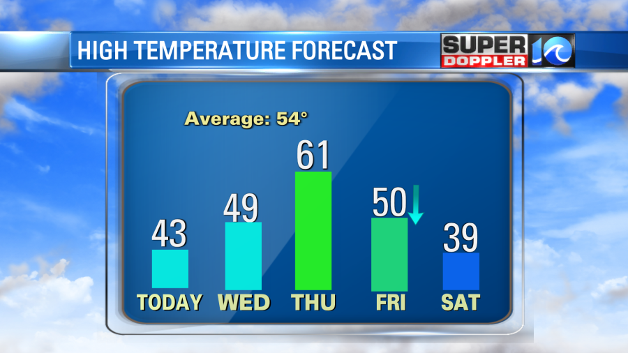
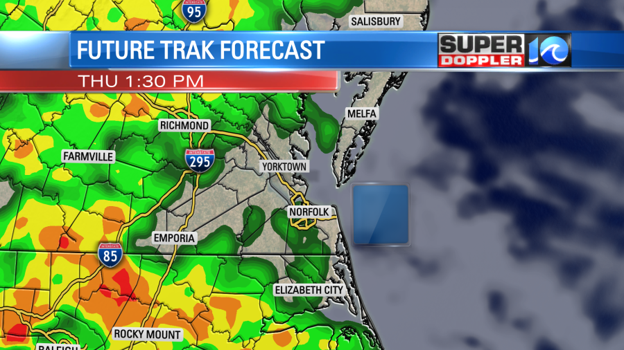
Things remain dry and chilly for one more day before this dynamic system moves in. Temperatures hold in the 40s tomorrow with increasing clouds ahead of round 1, which will be soaking rains on Thursday. On and off rain is set to move in Thursday, heavy at times, with a few thunderstorms thrown in there. The warm breeze takes temperatures close to 60°!
Round 2 moves in on Friday when the cold front blasts through the region. Expect a few showers with the front, there’s still a possibility of a few snowflakes mixing in but significant snowfall is not likely. Significant cold, however, is very likely. Temperatures will start close to 60° Friday morning before dropping 25°+ within an hour.
Round 3 is the arctic air blasting in going into the weekend. Wind chills will easily be in the teens waking up Saturday and Sunday mornings. High temperatures for the holiday weekend will only be in the 30s as the cold air settles in.

Meteorologist Steve Fundaro
______________________________________________________________________________________________________
Our local weather hasn’t changed much over the last couple of days, and it won’t change much over the next couple of days.
Today we have high pressure to the west. There’s a weak area of low pressure near the Gulf Coast with another one far to our northeast.
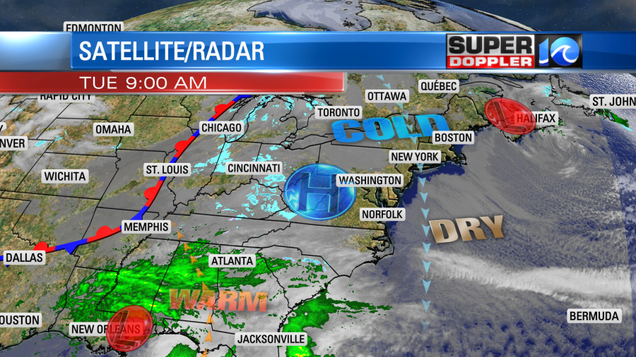
We’ll be dry and chilly today. High temps will run in the low-mid 40s.

These will be pretty close to yesterday’s high temps. We’ll have a mix of sun and clouds with a steady north breeze (8-12mph). Tomorrow the wind will lighten up, and it will be out of the east. We’ll start to pull in a little more moisture. So clouds will increase through the day form south to north.
We’ll stay dry except for a couple of stray showers over the southern Outer Banks. High temps will rise to the upper 40s to near 50.
During the day tomorrow a big area of low pressure will start to strengthen over the central U.S. There will be a column of snow showers from Denver to Minneapolis ahead of that system.
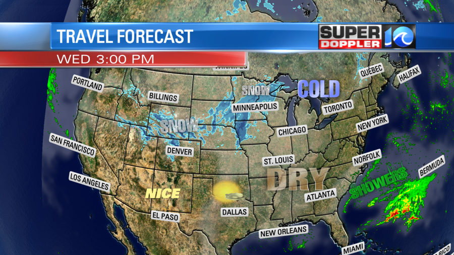
Luckily a big portion of the country will be dry tomorrow for travel. Many won’t be so lucky on Thursday. We’ll develop some scattered rain showers over much of the eastern U.S. on Thursday. This will be mainly due to high moisture return and some overunning precip. However, the low will be strengthening over the Plains states. This will create a growing area of snow over the Midwest.

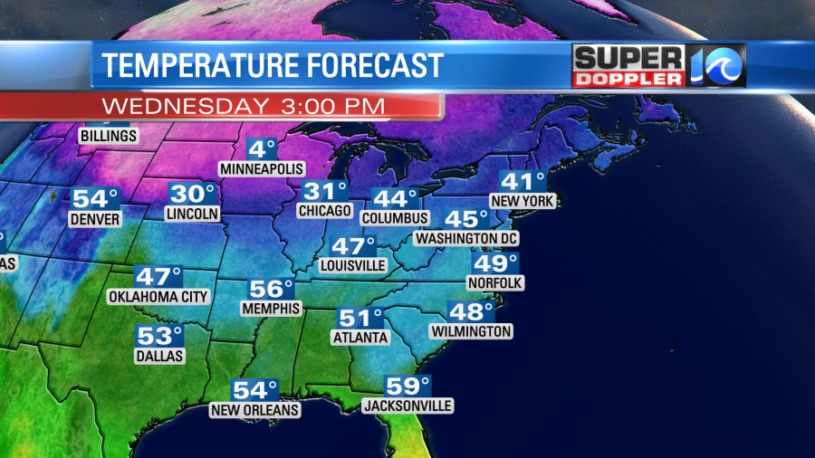
We will warm up here during the day (Big Time!) High temps will rise to the low 60s Thursday afternoon. This will mainly be driven by the increasing south wind.
The storm system in the Midwest is going to get a shot of energy on Thursday. A huge upper level trough will dip down from Canada. Plus, there will be some very cold air dropping southeast to meet some much milder air in the east. We’ll have lots of rain in the region. Showers will be scattered in the morning, but it could become pretty widespread in the afternoon.
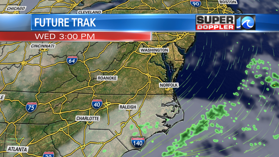
The rain will continue on and off into Friday as the system slides east. We’ll start off mild on Friday morning with temps in the 50s. However, temps will crash as a powerful cold front slides through the region. Behind the front winds could gust to 40mph out of the west. We’ll have lots of rain in the morning, and that is agreed upon by most of the models. However, the afternoon is where it gets tricky. Drier air will be punching in from the west while our surface temperatures drop like a brick. So there is a chance for the rain to end as a brief wintry mix over our area.
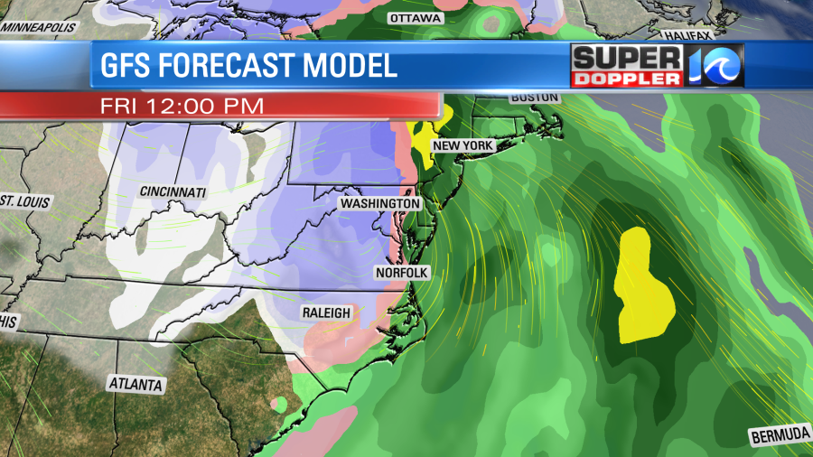

The GFS is a little slower to bring in the dry air while the Euro is very quick to do so.

This difference in the handling of the drier air and timing will make a big difference in the forecast. Keep this in mind though. The GFS model is always too broad in the 3+ day forecast. So the precip will likely be more scattered than you see. Also, surface air temps will be falling, but they will likely be above freezing. Ground temps will also be above freezing. So even if there is snow or sleet falling out of the sky for a little while, then it would likely melt. Tomorrow this time frame will be in range of the higher resolution models. So we’ll have more confidence in the forecast trend. There’s still plenty of time for the forecast to change, and it likely will due to the size of the developing system. Stay tuned for updates!
Either way we will be drier and much colder for the weekend. High temps will be only be in the upper 30s on Saturday. We’ll be in the low 30s for Christmas Eve.
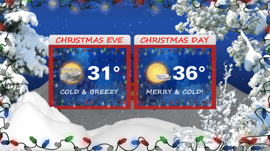
With the big upper level trough (dip in the jetstream) overhead I do think we could get a few flurries between Friday night and Saturday, but we’ll see. It will be cold and breezy on Christmas Eve day. Low temps will be in the 20s and possibly teens in the morning. Wind chills could be in the single digits. Then in the afternoon high temps will only in the upper 30s. We’ll be cold and dry on Christmas Day. High temps will only be in the mid 30s. There will be less wind.
Again, the weather will be pretty messy for travel and shopping Thursday and Friday, but it will be colder and drier for the holiday weekend. Check back for updates on the active weather.
Meteorologist: Jeremy Wheeler


