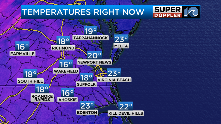
This morning we woke up to wind chills in the single digits in some locations. It was in the teens in others. Temps were in the teens and 20s.
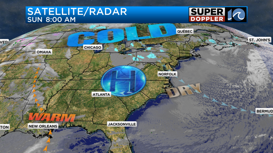
We have a large area of high pressure still building into the region with a very cold/dry air mass in place.
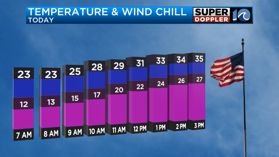
We’ll have lots of sunshine today. However, the wind will stay up out of the northwest for a while. Gusts will be to 25mph. The wind will decrease quite a bit by the evening.

Temps will only manage the mid 30s this afternoon. However, wind chills will be in the 20s.
By tonight the winds will finally die down. They will be light and out of the northwest. However, temps will still be able to drop to the teens and 20s tomorrow morning. Go ahead and slow drip the faucets for one more night. We’ll have clear skies.
Tomorrow we’ll start warming up. We’ll have lots of sunshine with a light southwest wind. So high temps will be able to reach the mid 40s.

Things will get even warmer. By Tuesday we’ll be in the mid 50s with partly cloudy skies.
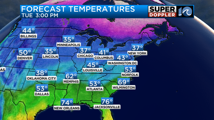
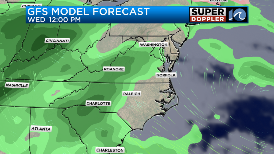
We’ll warm up even more by Wednesday. High temps will shoot up to the low 60s.

We’ll stay in the 60s Wednesday through Saturday. It’s even possible that we’ll get close to 70 degrees on Thursday. We’ll see. However….There will also be more moisture and a chance for some rain. Luckily the chance for rain doesn’t look too high Wednesday and Thursday. I’ve got a 30-40% for now.
However, the rain chance looks like it will go up on Friday. It could possibly even be a washout. I’ll have more about that in tomorrow’s weather blog.
Meteorologist: Jeremy Wheeler