Yesterday’s weather was very nice! We had fair skies all day with high temps mainly in the upper 70s. The dry air has felt really nice. My dog is now pulling me on the walks. A couple of weeks ago, during the muggy weather, her energy would drop about half way through the outing. This is typically the dog days of Summer in Hampton Roads. After this nice break that we are currently in we will heat up next week to more Summery temperatures.
We still have high pressure to our north today. There is a stationary front to our south.
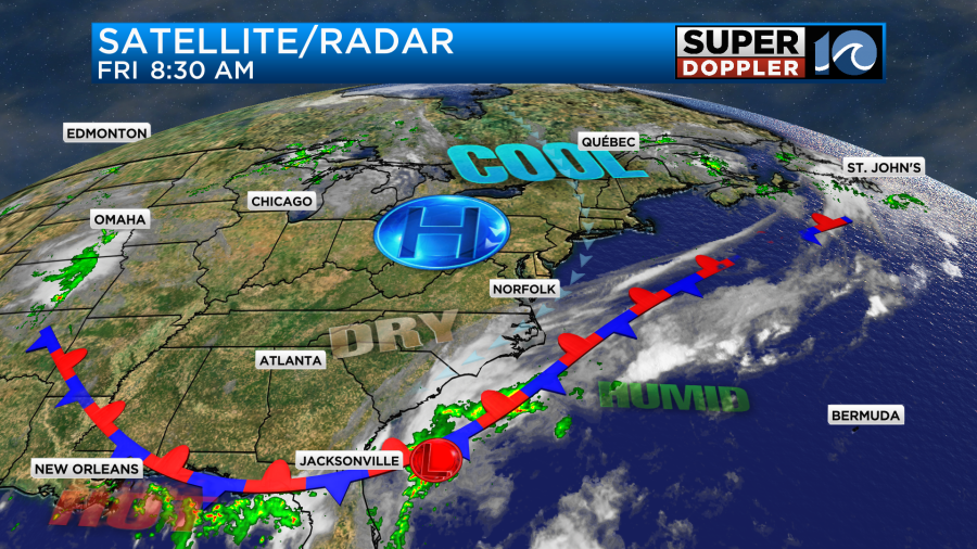
There is a weak area of low pressure along the front near Florida.
We’ll have partly sunny skies today. High temps will rise to the upper 70s to low 80s.
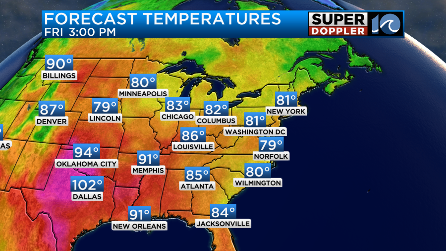
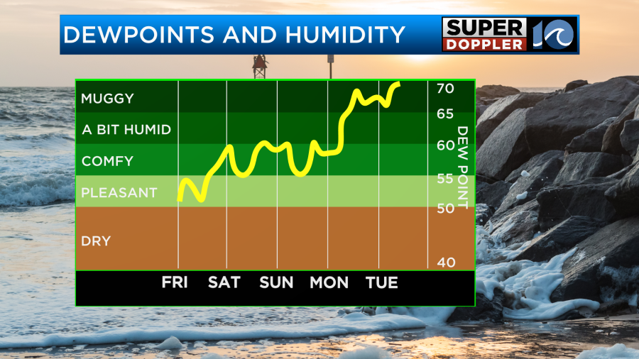
The humidity is still low, but it’s not as dry as the last 3 days. Dew points are in the low-mid 50s. That’s still pleasant for this time of year. We’ll have a light northeast breeze develop.
Tomorrow we’ll have a light east breeze with partly cloudy skies. High temps will be more in the low 80s with some mid 80s inland.
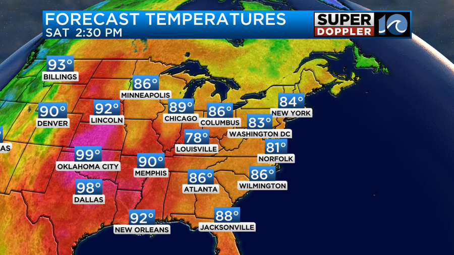
It will still be nice out, but the humidity will go up a little more.
Skies will be partly cloudy. That low pressure area that I mentioned will ride northeast along the stationary front (offshore). It will stay to our south. However, it will push a little extra moisture up to the Outer Banks. This will create a few spotty showers around Hatteras and Rodanthe this weekend. Otherwise, the area’s weather looks good. We’ll have similar weather on Sunday, but high temps will be closer to the mid 80s.
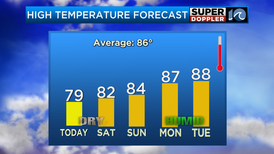
As you can see though, next week the high temps will rise to the upper 80s. Plus, the humidity will go up. So it will feel like the low-mid 90s with heat index. We could use some more rain. Some places need it more than others. I think we’ll have some scattered showers and storms by Monday evening. Then we’ll have some more scattered showers and storms on Tuesday. We’ll have more details on that over the weekend.
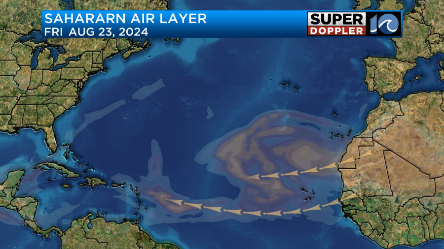
Things are still quiet in the tropics. Wind shear is up a bit. Also, there is a significant Saharan Air Layer coming off of Africa that could limit activity in the development zone.
I mentioned in yesterday’s blog about a cool pocket of water over the eastern Atlantic down towards southwestern and western Africa.
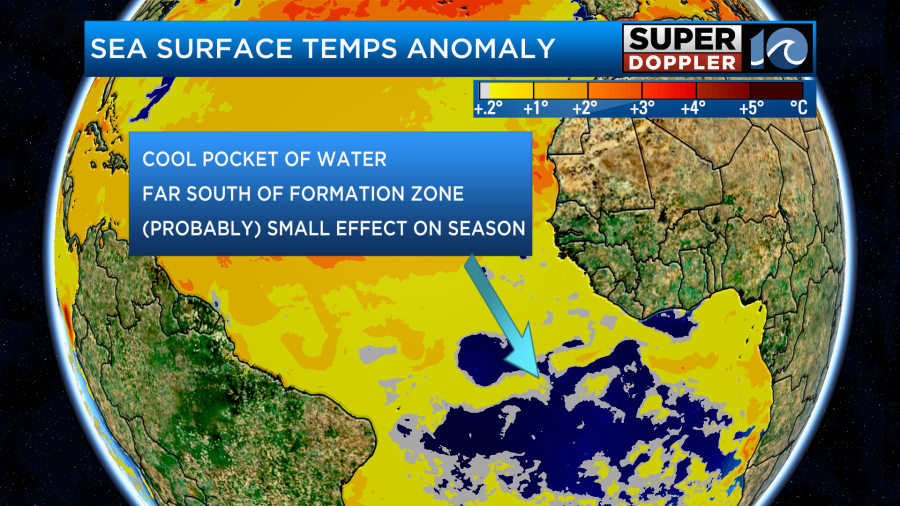
This is pretty far south of the tropical formation zone. So it (Probably) won’t have an impact on the rest of the hurricane season. However, it is interesting how fast some waters of the Atlantic are cooling compared to last year. We’ll continue to monitor.
It would be nice to have a system form somewhere offshore. Because the surf is forecast to be pretty flat for the weekend. That’s not good for the ECSC.

Meteorologist: Jeremy Wheeler


