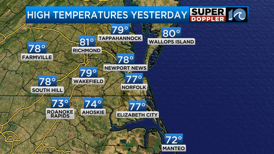
Yesterday, I was down at the north end of the Oceanfront in Virginia Beach for the day. While I did enjoy a long stroll along the boardwalk. I was actually down there for a weather conference at one of the local hotels. The view of the ocean was great, and there were several dolphins briefly popping up above the water. The weather was very nice, but it was chilly at times with the breeze. Especially in the late afternoon. However, inland locations were seasonably warm. Most of the area hit the upper 70s, but there were also a couple of 80s.
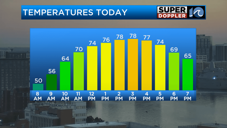
We have had some mild temps in the afternoons recently, and we are going to continue with that today. In fact temps are going to warm up quite a bit between the morning lows (40s and 50s) and the afternoon highs (upper 70s).
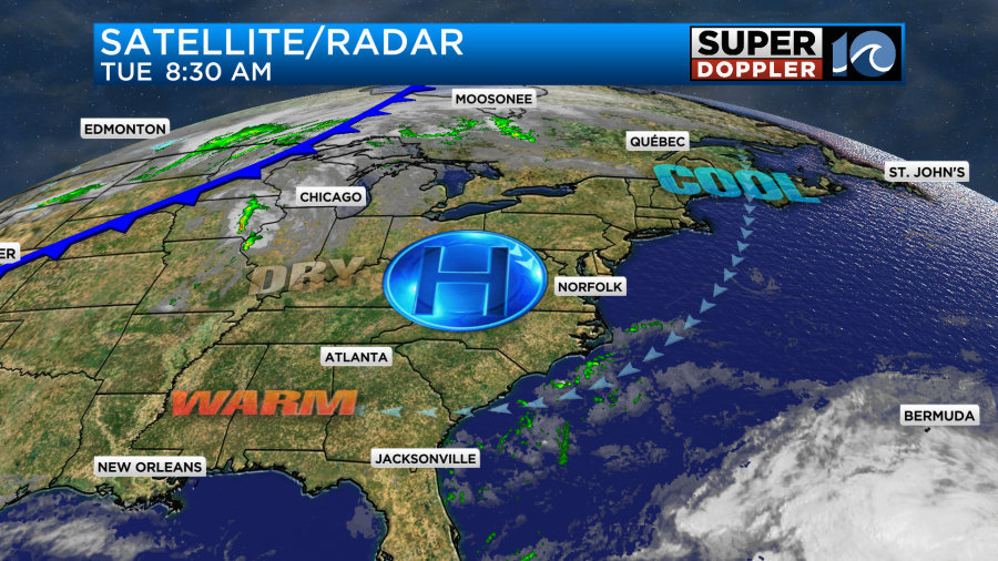
This is due to light winds, very dry air, and lots of strong sunshine. We have a large area of high pressure over the region, and this will help to produce the high amount of sun.
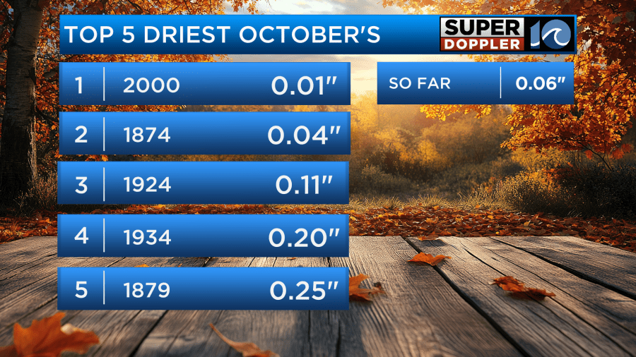
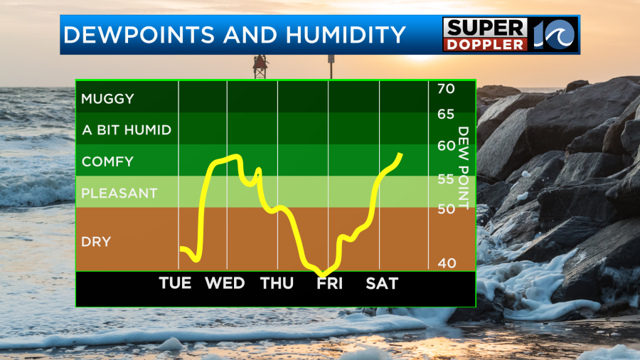
Winds will be light and out of the east. I mentioned that it is dry. It is. Both the air and the ground are parched. Dew points are down in the 30s and 40s today. The ground is also super dry. In fact we are currently in the 3rd driest October on record.
There’s only a slim chance for a shower tomorrow. There will be a moisture push in the morning, and an isolated shower or sprinkle could briefly fall as that comes in off of the ocean. The rest of the day, however, will be partly cloudy. We’ll warm up to the upper 70s to near 80.
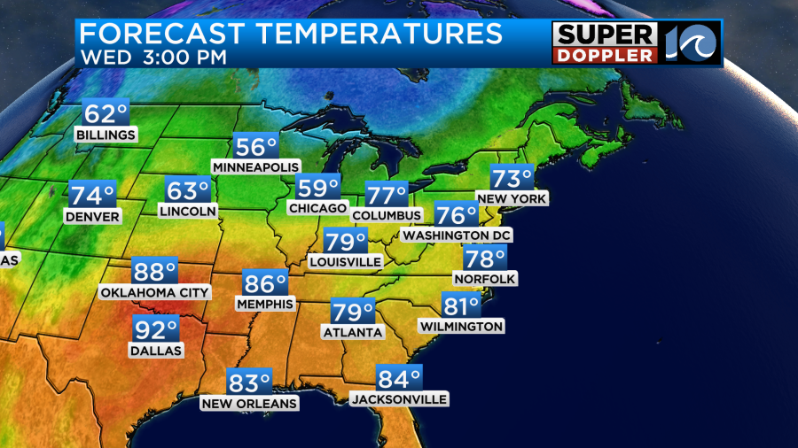
A cold front will move through the region Wednesday night into Thursday morning. This also may create a stray shower, but the chance is 10% or less.
We are going to cool down nicely on Thursday and Friday as a front drops to our south.

Highs will be in the 60s. We’ll be dry on Friday with only a stray shower possible late Saturday. The humidity will bounce around a bit, but it won’t be what I’d call “muggy” or even “humid” over the next 5 days.
We’ll warm to the 70s again on Saturday before cooling down to the low 60s on Sunday. Get ready for some bouncing temps! At least that cold front may bring us a few rain showers on Sunday. Stay tuned.
Speaking of rain. There are more stories of extreme flooding over some world locations. The more recent one was in Roswell, New Mexico. Several inches of rain fell in a short period of time. This is called Flash Flooding. The flooding was bad enough to be deadly. Here’s the article for that story. New Mexico Flooding.
Across the Atlantic, there was recent flooding over parts of Italy that were also pretty bad. This was in the northeastern part of the country.
Finally, there was flooding associated with hurricane/tropical storm Oscar over eastern Cuba. The island already had issues with power before the storm hit.
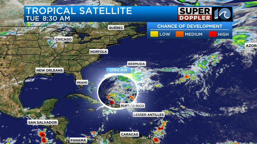
Oscar is now going to move away from the Bahamas. It is barely a tropical storm at this point as the storms around it are very disorganized. It will likely become post-tropical soon.

It will then move north (offshore) and become a non-tropical cyclone. It won’t directly affect the U.S. However, it will continue to leave our coastal waters churned up for a while longer. The surf should be pretty good today. Wave heights are about 2-4 feet with some nice swells arriving. Wet suits only.
Meteorologist: Jeremy Wheeler


