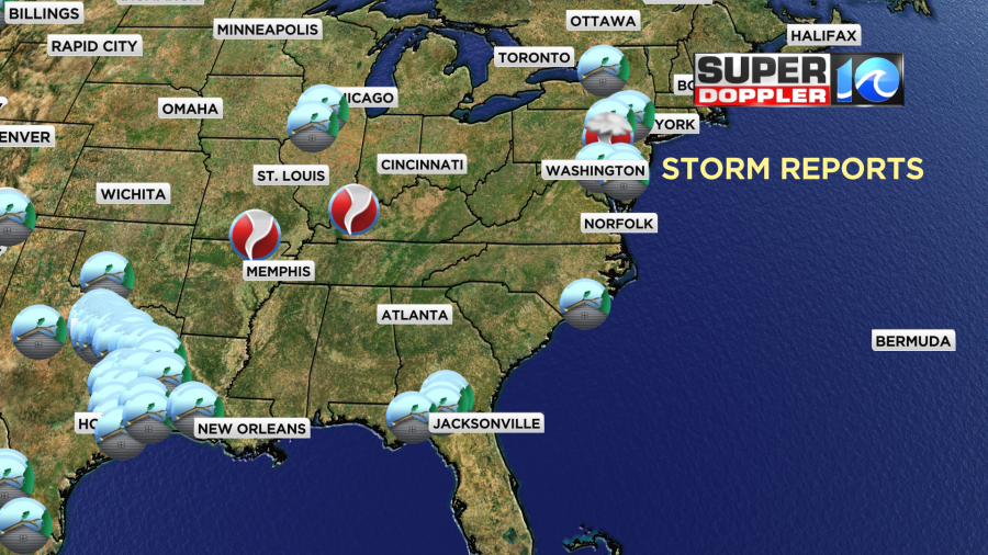
Over the last 36 hours there were more storms, more tornadoes, and more damage over parts of the U.S. Here are the storm reports over the last 36 hours.
There were a couple more tornadoes, and there may be some more over parts of the central U.S. again today and tomorrow.
This is going to add to the already busy severe weather season. In fact, in terms of tornadoes, we have had the second busiest season in the last 14 years and perhaps the second busiest on record.
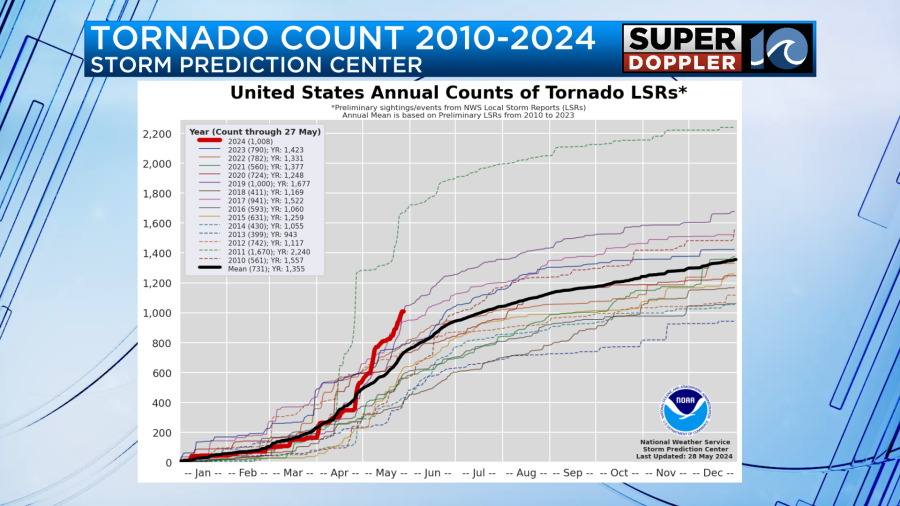
In the graphic above the red line is the tornado tally from this year (already over 1000). It is second to the year 2011 which was the year we had the large tornado outbreak.
There’s various reasons for the large amount of tornadoes this year. This year was characterized more by many days with severe weather as opposed to one or two large outbreaks. There have been unusually warm/hot temperatures across the Gulf coast along with high humidity. Meanwhile, there have been several shots of cooler weather dropping in out of the north. This has created many clashes of the airmasses. There have also been some pretty strong areas of low pressure which inherently produce a broad area of spin. Luckily for us the fronts and the lows have weakened as they have moved east. So we haven’t see a lot of severe weather this Spring. There were a few exceptions. Today we have one of those weak fronts rolling offshore. Another one is to our west.
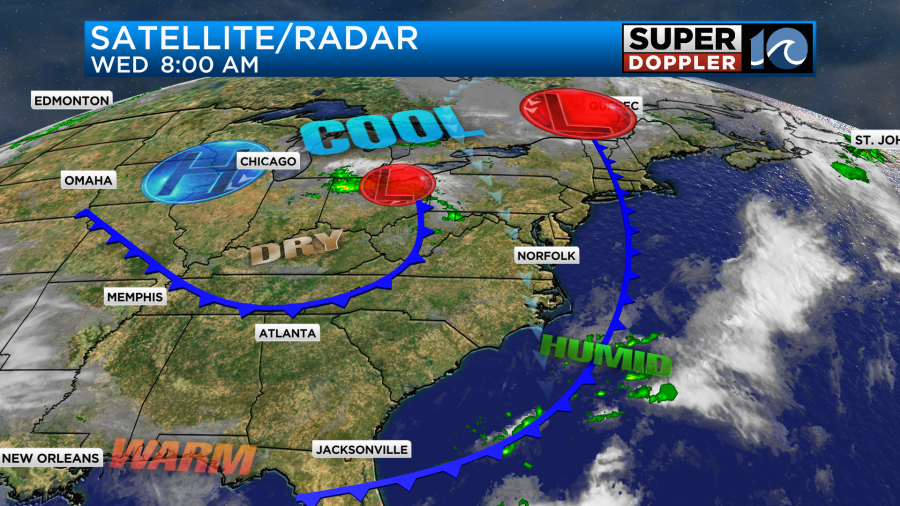
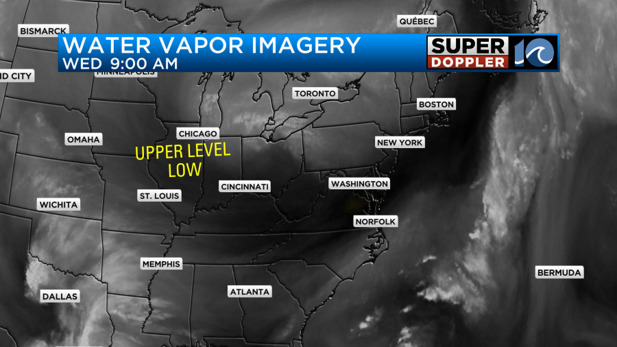
There have also been some upper level lows that have contributed to the instability out west. It’s a bit ironic as these are typically cool pools of air aloft that are also spinning. There is one that is over the Midwest right now.
So with all that said… Our local weather today is looking good. We started with lots of sunshine this morning over the region.

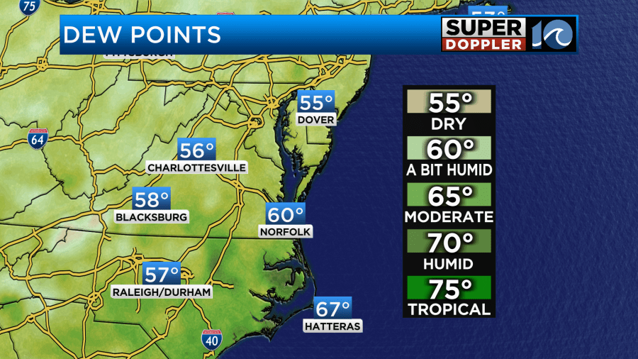
We’ll have mostly sunny skies through the first half of the day. Then we’ll be partly cloudy during the afternoon. There will be some isolated showers in the region. The dew points are not bad. They are in the upper 50s to near 60.
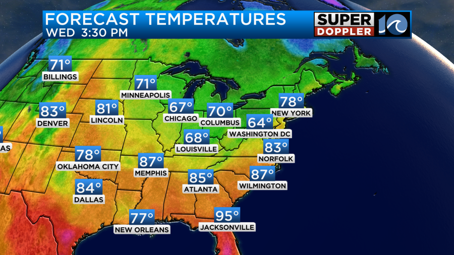
So I think there will only be a couple of showers with only an outside chance for a lone thunderstorm. High temps will be in the low 80s.
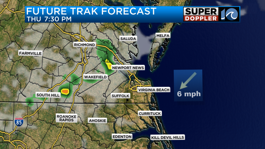
As we get into the evening there will be that upper level low moving in overhead. Plus, the second cool front will be moving in from the west. So there will be a few more showers sliding through the area.

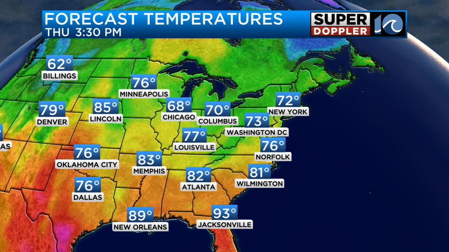
These should end before midnight. Tomorrow we’ll cool down some more behind the second front. High temps will be in the 70s.
We’ll have a steady north/northeast breeze. With the drier air pouring in we’ll have lots of sunshine through the day Thursday. However, the center of the upper level low will be moving overhead from west to east. This will probably create some isolated showers in the evening.
After that we will have even drier air enter the area.
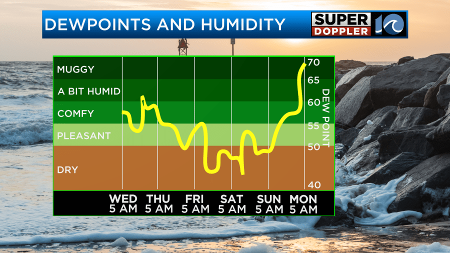
This will lead to a beautiful weekend. Along with very dry air the high temps will be in the 70s Friday and Saturday.

We’ll rise to the low 80s on Sunday. In terms of weather it should be a fabulous weekend!
Meteorologist: Jeremy Wheeler


