Update Tuesday Afternoon:
After our brief break today, the next round of rain moves in tomorrow and we’ll get soaked again! On and off rain showers are likely from mid-morning through the late afternoon and evening. A few zones of heavy rain will develop, there could be an additional 1″+ in many spots!
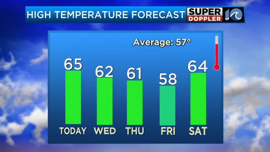
Lingering showers are likely overnight Wednesday into Thursday, with a few showers and stubborn clouds for most of the morning. We’ll dry out Thursday afternoon to give a break from the rain, this will take us into a nice day Friday. Look for some sun between the clouds and temperatures in the 50s.
Round three of rain comes in for the weekend, but as of now, the weekend does not look like a washout. Scattered showers should come in later Saturday through the night into Sunday morning.
Grab the umbrellas and stay dry!
-Steve
______________________________________________________________________________________________________
This morning we woke up to cloudy skies, a lot of drizzle, and a few rain showers.
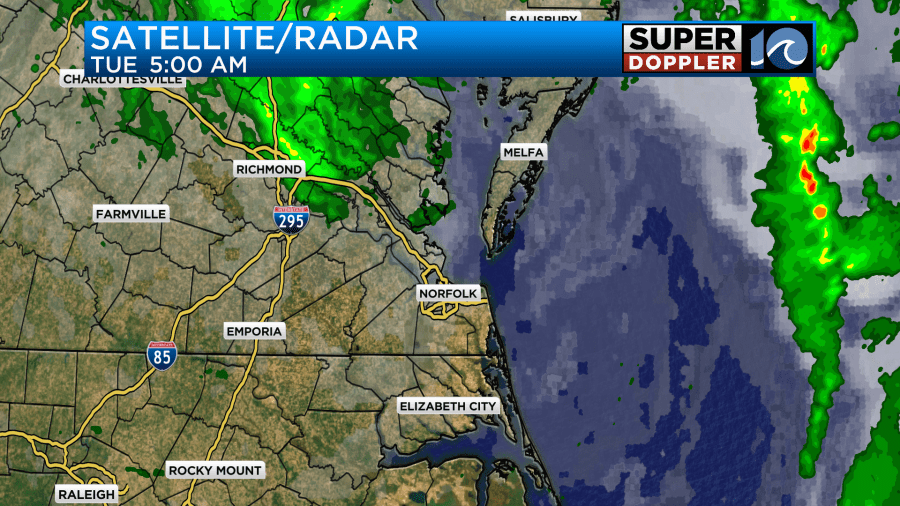
There was also some fog. This was after on-and-off rain showers that fell over the last 24 hours. We did pick up about an inch and a half of rainfall with almost 2 inches over Elizabeth City.

My weather watcher Scott in York county had 1.32″.
This was all from a weak area of low pressure that slowly moved through our region. Today that low is moving to our north.
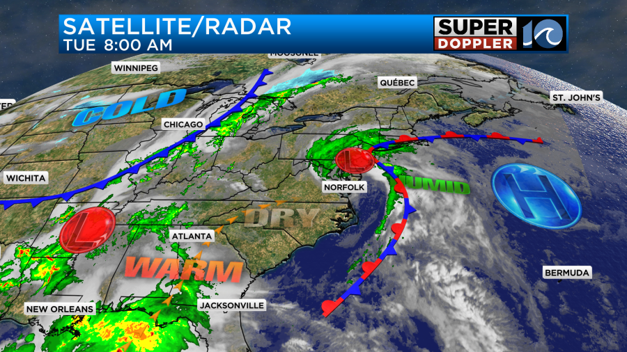
We’ll have drier air moving in behind the system today, but it will be gradual. We’ll gradually clear out from the late morning into the afternoon. There won’t be any more precip. It should be good for voters at the polls.
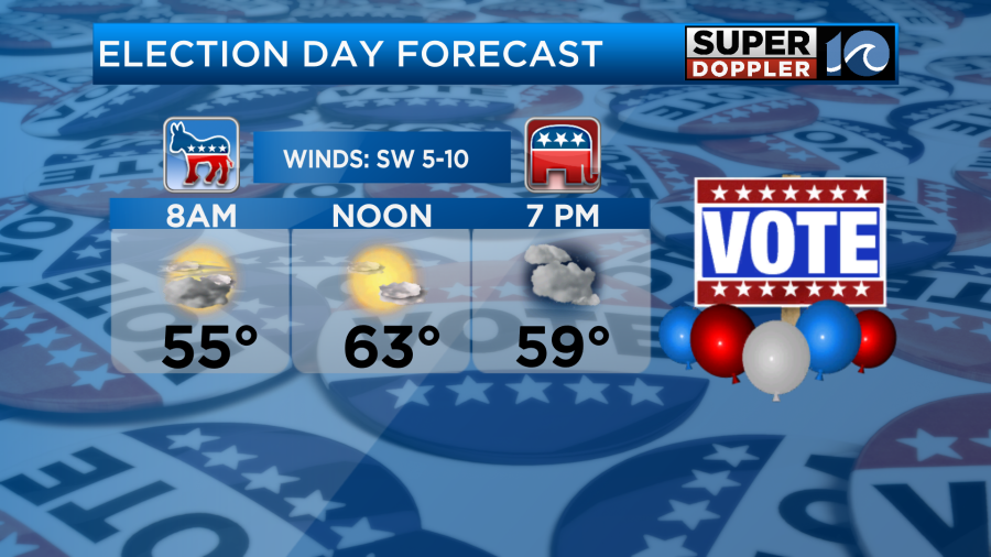
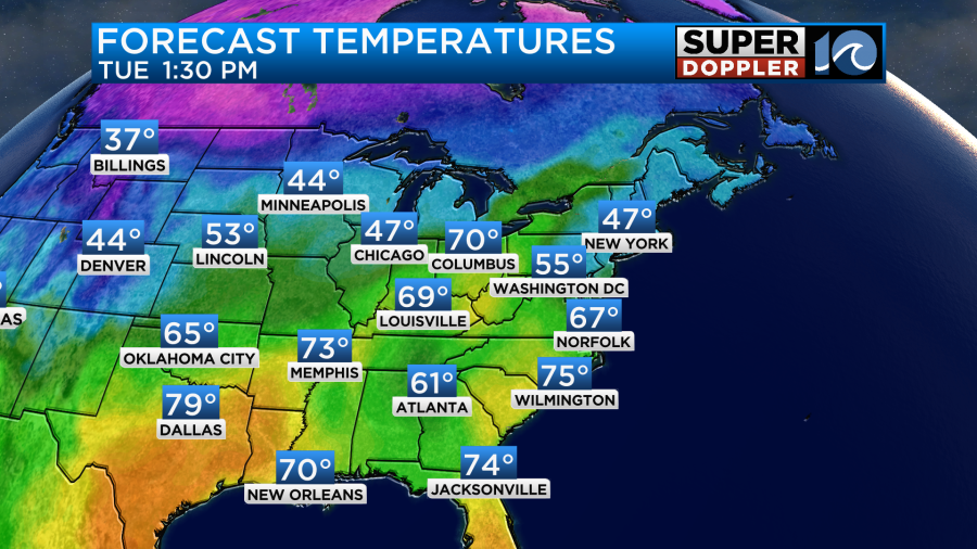
We’ll have a light southwest wind through most of the day. It will be out of the southeast late. High temps will warm to the mid 60s.
It will be pretty nice to head outside. Just keep in mind that a lot of the parks have a very soggy ground right now.
Having said that… Tomorrow another system will move through the area. An area of low pressure and a cold front will move in from the west. We’ll have a few rain showers in the morning. Then we’ll have a bigger area of rain during the afternoon.
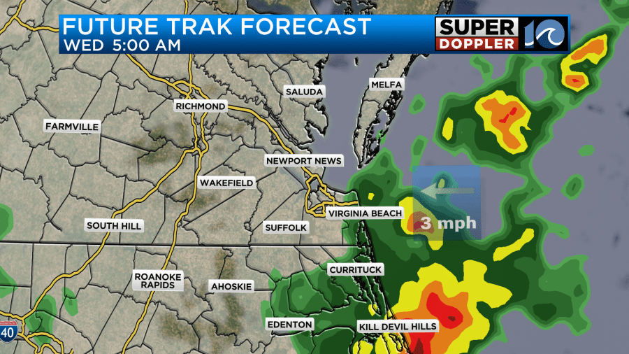
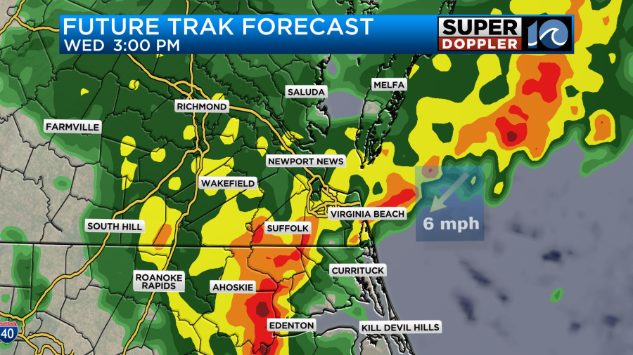
The rain in the afternoon may be heavy for a time. With all of the rain that we had recently, this could lead to some isolated flooding. At a minimum there will be more standing water in some of the yards and many ditches. There could also be a few thunderstorms. Winds will be out of the east at 5-15mph. High temps will probably be in the low 60s, but if the heavy rain starts earlier then we may only top off in the upper 50s.
The low will be moving out by Thursday morning. We’ll probably have some isolated showers or drizzle in the morning, but we should dry things out by midday. Before it wraps up we’ll have had about 1.5 to 2″ more inches of rainfall.

High temps will be in the low 60s. We’ll be partly cloudy on Friday. High temps will be in the 50s.
Then another system will move through on Saturday. We’ll have lots of rain through the day. The good news is that Sunday looks a little drier. There may just be a few showers in the morning. I’ll be more specific in tomorrow’s weather blog.
Meteorologist: Jeremy Wheeler