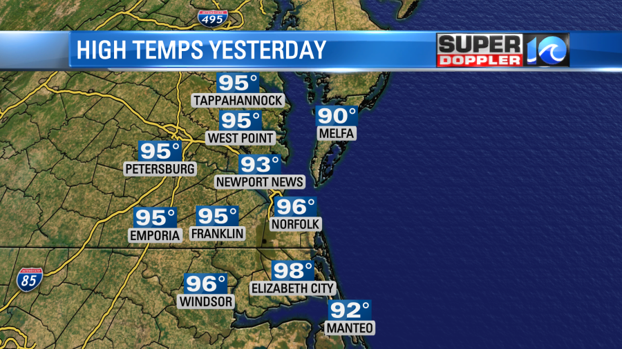
I was off for a few days to take my son back to college down in Louisiana. It was hot! The afternoon temp down there was 104 degrees. I returned to more heat, but not quite as bad. High temps made it to the mid 90s over much of the local area yesterday.
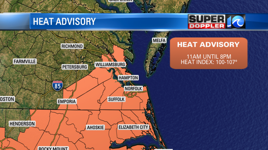
The heat index was over 100 for most. Today we will still be very hot and humid. In fact we have a Heat Advisory posted for most of the region.
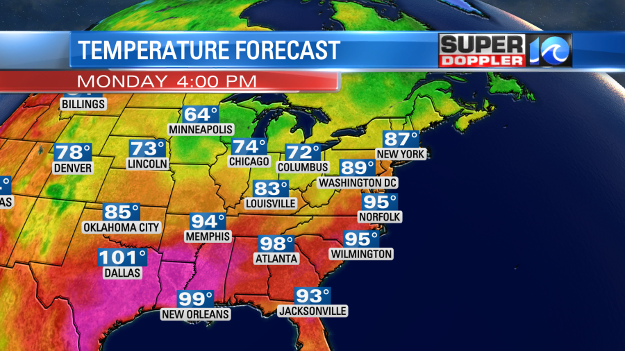
High temps will aim for the mid-upper 90s this afternoon. There will be some cooler weather over the Midwest and Great Lakes, but it will be hotter across the Deep South.
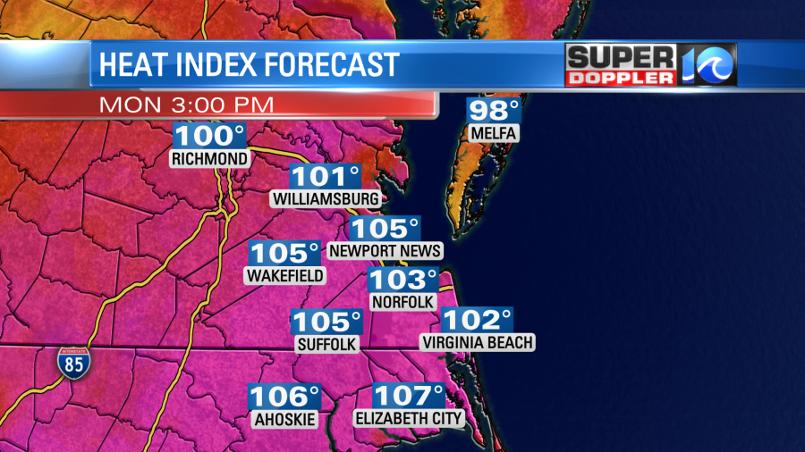
The heat index will be between 100 and 108 degrees.
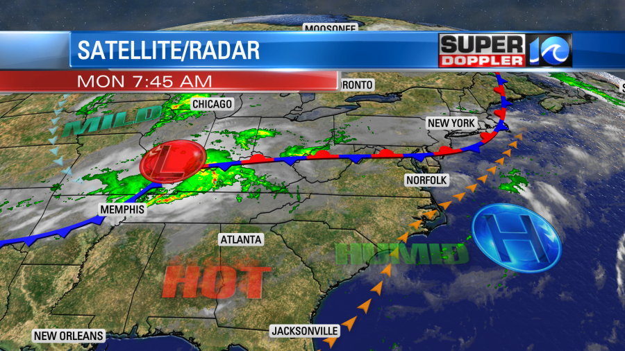
There is a stationary front to our north with a fast-moving cool front over towards Memphis.
We’ll be partly mostly sunny to partly cloudy for a while. Then a few showers and storms will pop up this afternoon.
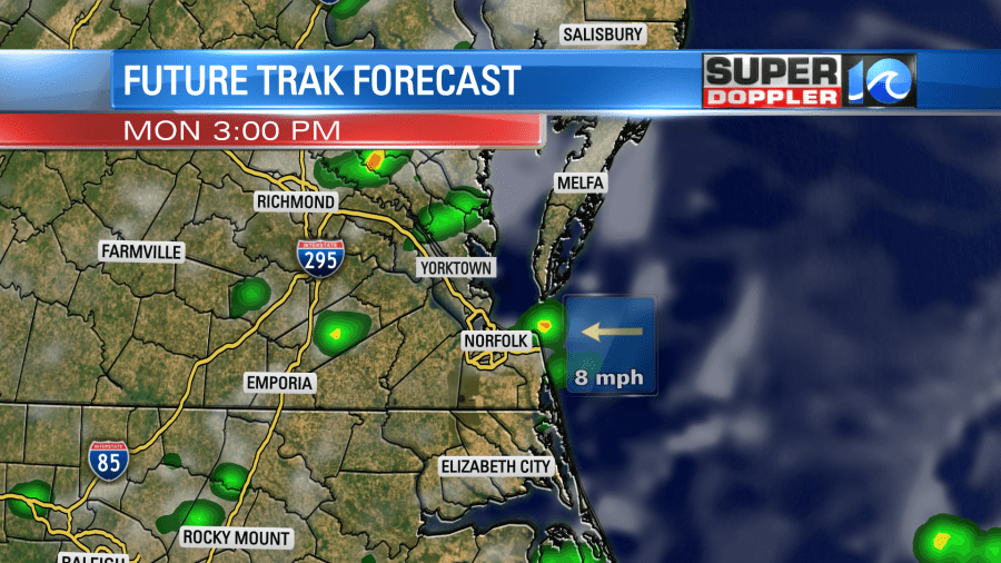
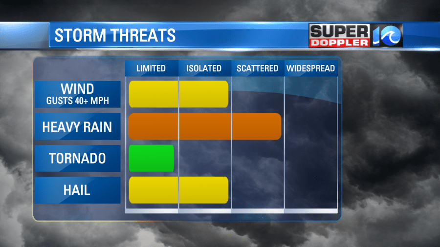
While the coverage doesn’t look too large today (30% chance), a couple of the storms could be strong to severe. There will be a few downpours. There could also be some isolated strong gusts of wind and hail.
A few storms could go into the early evening, but they should die down overnight. Tomorrow we’ll be partly cloudy for a while. Then some more scattered showers and storms will pop up in the afternoon. At that point high temps will be running in the mid 90s with the heat index between 100 and 109 degrees. By the time we get into the evening the cold front will be approaching from the west. This will create a line of showers and storms that will swiftly move in.
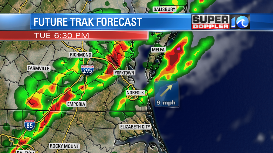
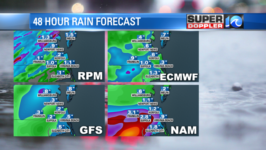
There could be a sizable area of heavy rain along with some more strong to severe storms. In fact some of the models have 1-3″ of rainfall in the region in a short period of time.
The cold front will move through, but it will stall out just to our south on Wednesday. This will increase the clouds, drop the temps to the 80s, and it will bring us more scattered showers with a few storms. The heat index will still be in the mid 90s, but that will be better than the 100s.
For now it looks like the front will still be fairly close on Thursday. At least in the morning. So I have more scattered showers during that time. Highs should still be in the 80s, but it will be muggy. We won’t dry out much until the weekend.

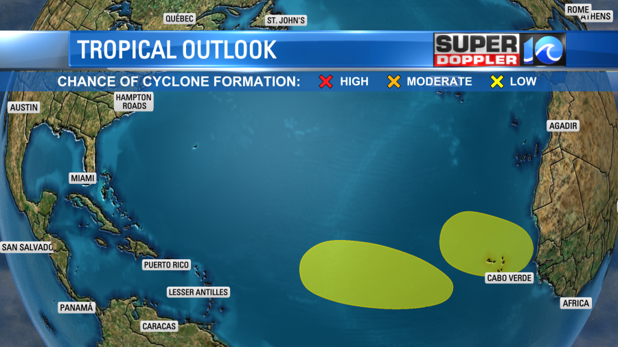
It’s still pretty quiet in the tropics, but we are watching 2 tropical disturbances in the eastern Atlantic. They are moving generally to the west/northwest.
Meteorologist: Jeremy Wheeler