
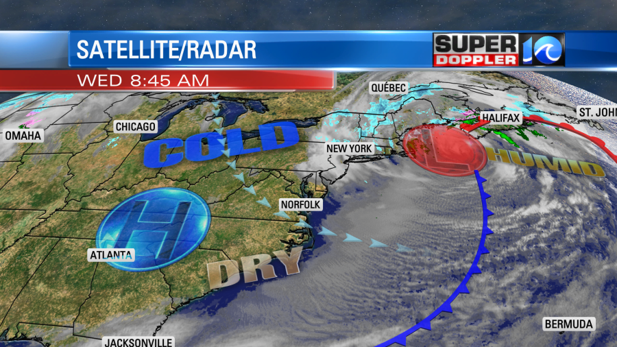
The eastern U.S. weather map hasn’t changed much in the last 24 hours. The nor’easter in the northeast has caused lots of problems up there.

Some areas have had over 2 feet of snow. Heavy/wet snow has caused thousands of power outages. Plus, they have had strong winds and tidal flooding. Many flights have been delayed. Here is an article with more information: Nor’easter effects.
At the same time strong high pressure is just to our west. This setup has created a non-stop flow of gusty winds out of the northwest for the last 36 hours.
We’ll have similar conditions today. We had lots of sunshine this morning, but wind chills were in the 20s area-wide. As we go through the day we’ll continue with ample sunshine, but the wind will keep temps chilly. Highs will be in the low 50s this afternoon, but wind chills will be in the 30s and 40s through the day.

Wind gusts will be up to 30mph. A few gusts near the shore could be up to 35mph. It won’t be quite as windy inland. Tonight the winds will finally decrease as high pressure builds in a little more, and the nor’easter starts its push out to sea. However, the decreasing winds overnight will allow temps to fall a little more. Low temps will drop to the low 30s in the metro with lots of 20s inland.
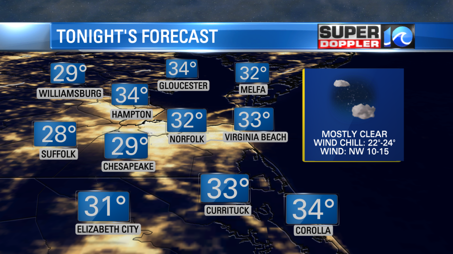
There could even be a few 20s IN the metro. Either way…even with less wind the wind chills will still be in the 20s.
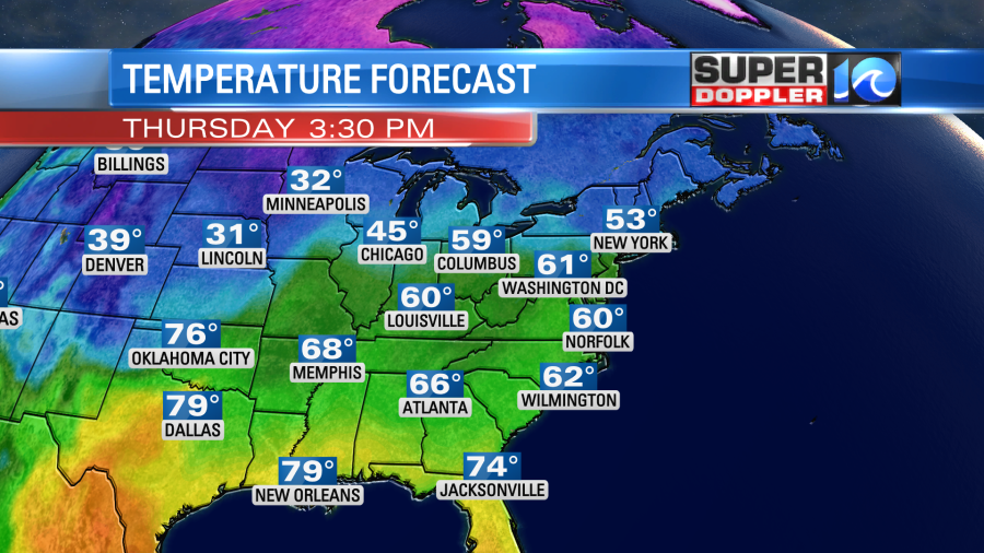
Things will improve fast tomorrow. We’ll have much lighter winds and they will turn out of the south. We’ll still be dry with lots of sunshine. So high temps will actually bounce up to near 60 during the afternoon.
It will be a day to dress in layers.
We’ll be even better on Friday. We’ll be partly sunny with a south breeze. High temps will warm to near 70 in the afternoon.
So you’re probably asking… “Ok, what’s the catch?”. The catch is that a strong cold front will move in by Saturday morning. This will usher in colder air again over the weekend. We’ll have scattered showers to possibly widespread rain Saturday morning as the front arrives.
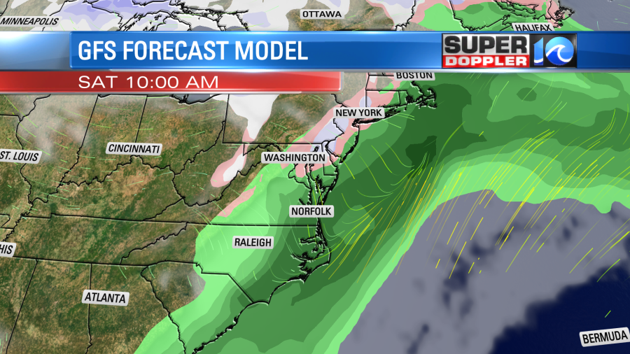
The front should quickly drop to the south. So temps will drop from the mid-upper 50s to the upper 40s to near 50 in the afternoon. There will be some rain behind the front. The models disagree on how fast it will move out. So check back for updates on that if you have outdoor plans. Regardless, we will likely dry out late Saturday into Sunday. High temps will probably only be in the upper 40s on Sunday. Insert sad emoji here……………
Meteorologist: Jeremy Wheeler


