This morning I thought it would be neat to look back at the high temperatures over the last couple of weeks. I thought I remembered a couple of warm days. However, temps were actually below average for the entire last 2 weeks.
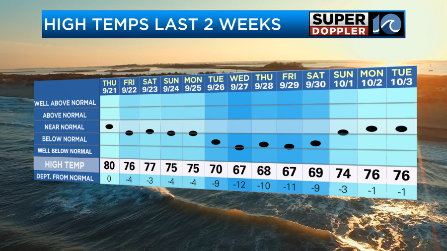
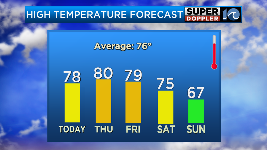
It has been nice lately with high temps in the 70s, but there was a cool stretch recently with highs in the 60s.
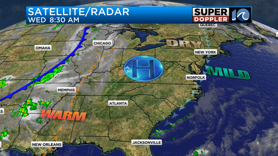
We started off cool this morning. Temps were in the 50s, and there were even a couple of upper 40s in spots. This was due to the clear skies, drier air, and no wind. Today we will have a lot of sunshine again. High pressure is anchored to our west.
We’ll have a light northeast breeze during the day. High temps will rise to the upper 70s with some 80s inland. It should be very nice out, but warm in the early Fall sunshine.

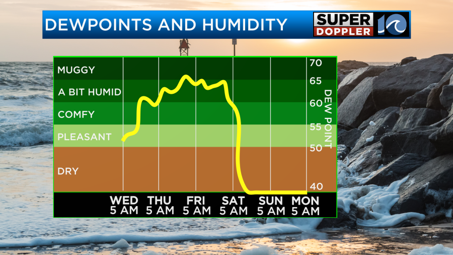
It is still nice and dry. Dew points are in the 50s. The warmth has been building to our west with colder air starting to brew over central Canada and the north/central U.S.
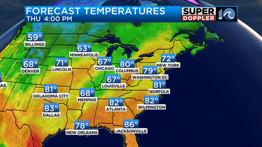
Tomorrow we’ll have partly cloudy skies. It should be another nice day, but it will be a bit warmer and more humid. High temps will rise to near 80 in the metro with low-mid 80s inland.
This will be due to a light wind out of the east/southeast along with a good amount of sunshine. Dew points will rise into the 60s.
We’ll still be warm and humid on Friday with high temps close to 80 degrees. However, there will be even more clouds, and a few rain showers will be possible later in the day. This will be due to the moisture increasing ahead of a cold front. The front will arrive on Saturday. On that day we’ll have a mix of sun and clouds with some scattered light showers or drizzle in the morning. The timing may change so stay tuned. The front will be pushing offshore during the day. So temps may actually fall by the late afternoon.
Behind the front temps will drop big time as the breeze picks up out of the north. The humidity will drop sharply as well. High temps will only be in the upper 60s Sunday afternoon.
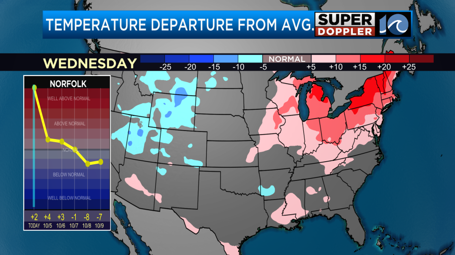
We will not be alone. Temps will be about 10-15 degrees below average over the eastern third of the country.

Low temperature Sunday and Monday morning will be able to drop down to the 40s and 50s. There’s a low chance that some upper 30s could happen closer to I-95. The cool/dry air will stick around for a couple of days.
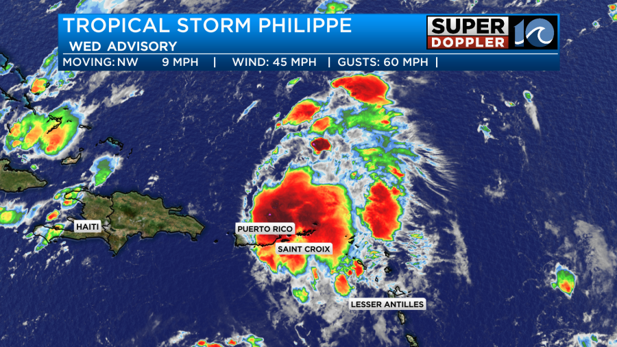
Meanwhile tropical storm Philippe is holding its own. It is north of the Lesser Antilles, but a cluster of storms just south of the center brought them and Puerto Rico some tropical rains and tropical storm forced gusts.
The storm will move north over the next few days. It is now forecast to pass very close to Bermuda by Friday. They can expect some heavy showers and some tropical storm forced winds. Then it will move north during the weekend, and it will become post tropical.
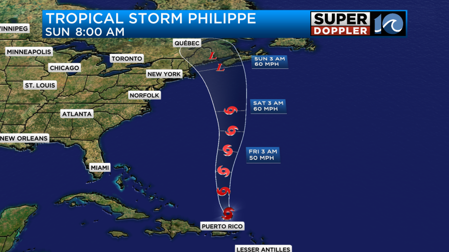
The storm will move near the coast of Nova Scotia or the Gulf Of by Sunday.
Seems like they are having a busy year between the tropics and the wildfire smoke.
Meteorologist: Jeremy wheeler


