
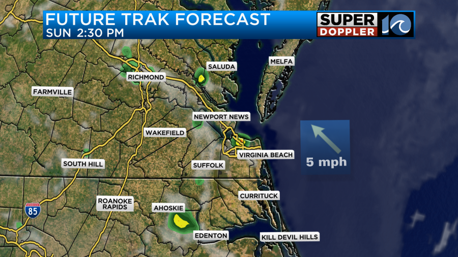
The Memorial Day weekend forecast has been tough to pin down over the past few days. Now it’s upon us. So it’s time to talk details. I’ll start off talking about last night first. There was a pocket of showers over North Carolina around 10pm. Then there was a bigger area of rain between 3 and 6am.
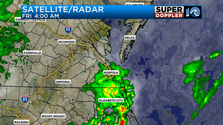
This first round of showers for the day has moved out. However, there is more rain developing to the west. We have a cool front dropping in from the north. The front did stall out last night, and it was expected to do so. However, now it looks like it will make a slight push more to the south. This has created a wetter Friday forecast.

A second round of showers will move through during the mid morning. It should move out either by the early afternoon.
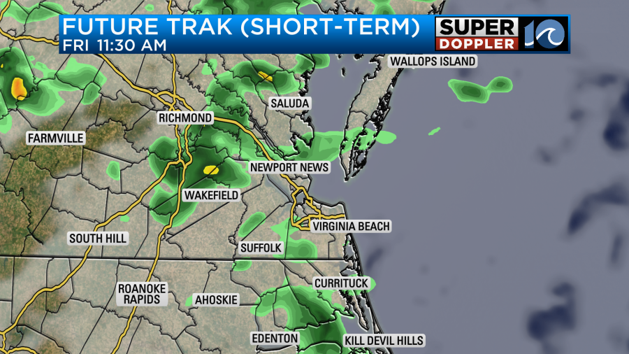
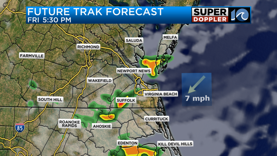
We’ll be mostly cloudy through the day with a few peeks of sun. After a decent break there will be some more scattered showers and storms developing towards the late afternoon. They will continue into the early evening.
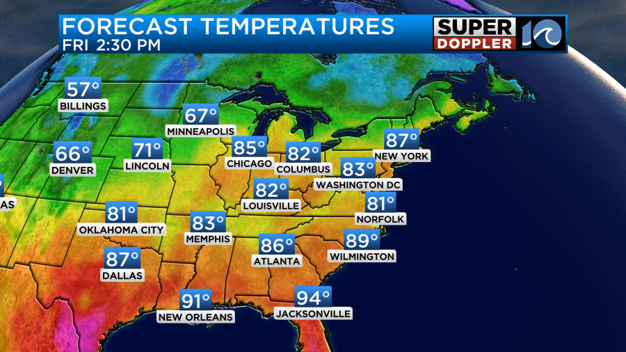
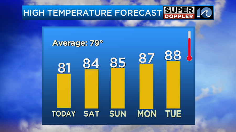
The wind will be light and variable through the day. This will all work together to keep us cooler. High temps will run in the low 80s with upper 70s north of the metro.
Rain amounts will vary widely. We could see anything from a tenth of an inch up to 1″ of rainfall. I’m actually getting more and more people saying that they still need rain. We did have a nice soaking rain though last night over the Southside and over North Carolina.
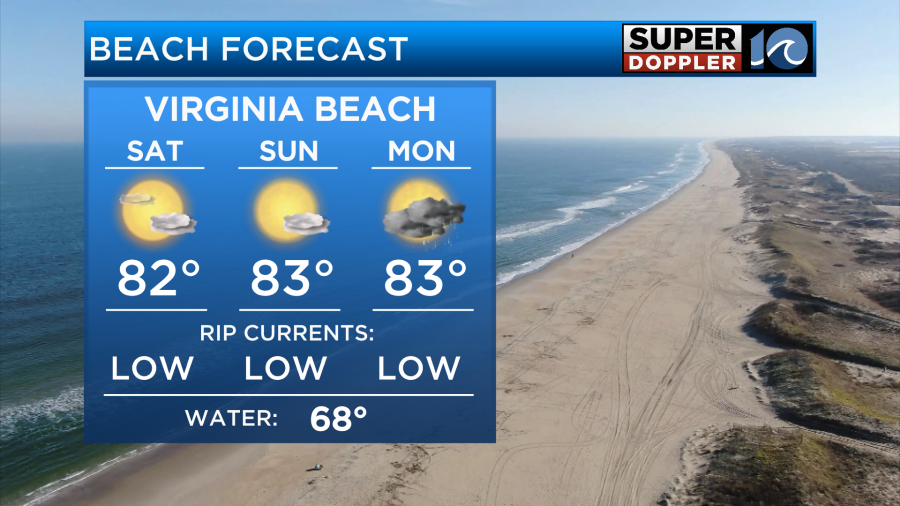
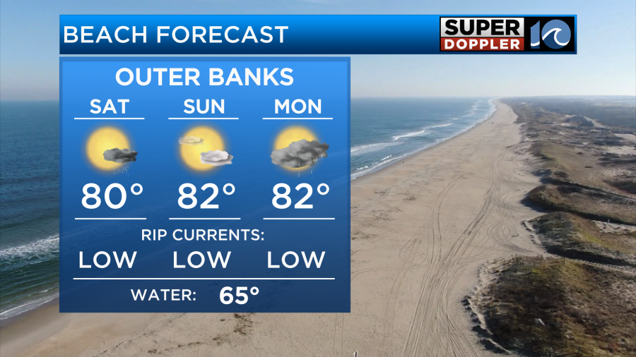
The good news for folks that want to head outdoors is that the forecasts for Saturday and Sunday look a little drier. I think we’ll be partly cloudy for most of that time. There will be a few pop up showers and storms each afternoon into the early evening.

High temps will be in the 80s for the entire weekend.
Keep in mind that will be pretty humid through that time.

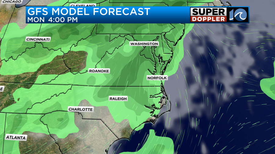
By Monday the rain chances will go up again. We’ll probably have some scattered showers and storms as we head into the afternoon and evening.
Check back for updates on the weekend forecast.
You may have seen the latest hurricane season forecast from the National Oceanic and Atmospheric Administration (NOAA). I believe that this forecast is the most active May one that they’ve ever put out.
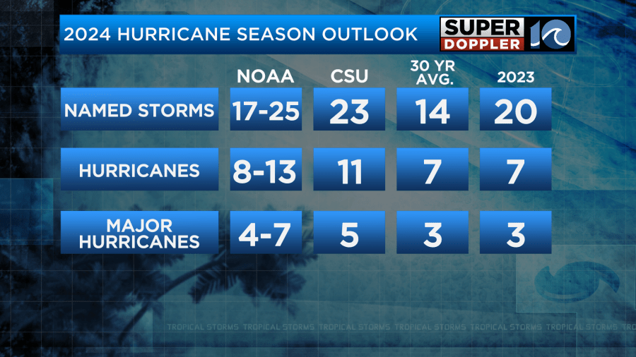
I am never big on seasonal forecasts. I have been pretty vocal about that over the last 2 decades. However, I do agree that this year could be one of the busiest ever. There are a few reasons for this. We are going into a La Nina weather pattern in the Pacific Ocean. There is a teleconnection that typically creates less wind shear and weaker trade winds over the Atlantic.
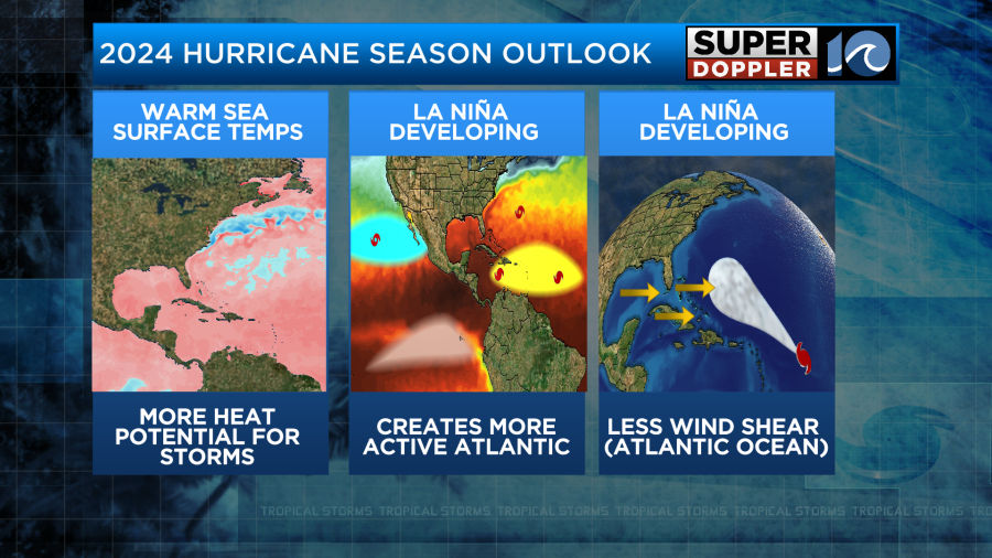
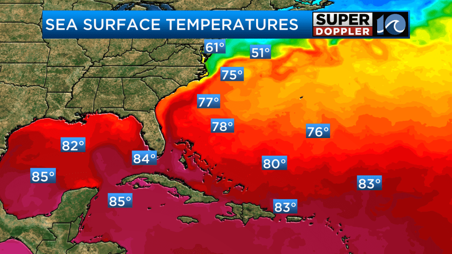
However, the main fuel for the super active forecast is literally the water temperatures. Water temps over parts of the Atlantic are already to the levels that they reach in August or September.
Nothing is forecast in the short term, but I wouldn’t be surprised if something tries to develop over the next couple of weeks. It is interesting that there hasn’t been anything so far this year. Over the last several years there has been at least one or two systems by this time. For now all you should do is start looking for deals on goods for your hurricane kits. Take your time and find the sales. Buy things that your family will eat outside of a storm. That way you can put it in your pantry if you don’t use it by close to the expiration date.
Anyway, have a good and safe holiday weekend.
Rip currents should stay low. Water temps are in the 60s, but rising a bit.
Meteorologist: Jeremy Wheeler


