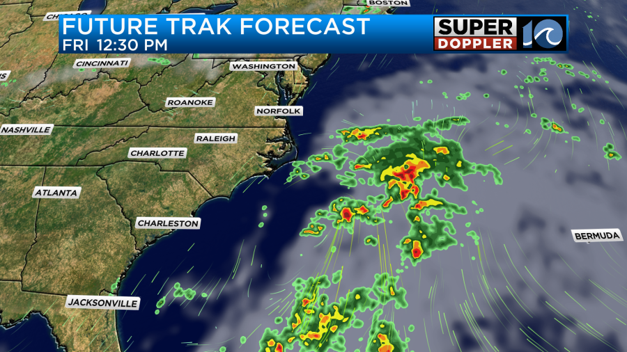
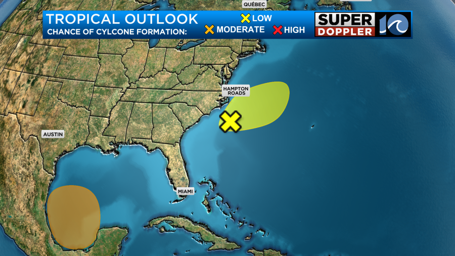
The forecast remains on track for today and the weekend. The weak area of low pressure is offshore, and (unless it makes some crazy turn) it should stay offshore.
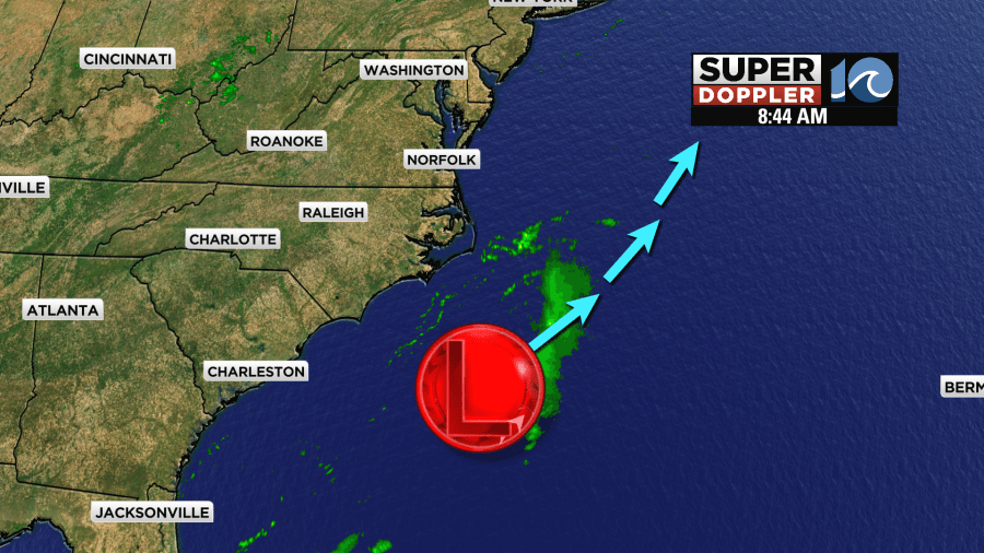
The low is moving slowly northeast along a stationary front.
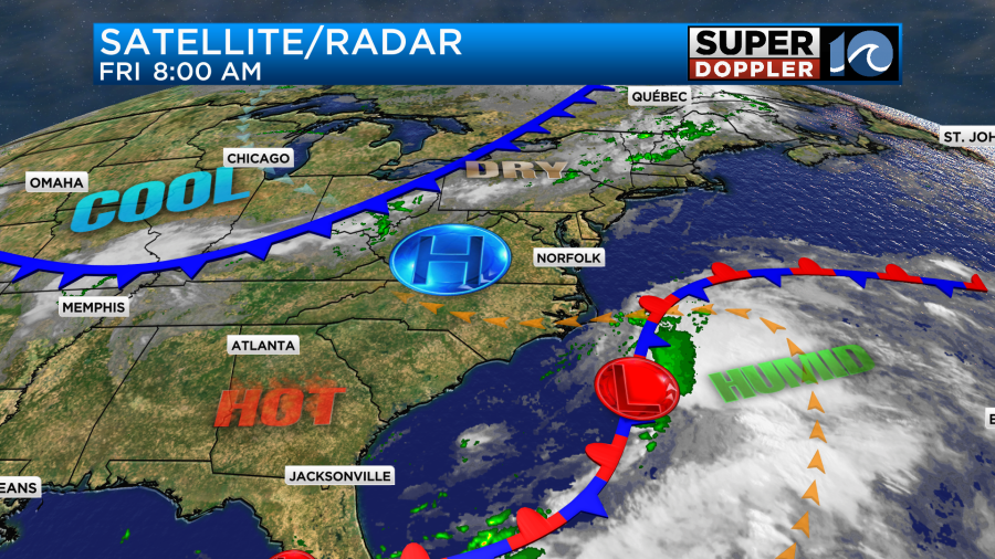
A small area of high pressure is to our northwest. There is a cold front farther to the northwest.
The forecast models are still in agreement at keeping the low weak and offshore.
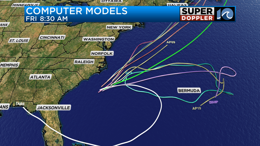
There is still a low chance that it could become a tropical system. Even if it does it would be more of a naming thing. The effects would be about the same here. At least in the short-term. As you look at the track models you may notice that a couple of them have the feature hooking back to the west in a few days. It’s possible. We’ll keep an eye on it either way.
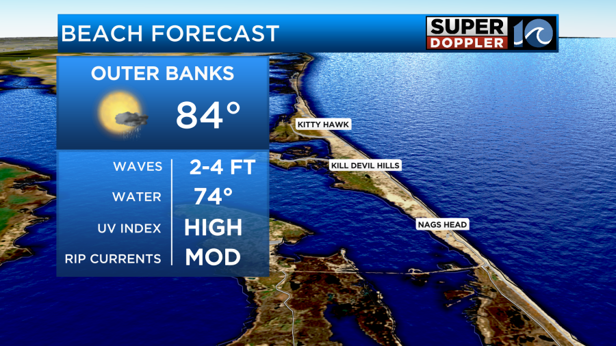
One impact that it will have is that there will be a moderate threat for rip currents along the Outer Banks with waves about 2-4 feet.
There is a low threat for rip currents in Virginia Beach. Waves there are around 2 ft.
We’ll have mostly sunny skies today with a few more clouds in the afternoon. There will be some more clouds along the Outer Banks with a few rain showers trying to move-in down there through the early afternoon.
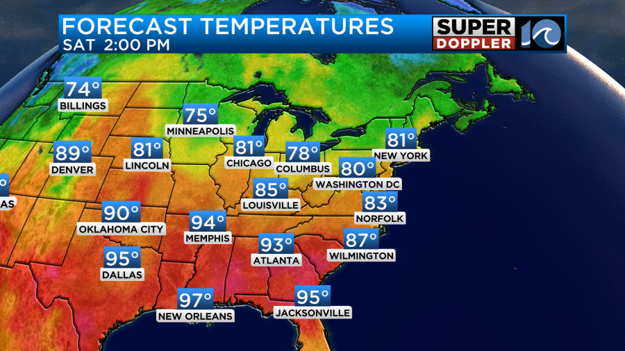
Most of the region will be rain-free. We’ll have a light breeze out of the east/southeast. It will run at 8-12mph. There may be some gusts between 15-20mph over the southern Outer Banks. That’s not bad at all. We will heat up to near 90 degrees this afternoon.
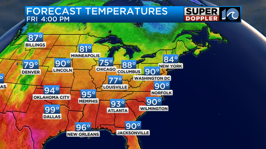
The high amount of sunshine and the east/southeast breeze will help to push the temperatures up to those levels. Luckily, the humidity isn’t too bad. Dew points are in the low-mid 60s.
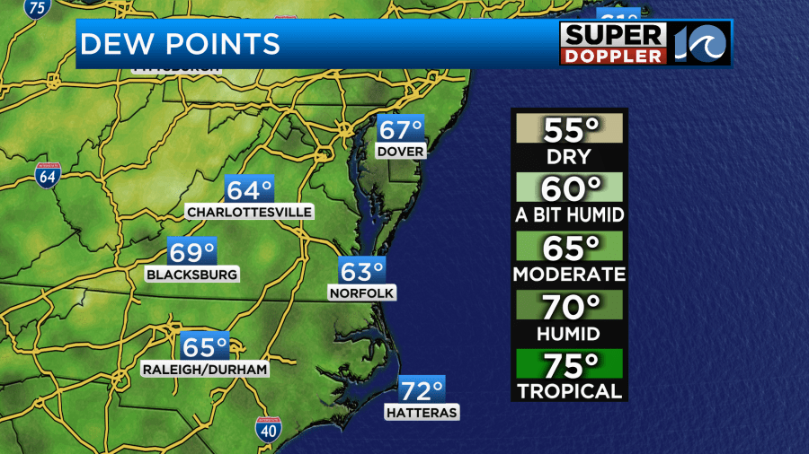
They shouldn’t rise too much today. The heat index will only be in the low 90s. Still…be sure to stay hydrated.
Tonight the cold front will slip into the region after midnight. It will produce a cluster of showers and thunderstorms.
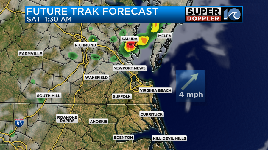
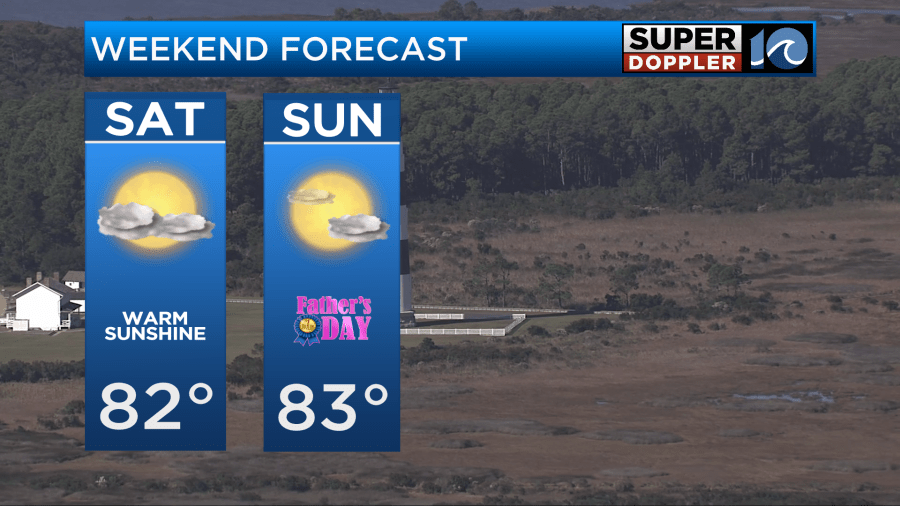
As this batch of showers and storms drops southeast a lot of it will fall apart. Tomorrow there may be an isolated shower or two left over in the morning. Otherwise, it will be a nice day. We’ll be partly cloudy with high temps in the lower 80s.
Sunday looks just as nice if not nicer.
We’ll start heating up next week. High temps will be in the upper 80s Monday and Tuesday.

We’ll be closer to 90 again later in the week. The first official day of Summer is next Thursday.
The models are still forecasting an area of low pressure to form over the western Gulf of Mexico over the next few days. The low hasn’t even materialized yet really.
I’ve said it openly. I’m not a fan of doing the tropical outlook out to 7 days. I still don’t think the overall forecasts (models and humans) are good enough. I think we need to focus more on the 2-5 day outlooks. Also…it could turn into a very messy map within the next month or two. We’ll see.
Meteorologist: Jeremy Wheeler