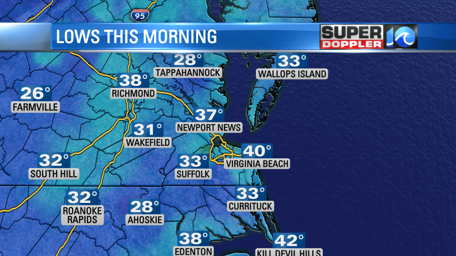
Today we are going to have a lot of sunshine again, but the wind should be a lot less than yesterday. This morning there was still a breeze near the shore. The kept up temperatures in the metro. However, inland locations made it down to the upper 20s to low 30s.
High pressure is now done building into the region. It is sitting overhead. Low pressure is pretty far offshore.
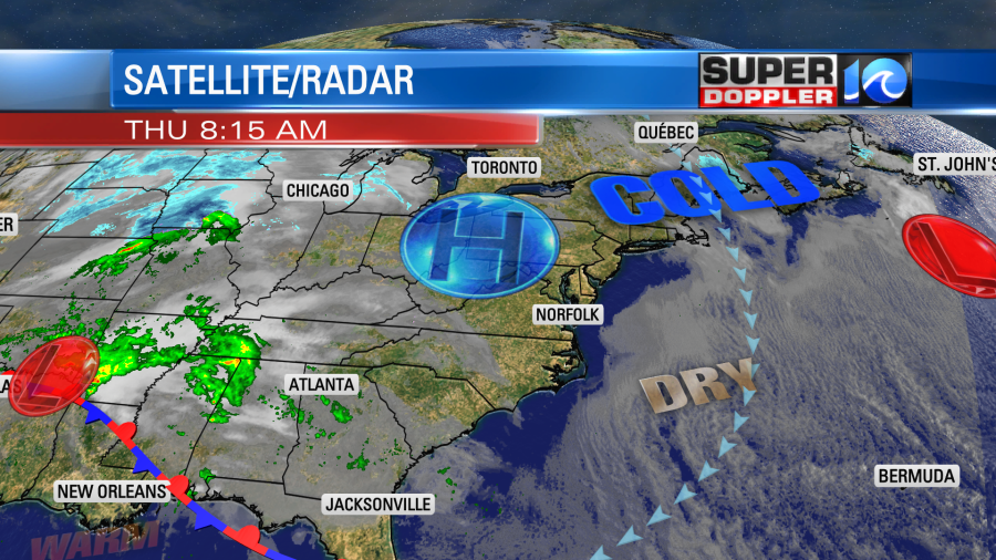
This has allowed the stronger winds to push offshore as well. There was some breeziness near the shore this morning, but overall the winds will be much less today.
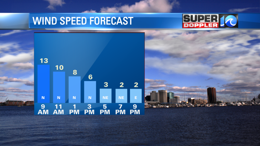
We’ll have lots of sunshine through the day. Temps will warm to the low-mid 50s. It will probably feel much warmer than yesterday due to the warm March sun and the lack of strong winds.
There is an area of low pressure developing around Oklahoma today. It will streak to the east over the next 24 hours. It will be near our region tomorrow. Moisture will increase ahead of it as winds turn out the southeast. We’ll have lots of clouds through the day with scattered rain showers at times.
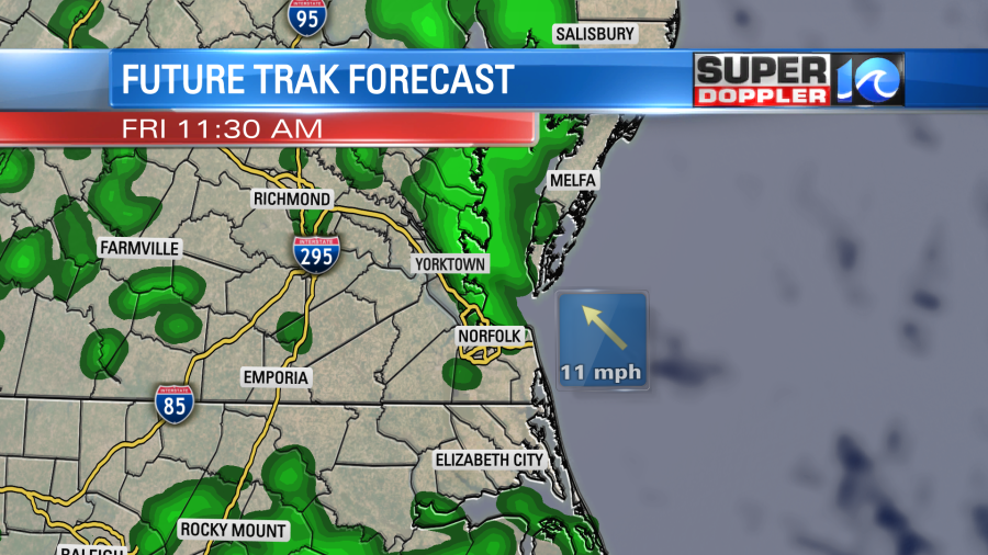
It won’t be a washout, but there will be some on-and-off showers through the day. Any rain that falls should be light. High temps will rise into the 50s. Winds will be light and out of the southeast.
The area of low pressure will move offshore, and it will strengthen Friday night into Saturday. High pressure will try to build in again, but it won’t do that right away. That means that we’ll have a strong wind out of the north again. There will be a mix of sun and clouds as moisture wraps in behind the low.
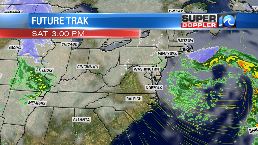
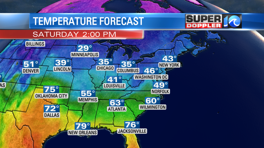
There may be enough moisture for some isolated rain showers. If the moisture lingers long enough, then it’s possible that we could have a couple of flurries by Saturday evening near the bay. We’ll see. High temps will only be in the mid-upper 40s on Saturday.
We’ll be dry for a while on Sunday, but clouds will increase into the afternoon. There will also be a few late day rain showers moving in. I’m hopeful that they hold off until at least after 4pm, but I’m not too optimistic. High temps will be in the low 50s.
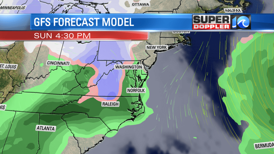
That rain will be from the next area of low pressure that will roll over the region late Sunday into Monday. High temps will be in the 50s. I will say that the middle of next week still looks pretty cold for mid-March. High temps will probably be in the 40s, but low temps may hit the low 30s and upper 20s. If you didn’t winterize your plants last night, then you may need to over the next several mornings.
Meteorologist: Jeremy Wheeler