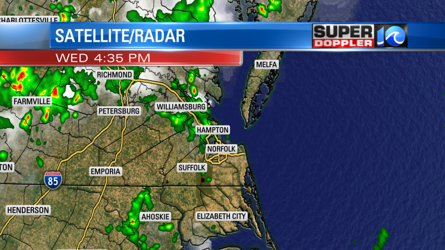
Tracking yesterday’s rain…We had a flare up on the Peninsula and Middle Peninsula during the afternoon.
Today we have more ingredients for rain and storms. We still have a lot of deep/rich moisture in the region from the last couple of days. However, today there is a stationary front creeping closer to us from northern Virginia. There is also a subtle wind-shift nearby (black broken line below).
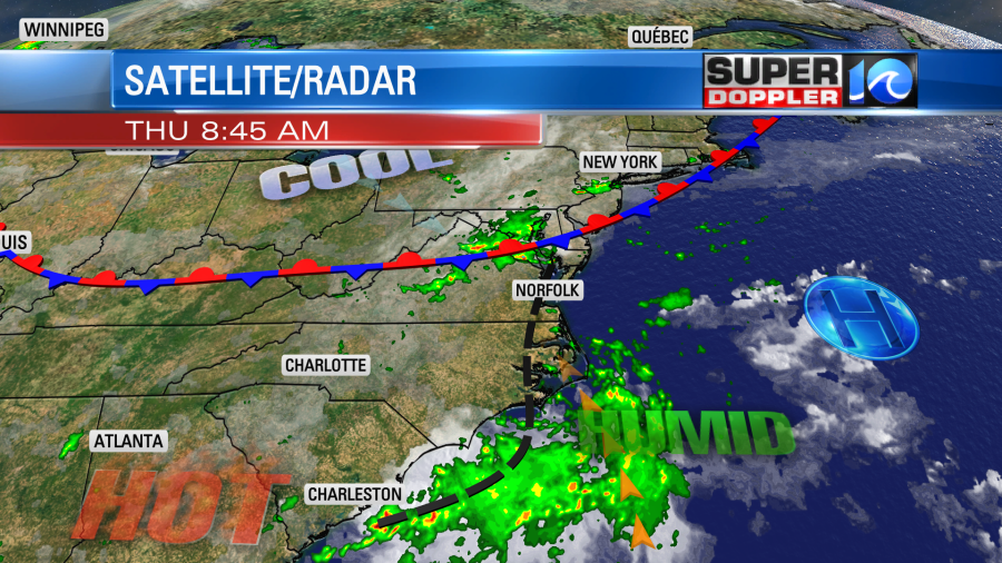
High pressure is pretty far offshore. So we will have some scattered showers and storms between the mid morning into the midday hours. Then the rain and storms will increase this afternoon.

Rain will be heavy in some places. With the recent rainfall that we’ve had, it won’t take much to produce localized flooding. So there is a Flash Flood Watch in effect for southeast Virginia.
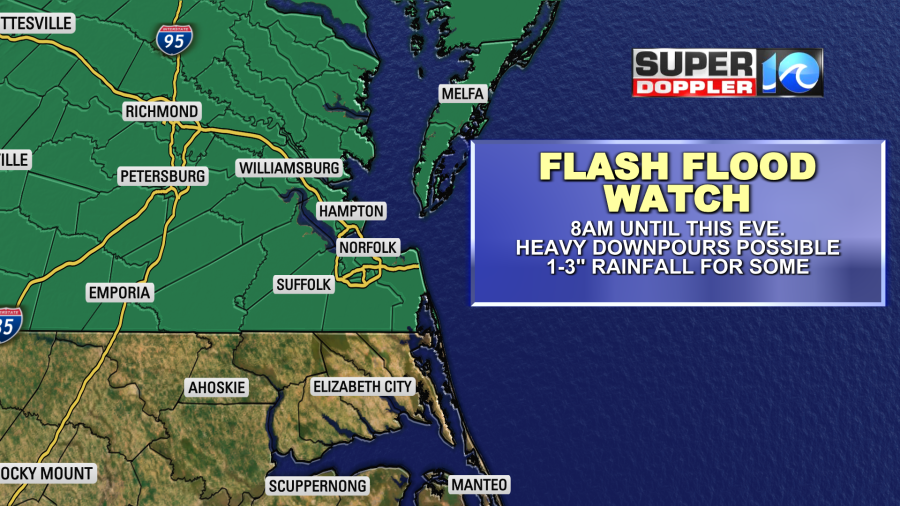
Some places could get between 1 and 3 inches of rain, but amounts will vary (widely)! There’s a bit of a silver lining….literally. The extra clouds and showers should keep high temperatures down. They’ll be in the upper 80s to near 90 this afternoon. Winds will be light and out of the southeast. By tonight it looks like a weak area of low pressure will form over our region. This will keep the rain chances going overnight into tomorrow morning. Scattered showers and storms will will be on and off tomorrow. We could easily see more downpours.
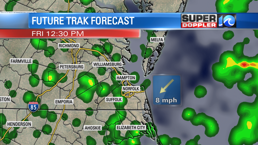
Tomorrow the wind looks like it will be more from the east/northeast. So high temps tomorrow might be more in the mid 80s. We’ll have the same type of weather going through the entire weekend. More showers and storms (though not a washout). More high humidity. Also, more high temps in the 80s. We’ll finally get a break on Monday. At least for a day or two. We’ll have to hang on until then.
We are still tracking tropical depression 11 (at least as of this writing). It is still forecast to become tropical storm Josephine. However, it has been flashing and ebbing over the last 24 hours. There has also been some wind shear around the system.
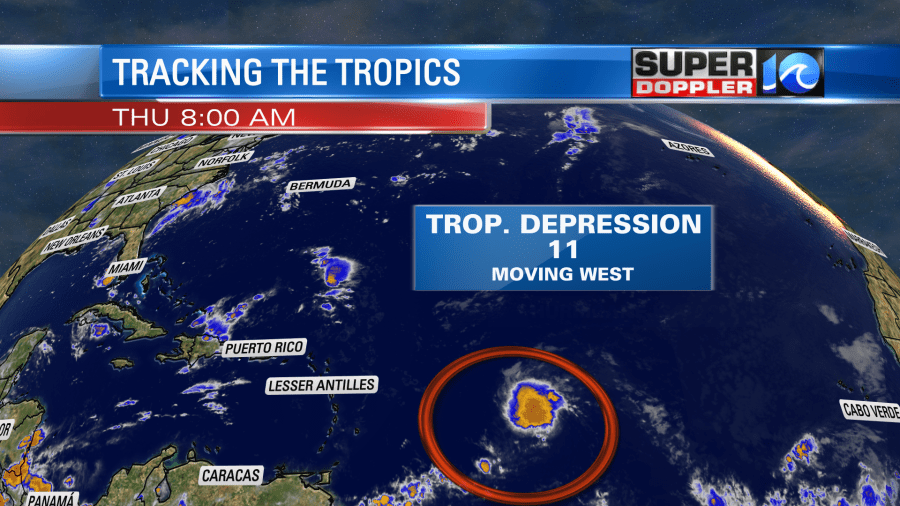
With the weakening shear around that area, the system is forecast to become tropical storm Josephine either later today or tonight. Then it will move to the northwest for a couple of days. After that time it should turn more to the north.
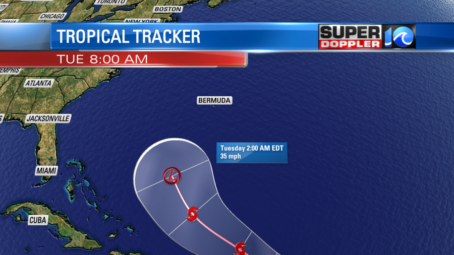
The latest models have really shown an offshore track. In fact today many of them move it closer to Bermuda.
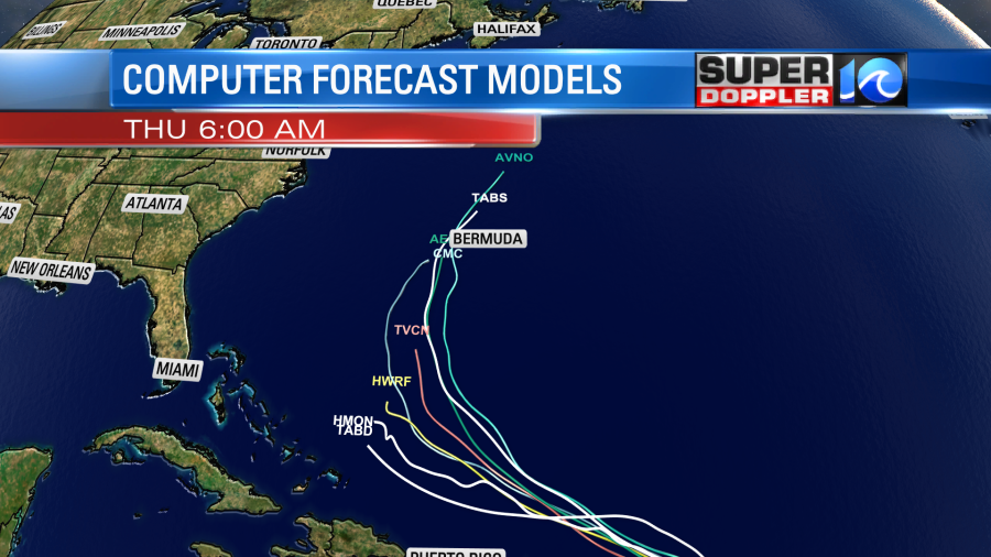
Notice that a few lines just end. Several of the models actually kill off the system in about 3-4 days. So we aren’t writing off the system just yet, but I’m not too concerned about it at this point. We’ll have enough problems with our local downpours over the next few days. Stay tuned for updates!
Meteorologist: Jeremy Wheeler