Monday Afternoon Update:
As skies have gotten grayer this afternoon, scattered showers and thunderstorms continue to develop to our southwest. The idea is they drift into the region closer to sunset – with the focal point being eastern North Carolina. While a majority of the region will not see thunderstorm activity, those that do could see some stronger storms.
A better chance of rainfall develops later tonight or overnight with scattered showers. This will develop into a soggy Tuesday, especially for the morning commute. The remnants of Hurricane Helene are still to our west and slowly drift overhead throughout the day tomorrow. By Tuesday night, things should be looking drier as the moisture moves offshore.
Brighter skies take over Wednesday and October sunshine should dominate the skies through late week and into the weekend.
______________________________________________________________________________________________________
While we have just come off of a nice (Summery) weekend, the cleanup efforts from Helene continue over other parts of the country. Unfortunately, the death toll is still climbing. Locally, we had a few showers early this morning, but they were light and scattered. So they didn’t cause too many issues during the morning commute.
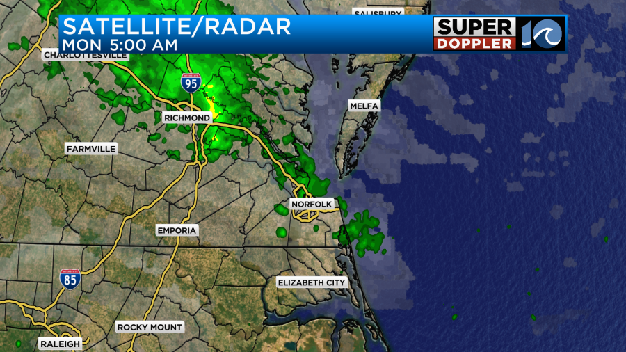
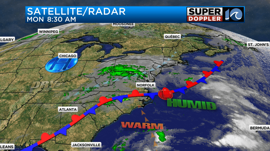
Today we have a stationary front just to our south. High pressure is to our northwest.
We’ve developed a light northeast breeze. It will run at 8-12mph today. Between that and more cloud cover we should be a couple of degrees cooler than yesterday.
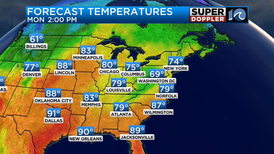
Even if we are a couple of degrees cooler, it still won’t be refreshing. Dew points are near 70 degrees. The high humidity and stationary front will allow for a few scattered showers and isolated thunderstorms to form this afternoon.
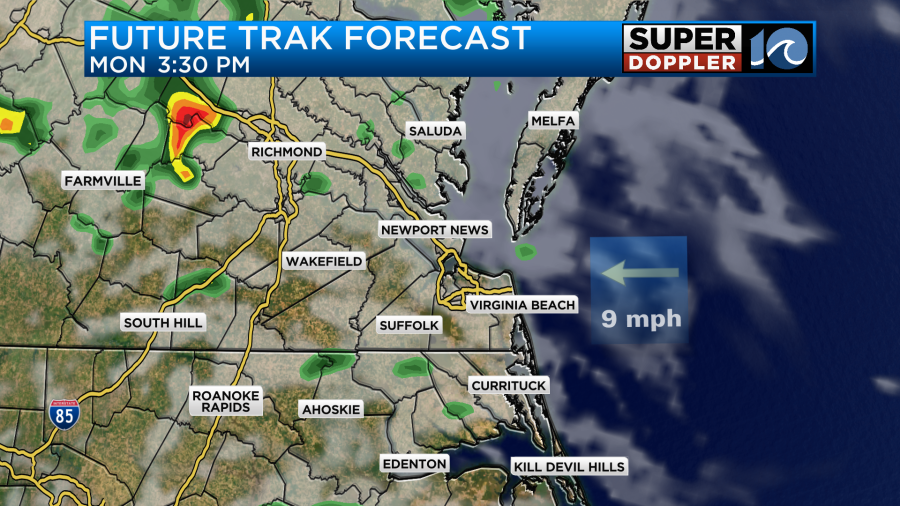
By tonight the stationary front will still be nearby with low pressure just offshore. However, there will also be an upper level low edging in from the west. So rain chances will actually increase tonight.
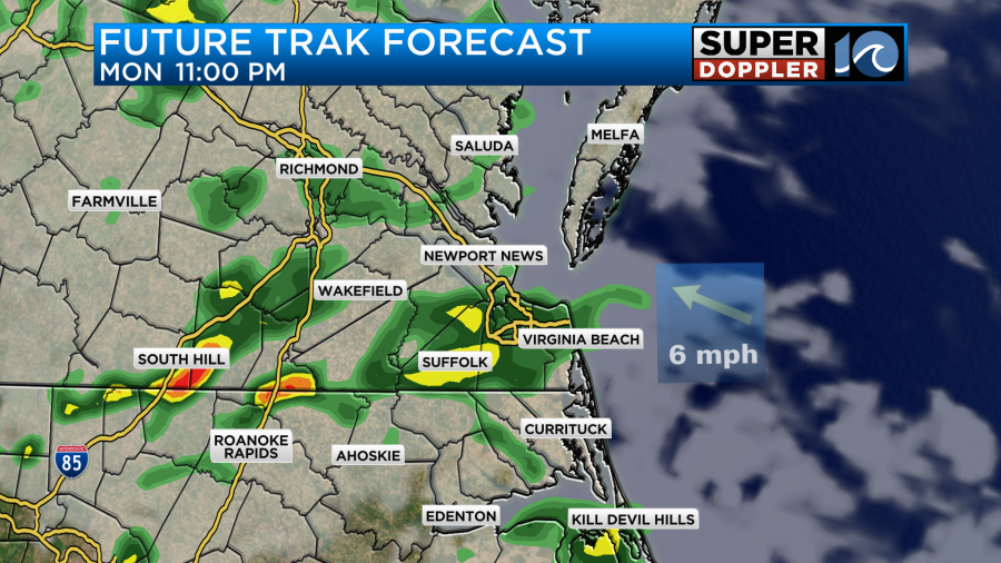
These features will all be around tomorrow. In fact there may be some ongoing showers tomorrow morning during the AM commute.
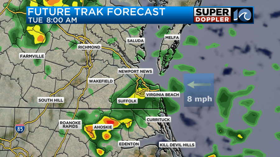
Be prepared for some slow downs on the roads in the morning. The showers should decrease as we go through the day. High temps will be in the mid 70s with a northeast wind. It will run at 5-15mph.
You’ll notice that the northeast winds are back. This is going to lead to some minor tidal flooding over the next couple of days.
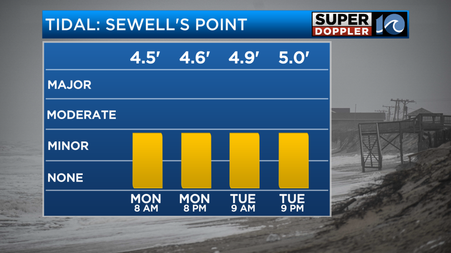
Unfortunately, this is going to be a problem for the same areas that had tidal flooding last week. Hopefully, it goes down by later this week. Fingers crossed. One thing that I am more confident about is that the humidity should drop by mid-week.
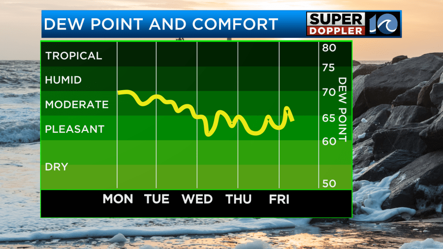
The dew point should drop below 65 and stay down for a few days. This wont’ be late-Fall-dry, but it will be more comfortable. Hopefully, it stays down next weekend. High temps will be in the 70s all week, but they may get closer to 80 degrees next Friday and Saturday. The long-term models do show some cooler weather by early next week. Maybe we’ll finally have some highs in the 60s. We’ll see. This is a big contrast to the ongoing record heat over in the west.
The tropics are very busy right now, but there’s a big reason I didn’t lead the blog with them. Despite 3 systems in the Atlantic basin right now, they should all stay out to sea.

Tropical depression Joyce has continued to weaken. It should fall apart today or tomorrow. Tropical storm Isaac is in the northeast Atlantic, but it should become post-tropical soon. However, tropical depression 12 is on the way to becoming tropical storm Kirk soon. It is forecast to not only strengthen, but it may reach major hurricane status within a few days.
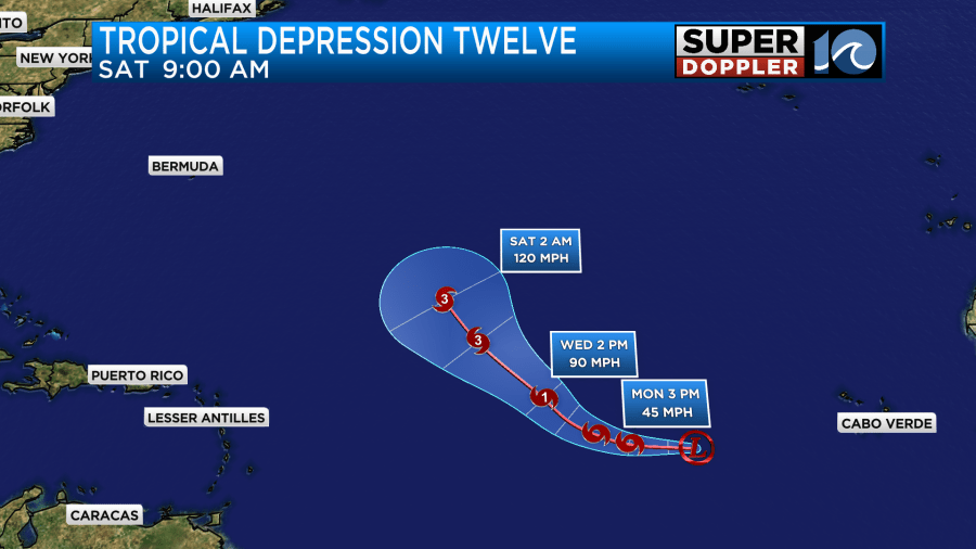
The models are in very good agreement in keeping that system out to sea.

But there’s more…
There is a tropical disturbance in the eastern Atlantic that has a high chance of formation over the next few days. It is far far away though.

I’m actually most concerned about the potential system that could form in the Gulf Of Mexico over the next several days. The models don’t have it nearly as strong as Helene, but even a weak system in the Gulf could cause some big problems. So we’ll be watching that closely over the next few days.
One last thing. As the northeast winds pick up again, we will return to some minor tidal flooding again.

The Atlantic is also very churned up right now. So that probably isn’t helping. Hopefully, the tides will go down later this week. Stay tuned for updates.
Meteorologist: Jeremy Wheeler


