
We are kicking off the weekend with some nice weather. However, the threat for rip currents and some minor tidal will be a problem for some. Here’s the setup…We have high pressure to the northwest. There is a stationary front well to our south. Then there’s an area of low pressure offshore.

That low is not the same as hurricane Earl. You can actually see that on the satellite (above photo) east of Bermuda. Between the high and the low is a subtle pressure gradient (difference in the value over a distance). So there is a steady northeast breeze. That northeast wind will have a positive effect on our weather. It will keep the temps to near 80 degrees, and we’ll dry out just a little bit more today.

Skies will be partly cloudy. It should be very nice. However, that same northesast wind is causing some minor tidal flooding.
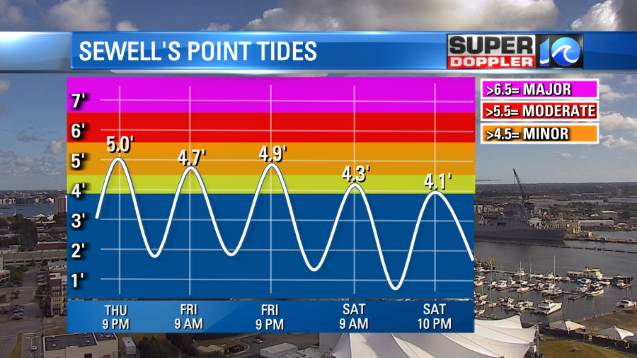
It shouldn’t cause too many problems, but it will affect some of the low-lying areas.
This is not directly attached to the rip current threat. That is coming from the recent tropical systems. It’s mainly from Earl. As of this writing Earl is the only named tropical system out in the Atlantic.
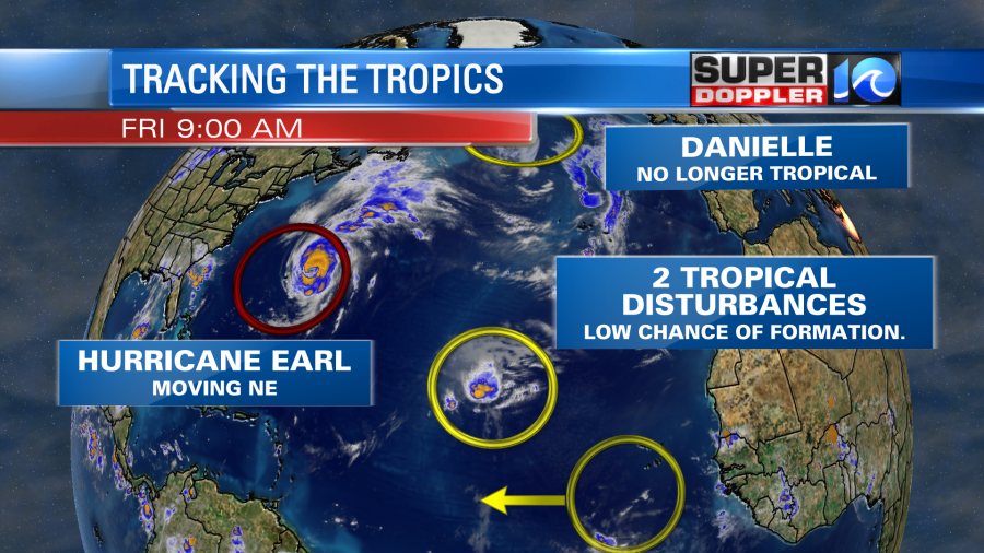
Danielle is no longer tropical and it is weakening. Earl did pass to the east of Bermuda this morning, and it is now moving away from the island. They did have some tropical storm force winds there, but those should decrease soon. Earl will move northeast, and it could briefly strengthen some more. However, in the next 3-5 days it will move over cooler waters. This should weaken the storm quickly. Then it will become post-tropical.
Even though Earl is far away from here, we are getting some long distance swells from the storm. I think Danielle also contributed a little bit. So we do have some high waves here today.

The problem is that we have a high threat for rip currents. It is along all of our local beaches.

This will probably continue into the weekend. It will be dangerous to swim. Red flags will likely be flying. There should only be experienced surfers in the water.
There are a couple of other tropical disturbances in the Atlantic that have a low chance of formation.
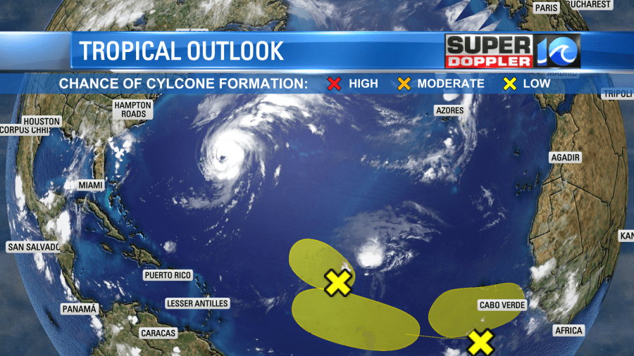
We’ll monitor those over the weekend.
I didn’t have a chance to talk about it today on-air, but tropical storm Kay may bring some rain to parts of southern California.
![[Image of WPC QPF U.S. rainfall potential]](https://www.nhc.noaa.gov/storm_graphics/EP12/refresh/EP1222WPCQPF+gif/114939WPCQPF_sm.gif)
Our local weather tomorrow should be pretty nice out overall. However, the models have been trending earlier with the moisture return. So now I have some isolated showers on Saturday with a higher chance towards I-95.
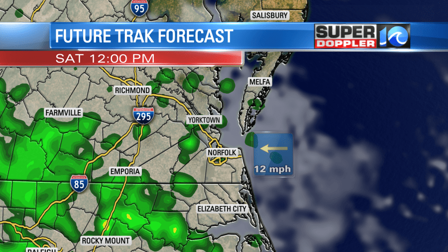
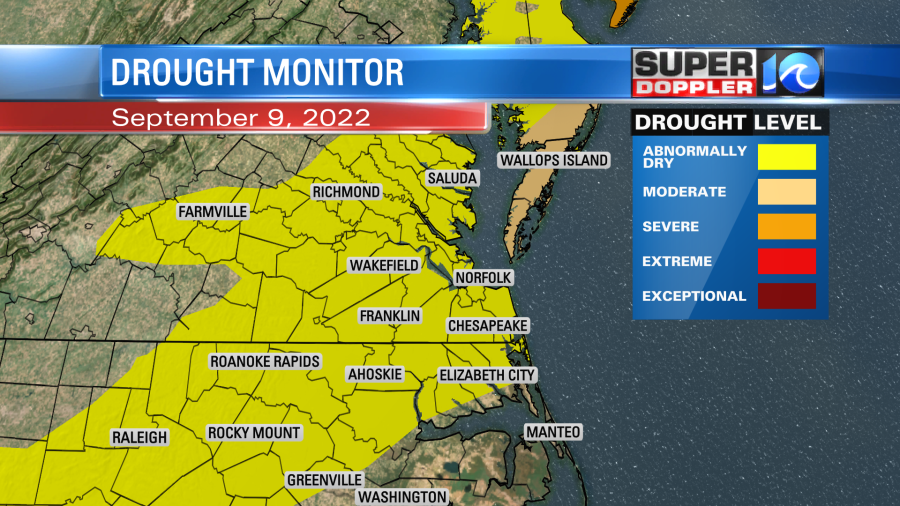
High temps will be in the 80s. We’ll have a mix of sun and clouds with a light east wind. By Sunday the moisture will increase even more, and an upper level low will be moving towards us. So we’ll be mostly cloudy with some scattered rain showers. Then on Monday we are looking at a lot of rain. It might be an all-day rain. That’s something we haven’t had in about a month. Maybe 2 months. We’ll have updates on that over the weekend. Either way we need it as we are now all in at least the first level of drought.
Meteorologist: Jeremy Wheeler