(Update…Tropical storm Helene has formed over the Caribbean Sea. See update below.).
Over the last few days we have been dealing with persistent minor tidal flooding. Some folks are pretty tired of it actually. Even though it has not affected a large part of the population, it has still cut off a few roads. Part of this was from the King Tide. Some of it was from the persistent northeast winds. There has also been a large area of low pressure over the middle of the Atlantic. It hasn’t been strong, but it has churned up the ocean. That low continues to sit far offshore today.
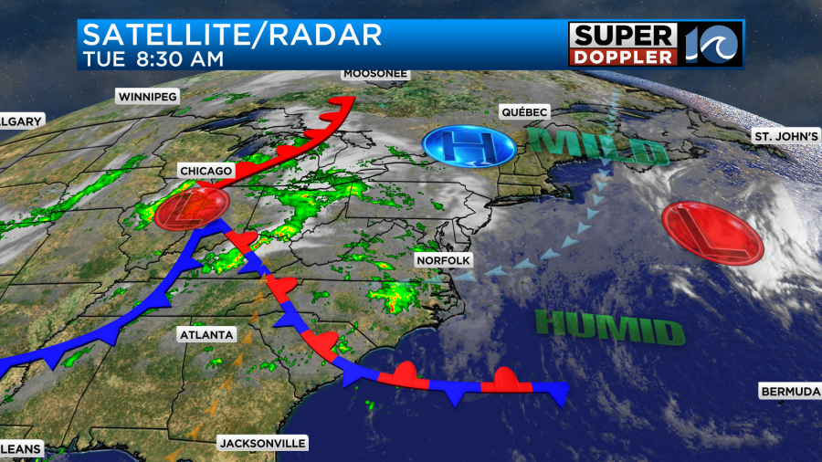
We’ll have one more high tide with minor tidal flooding. After that the low should slide farther east.

It should be more into the lower levels for the rest of the week. As you can see from the above satellite/radar, there were some scattered rain showers in the area this morning.
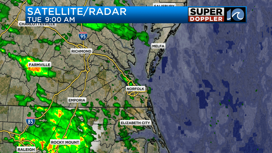
Most areas do still need some rain with a few exceptions. We’ll get a couple tenths of an inch between today and tomorrow. Most of the rain showers will be light and scattered today.
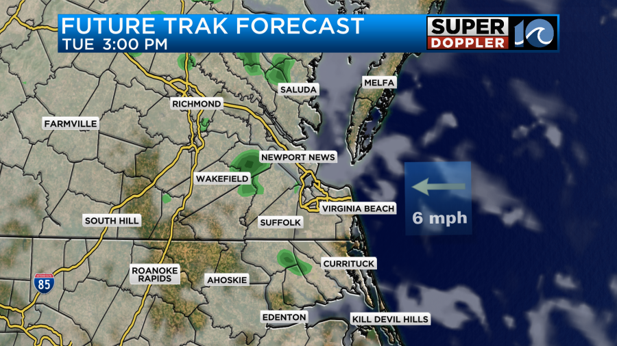
We’ll have a light east wind with high temps in the mid-upper 70s.
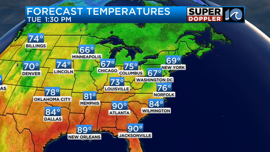
Tomorrow there will be a few more rain showers. There may be a big pocket north of the metro in the morning.

Then the showers will be more spotty or isolated in the afternoon. We’ll be mostly cloudy. We’ll have more of a light southeast wind tomorrow. That should allow the temps to pop up to near 80 degrees. On Thursday we’ll still have a lot of clouds as the deeper moisture actually increases over the area.
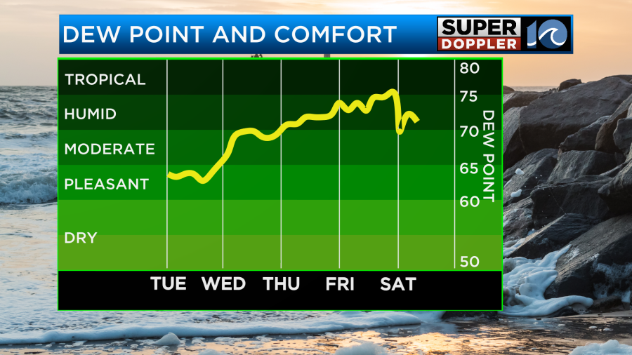
There is a slight chance for a shower. High temps will stay in the lower 80s.
By Friday things will get interesting here and even more interesting to our southwest. There will be an area of low pressure which could still be tropical. That will be pushing some tropical moisture and rain showers into our region.
As of this writing the tropical feature, that I just mentioned, is still disorganized.
(Update: As of 11am, The tropical feature is now tropical Storm Helene. Updated track below.)
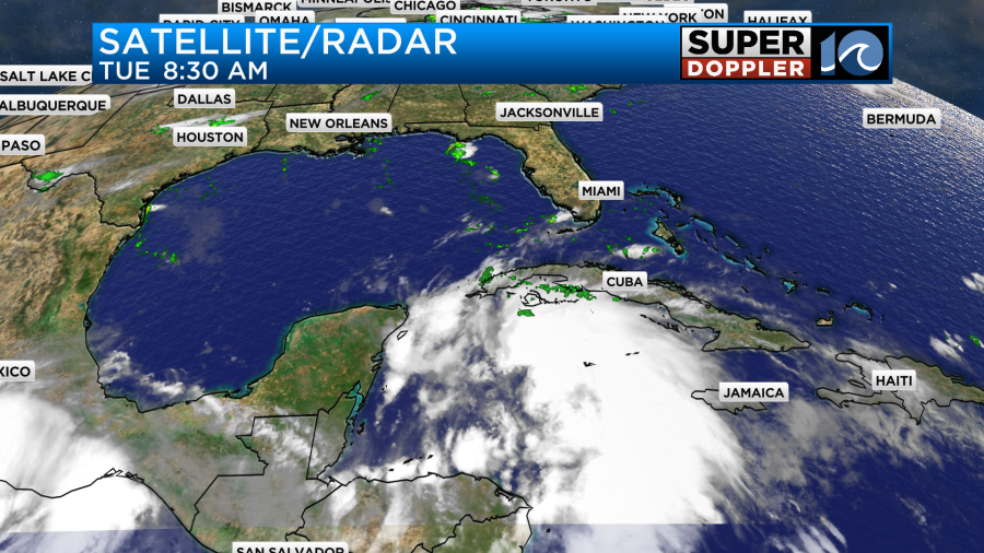
This Potential Tropical Cyclone was slowly rolling over the Caribbean Sea. It is forecast to become a tropical storm by later today or tonight. After it becomes a system it is expected to get into the Gulf of Mexico. Water temps there are super warm right now. Hot even.
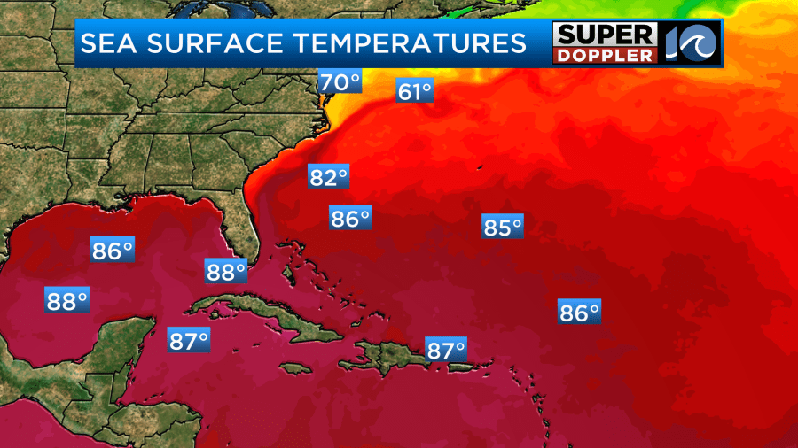
Some of the water temps are in the 90s over the Gulf. Because of this and a slackening wind shear, the system is forecast to rapidly intensify. In fact, the National Hurricane Center has it becoming a major hurricane before landfall late Thursday.
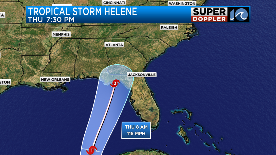
After that point they have it moving north over land and weakening. Then it should track a bit to the northwest.

Even if it passes more towards the eastern part of the track it should still stay to our southwest. However, there are some models which do favor a track that is closer to western North Carolina.
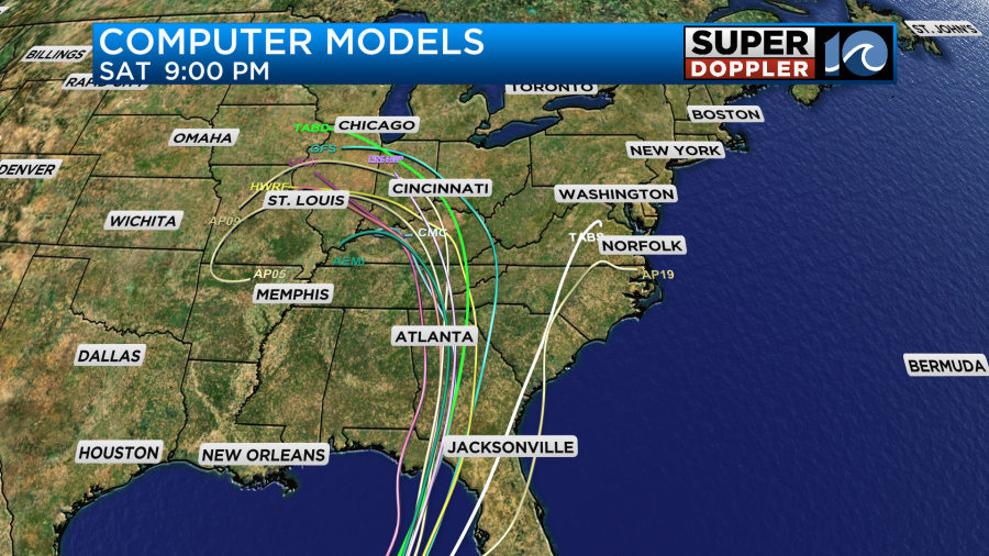
Even though the system may track to our west a lot of the models show the rain spreading far out from the center. Here is the GFS and Euro models around the time of landfall.
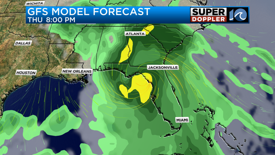
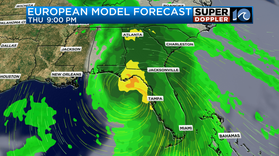
They then both show the system weakening and moving to the north/northwest through Friday. However, as you can see, they also push a lot of rain up into our area.
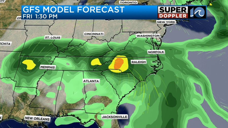

After that they open the system up some more and have it moving northward. This takes a lot of the rain with it. For now I’m a little skeptical at how much we dry out on Saturday. Let’s say I’m cautiously optimistic. I only have a 20% chance for a few lingering showers with highs near 80. I then have even drier weather on Sunday. I should have more confidence in that part of the forecast. So I’ll talk about the weekend a lot more in tomorrow’s weather blog.
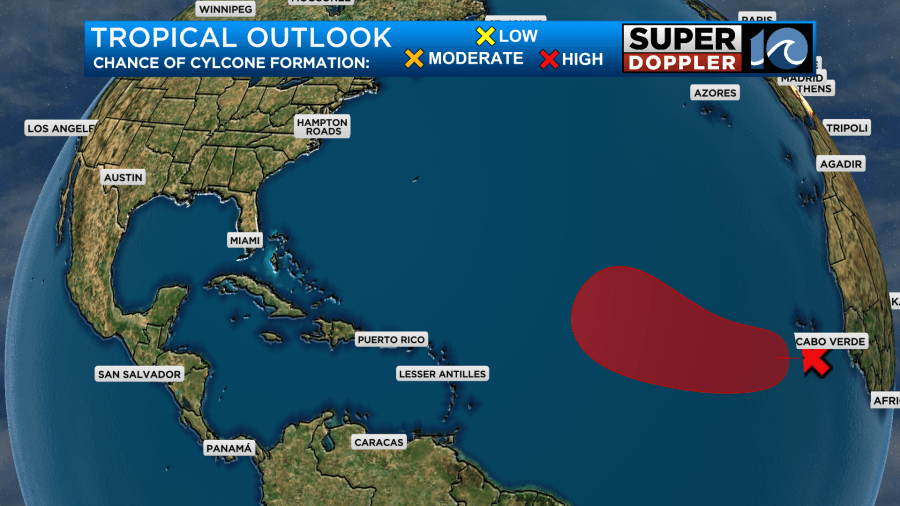
There is actually another tropical disturbance in the eastern Atlantic. It is moving to the west/northwest. It has a high chance of formation within a few days, but it would probably stay out to sea.
Meteorologist: Jeremy Wheeler


