Over the last few days I took my son part way down to college (long story). When I left we were dealing with the rain bands of Debby. Now we are tracking a new tropical system in the Atlantic. That is tropical storm Ernesto.
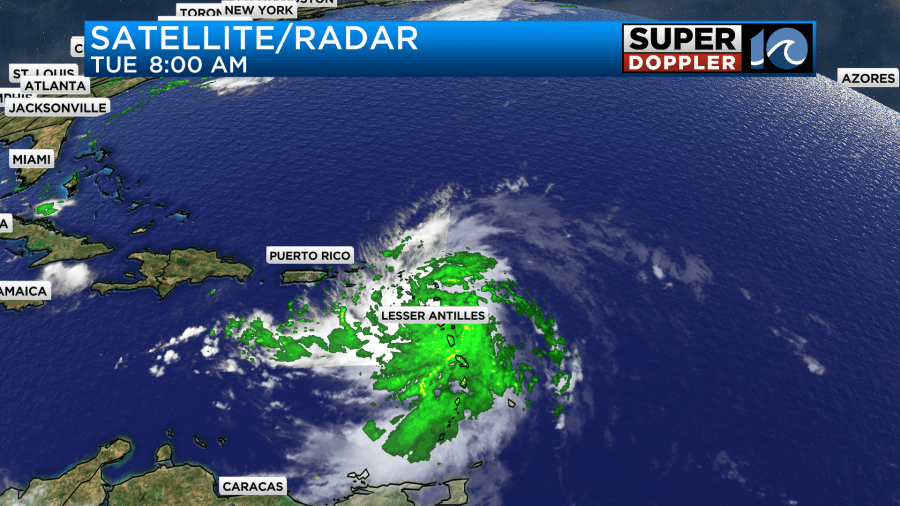
As of this morning Ernesto was a fairly disorganized storm near the north end of the Lesser Antilles.

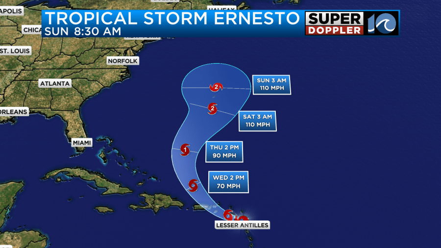
The storm is moving slowly to the west/northwest. It is forecast to move towards the eastern side of Puerto Rico in the next 24 hours.

They will likely have tropical storm forced winds over the eastern part of Puerto Rico and the Virgin Islands. After that point it is expected to snake its way north towards Bermuda.

It would likely get its act together after Puerto Rico. It should be able to feed off of the warm ocean water, and so it is expected to become a hurricane in the 3-5 day range. The models are in pretty good agreement as to the track. There is some wiggle room around the latitude of Bermuda, but not a lot of wiggle room.

The good news is that it should stay offshore as far as the United States is concerned. However, it could affect coastal Canada in about a week. Keep in mind that we will probably have an elevated risk for rip currents over the weekend. However, we may also have some really nice surf. We’ll have updates.
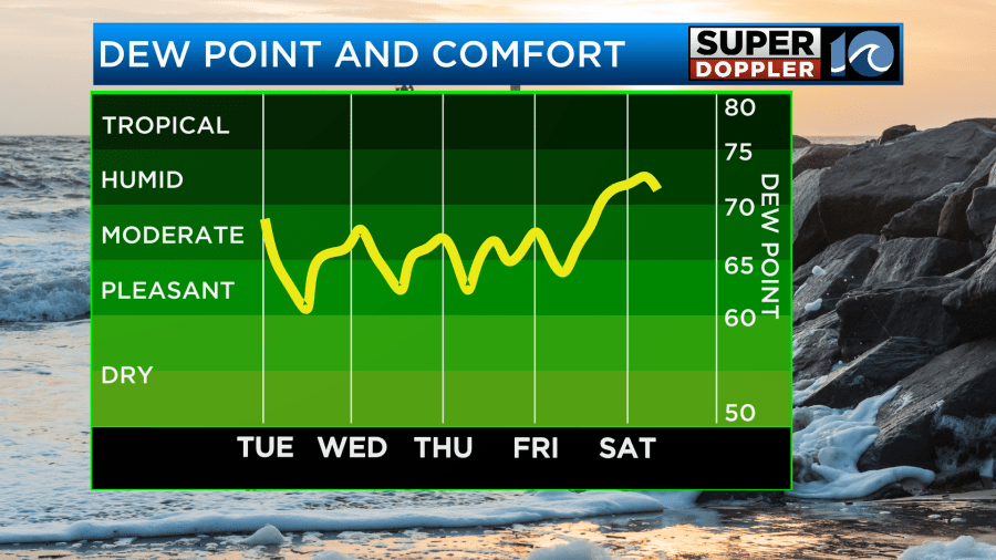
Meanwhile, around here we have some pretty nice weather for the next few days. I was in Huntsville, Alabama a couple of days ago, and the air was super dry. I forgot what really dry air feels like. It was awesome! Luckily we are getting some of that dry air here now. The dew points have dropped since Sunday. They are mainly in the 60s. It is going to stay fairly dry for the next 4 days.

It felt really nice this morning heading out the door, and it should feel really nice overall through Friday. We have high pressure to our northwest. There is a stationary front to our south.

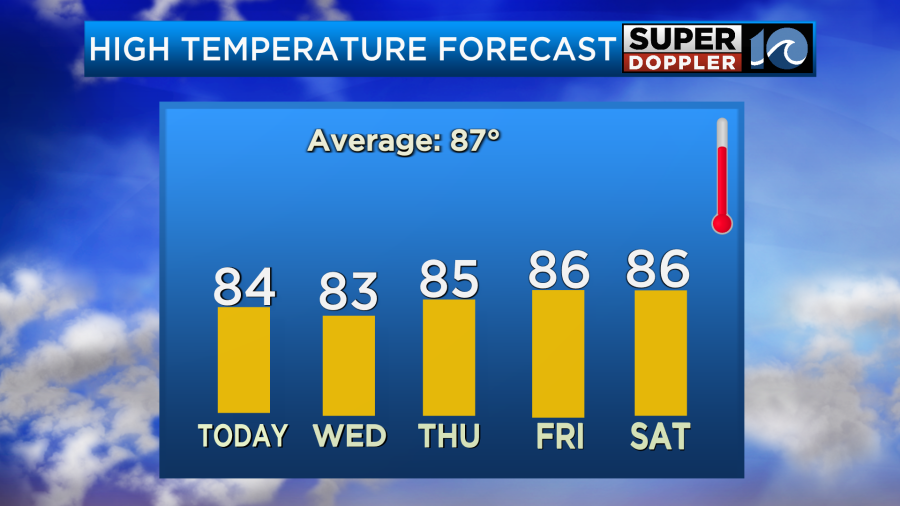
You’ll notice that there are a few rain showers just to our west. These are from an upper level disturbance that will swing through the region today. So we’ll have some isolated showers with partly cloudy skies. High temps will be in the low-mid 80s.

Tomorrow that disturbance will be gone. We’ll have lots of sunshine with only a stray shower or two in the region. High temps will be in the low-mid 80s again. It should be very nice with the low humidity continuing. Then we’ll be in the mid 80s Thursday and Friday with lots of sunshine.

By the weekend the humidity will increase again, the temps will rise a bit, and we’ll have some scattered rain showers. I’ll talk more about that in tomorrow’s weather blog.
Meteorologist: Jeremy Wheeler


