
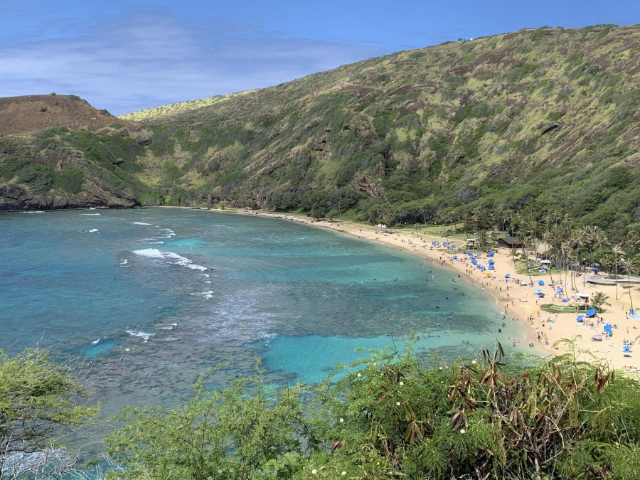
Where do I begin? Well, first off I should tell you where I’ve been for the past few days. I was in Hawaii with the family. It was beautiful! The weather was great! It was a good family trip.
I got back just in time for round 1 of the high heat and humidity. Yesterday, we cooled down slightly, but the humidity was still very high. After the rain in the morning we had another round in the afternoon.
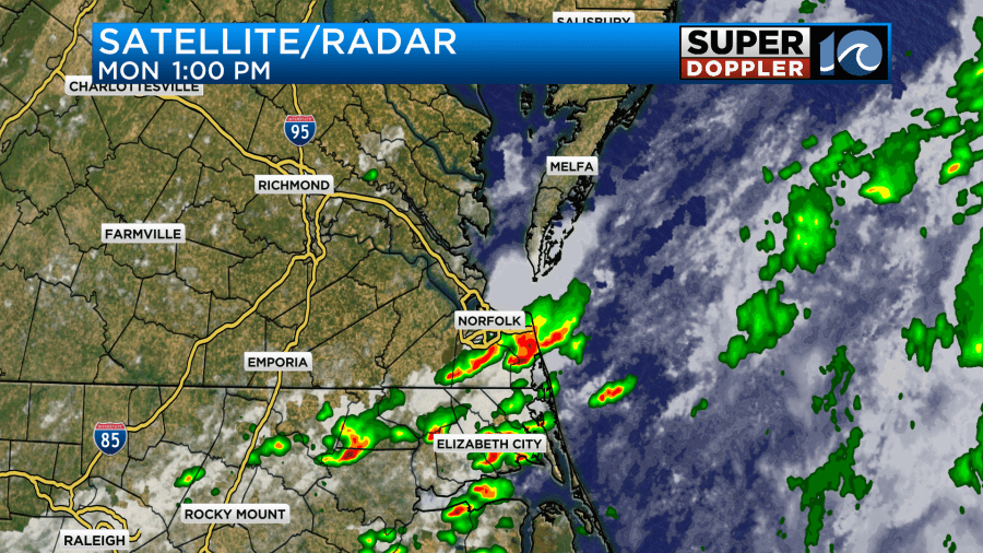
There were some strong storms as well during the afternoon storms. We picked up about a quarter to a little less than three-quarters of an inch of rainfall over parts of the area.
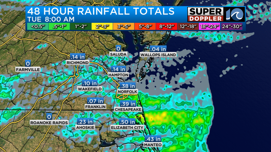
Virginia Beach and Elizabeth City both had over 0.6″ of rain. That’s great, but some areas basically got missed, and we all need more rainfall in the long-term. In-between the showers it felt like a steam bath!
This was caused by a cool front which slowly sank to the south. Today that front is steadily sinking south of Hatteras.

With the cool front to our south we’ll dry things out a bit today. Dew points will be more in the mid-upper 60s. We’ll have lots of sunshine with a light east/southeast wind. High temps will be near 90 degrees this afternoon with 80s near the shore.

The heat index will only be in the low 90s this afternoon.
However, tomorrow the heat and humidity will bounce back. The front will lift north as a warm front. We’ll develop a stronger southwest breeze (5-15mph). We’ll also have mostly to partly sunny skies as well. That will push our high temps to the upper 90s.
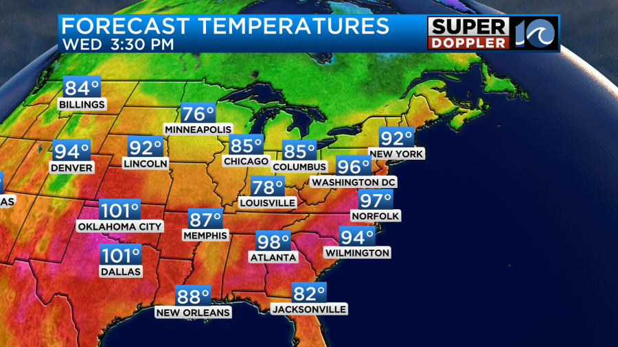
The humidity will also bounce back. That will put our heat indices up into the lower 100s.
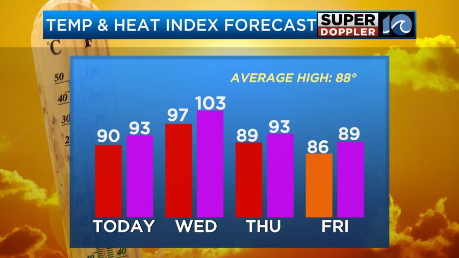
It will be pretty rough again for those working outside and for kids at Summer camp. We’ll be mostly to partly sunny. There won’t be much rain, but some isolated showers or storms could happen by the late afternoon. Then a few scattered showers and storms will be possible by the evening. This will be ahead of the next cool front. That front will work its way through on Thursday. There will be some scattered showers and storms from the late morning through the early afternoon.
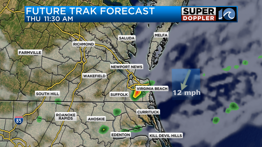
It’s possible that we could get some heavy rain again and possibly a few strong storms. High temps will be knocked down to the upper 80s, but the heat index will still be in the low 90s. We’ll develop a north breeze.
We’ll be pretty good on Friday. High temps will be in the mid-upper 80s with partly cloudy skies. There will be even less humidity (but it will be far from dry). Temps will then rise to near 90 over the weekend. Humidity will be average. It doesn’t look like much rain on Saturday, but there may be a return of some more storms on Sunday. I’ll go into more detail on that in tomorrow’s weather blog.
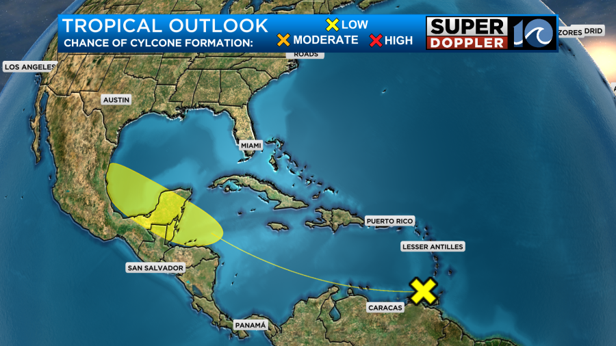
The tropics are quiet for now. We are tracking one weak disturbance in the eastern Caribbean that has a low chance of formation as it rolls west over the next few days.
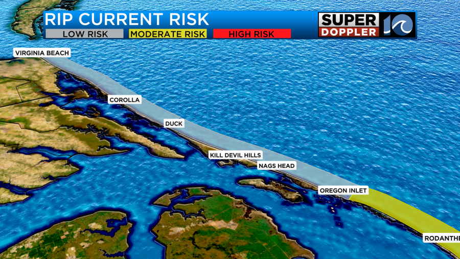
Locally we have a low threat for rip currents over most of the region with a moderate threat over the southern Outer Banks.
Meanwhile, there is a lot happening over other parts of the world. Unfortunately, the extreme heat has affected a big annual event (The Hajj). Sadly over 1,000 people have died during the pilgrimage this year due to the high heat.
There has been some severe storms and dangerous flooding across parts of the upper Midwest. A bridge has even collapsed between Iowa and South Dakota. Officials in Minnesota are now monitoring for a possible dam break.
Meteorologist: Jeremy Wheeler


