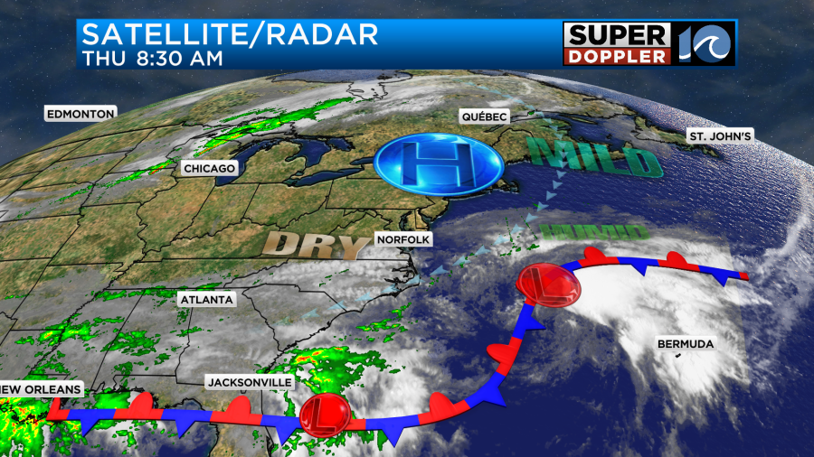
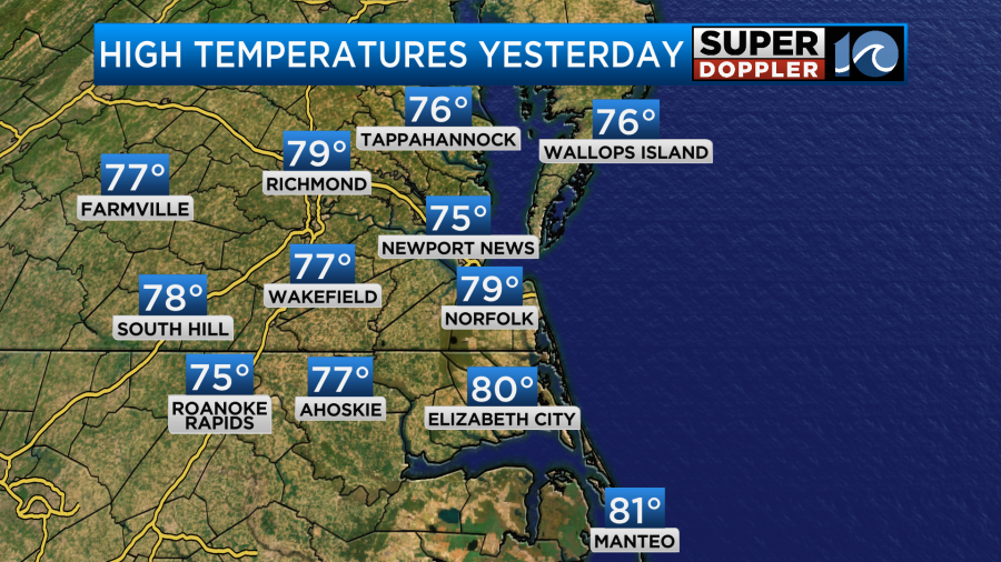
Today is still going to be a decent day, but there are some subtle changes that will be happening to our region. High temps yesterday were mainly in the upper 70s. There were a couple of 80s to the south.
Today the northeast breeze won’t be quite as strong. It will run at 10-15mph with gusts up to 20mph. So our temps today will warm up a couple more degrees. Mainly inland.
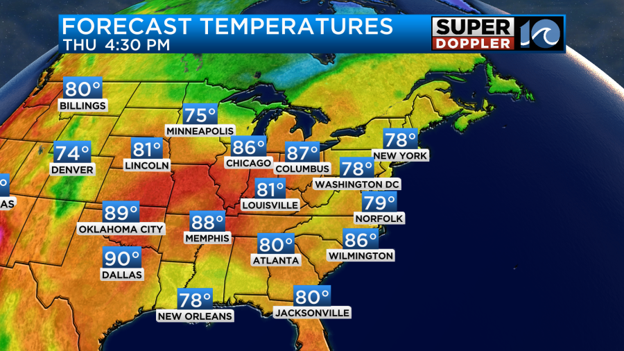
We’ll have highs in the upper 70s with a few 80s inland. We’ll have a mix of sun and clouds. There will only be a stray shower or two in the area.
The humidity will be moderate today. It should still be comfortable with the breeze. But the humidity will climb a little more tomorrow.
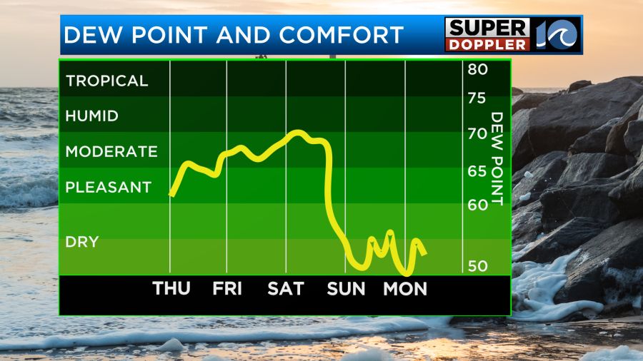
There will be even less of a breeze Friday. Skies will be partly to mostly cloudy. So high temps will climb a bit more into the lower 80s. There will be some isolated rain showers, but I only have the chance at 20% for now. By the time we get to Saturday we’ll have even more moisture in the area. We’ll have lots of clouds in the morning with a large swath of rain over parts of the region.
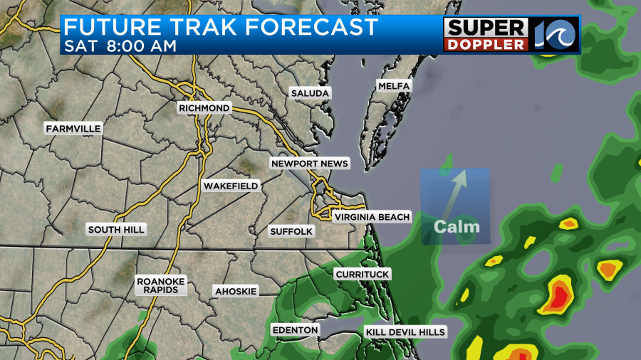
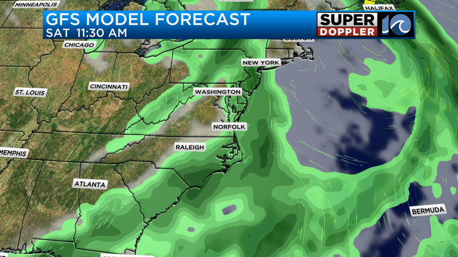
Future Trak has it up to the VA/NC state line. However, the GFS model has it a little more to the north.
After that rain moves out, then Future Trak has some more scattered showers over the area in the afternoon.
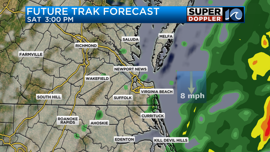
This could affect some of the regional football games on Saturday, but I’m hopeful that it’s a low-impact. While we did get some rain recently, we really need it to keep coming. We are entering the Fall planting season soon, and the ground is still fairly dry.
High temps will be in the low 80s again Saturday. However, a cold front will swipe through the region late in the day. This will drop the temperatures and the humidity on Sunday.
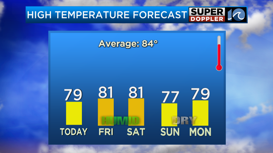
Some very comfortable and Fall-like weather will move into the region from Sunday into Tuesday. Low temps will be in the 50s again at least for one of the mornings. If it’s not raining, then it may as well be comfortable. It will be good sleeping weather for sure.
The tropics is…interesting. There are currently (5) tropical disturbances in the Atlantic basin.
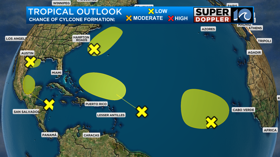
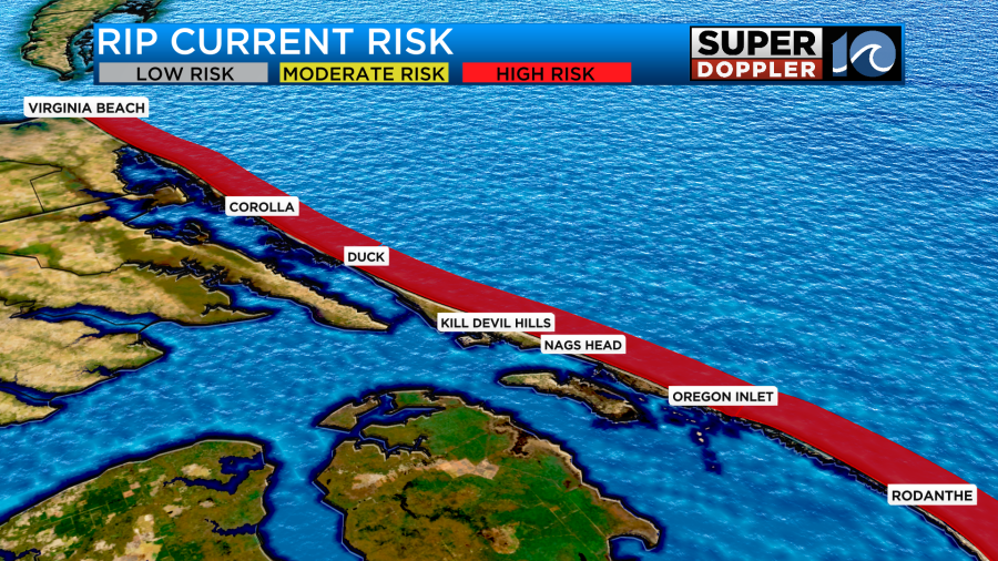
All of them only have a low chance of formation. The one east of the U.S. coast could move north and become subtropical. However, it still wouldn’t really have an impact on our weather. It would probably just keep up the rip current threat. That threat is high again today.
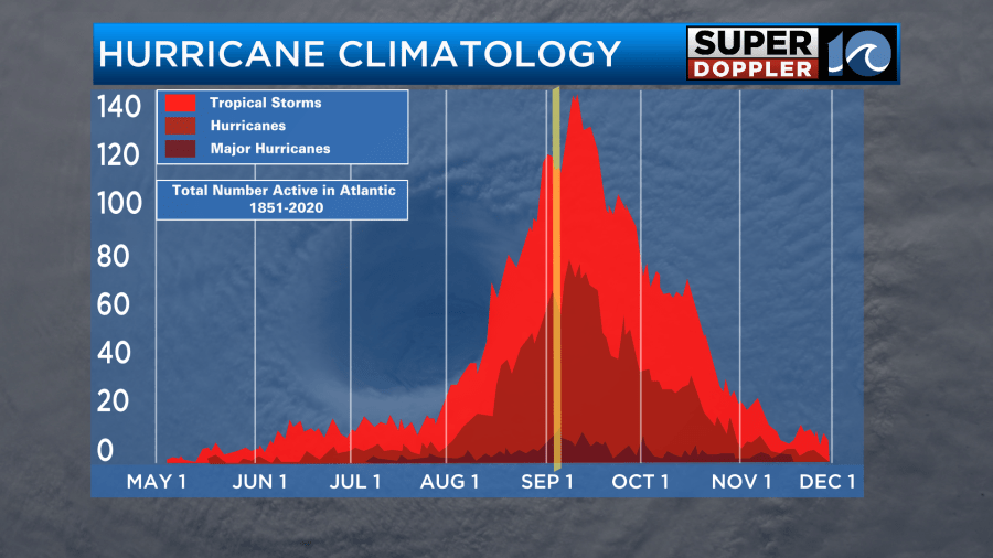
Many people are asking why the tropics aren’t going nuts with tropical systems by now. Wasn’t this year supposed to be off the charts? Well, first off there is still plenty of season to go. Really the bulk of the activity doesn’t even happen until early September through the middle of October.
Recently, the Atlantic water has been very warm. So that has been one factor. However, there have also been a lot of negative factors.
- There has been some stronger than usual dust storms coming off of Africa.
- There has been some higher than expected wind shear over the Atlantic
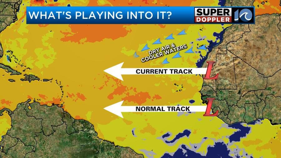
- Storms have been tracking a little more to the north, and that has put them over a region of drier air and cooler water.
I believe things will pick up in the western Atlantic over the next couple of weeks. Stay tuned for updates.
Meteorologist: Jeremy Wheeler


