Locally, today we are going to have lots of sun, cooler temps, drier air, an increasing breeze, and large waves. Whew!
This morning we were watching the Surfchex.com camera at Avon Pier over the Outer Banks. Wave there were hitting the bottom of the pier.

It was pretty impressive for a system that is hundreds of miles offshore. Waves will run between 4-6 feet at the Virginia Beach oceanfront. They will run about 6-9 feet along the Outer Banks.
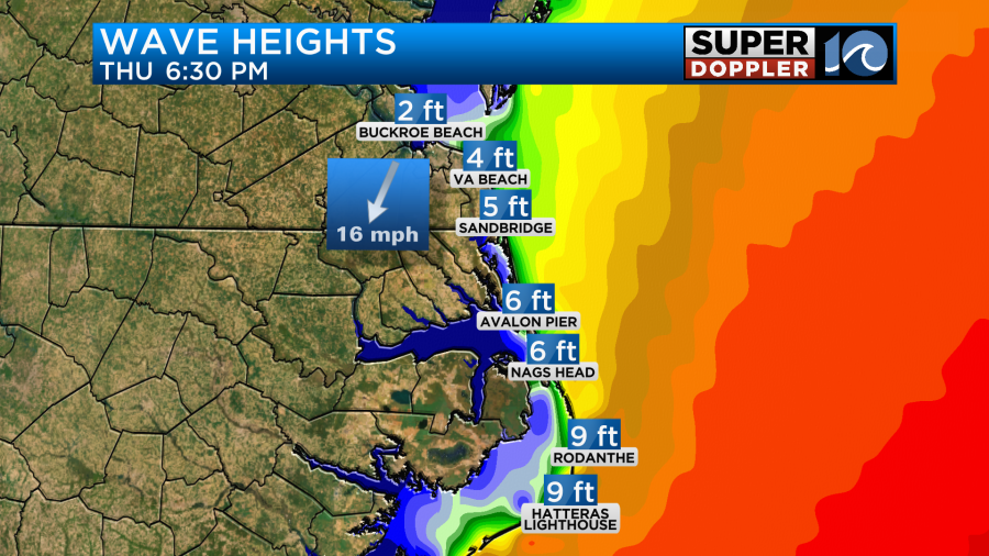
They may be a little higher still by tomorrow.
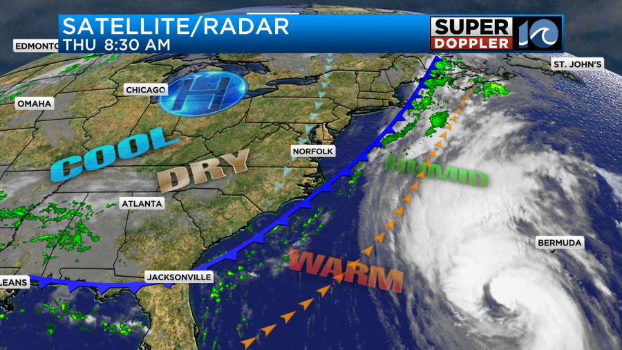
Lee is far from our region. It was over 250 miles southwest of Bermuda this morning, and it was tracking north. Today hurricane Lee will pass well to our east, but it will stay west of Bermuda.
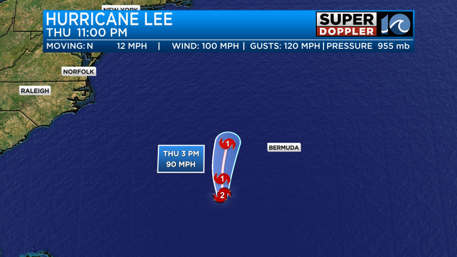
They will experience tropical storm forced winds there today and this evening. However, they will miss the hurricane forced winds.
We will have a few gusts to 20mph here out of the northeast with some gusts 25-30mph near the shore, but that is mainly from the cold front. Lee will weaken to a category 1 as it works northward. It could weaken to a tropical storm by the time it reaches the coast of Nova Scotia this weekend,

It run over some gradually cooler waters, and the wind shear will also increase. That is why it will weaken in overall strength. However, it will eventually interact with a cold front, and that could allow it to become a hybrid system. That means that as cooler air wraps into Lee it could expand in size. Here is what GFS and European models show this weekend for wind and pressure.
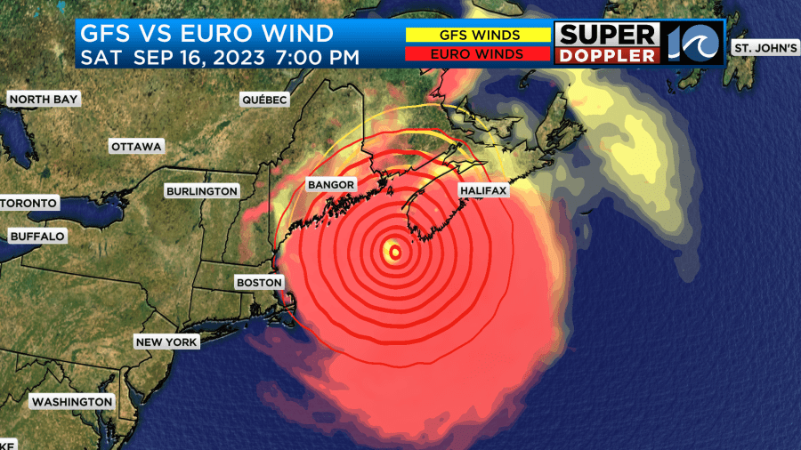
You’ll note that they are in very good agreement in that time frame. So there is pretty high confidence in its track now. The other forecast models are tightly clustered over that area.
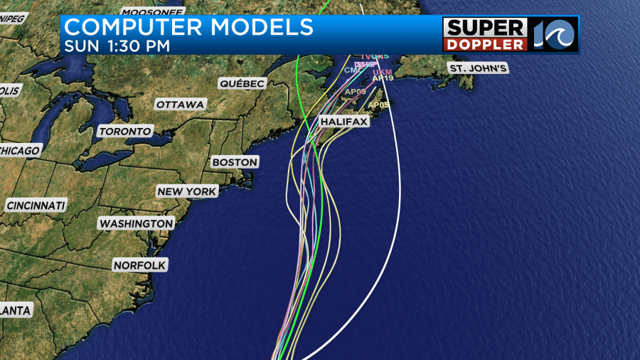
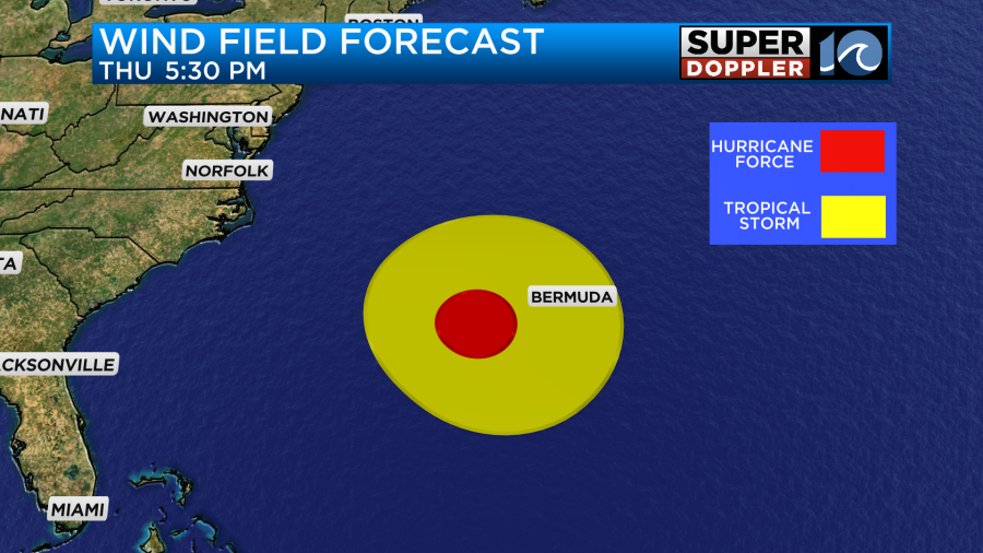
While the models are showing the forecast for the center of the storm, remember Lee will be able to spread tropical storm forced winds over a large area in the northeast.
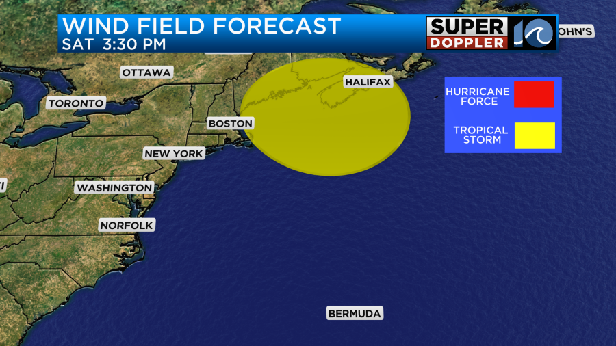
This will impact areas from Boston to Halifax, Nova Scotia. The tidal surge will create some tidal flooding there as well.
Hurricane Margot is still churning in the eastern Atlantic. It will stay out to sea.
There is also a tropical disturbance in the east/central Atlantic that has a high chance of formation. It may already be a tropical depression or storm depending on when you read this blog.

Meanwhile, back home we have a slow-moving cold front dropping to our southeast.
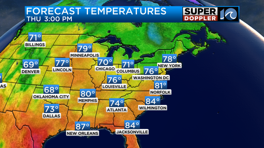
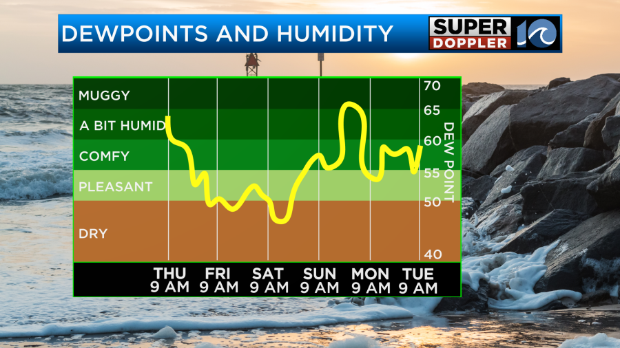
High pressure will build into the region behind the front, and that will help to create a northeast breeze. It will run at 10-15mph with gusts to 20mph. There will be some higher gusts near the shore. We’ll have lots of sunshine. It will feel great as the dew points drop into the 50s. High temps will be near 80 degrees, but the dryness and the breeze will make it feel great!
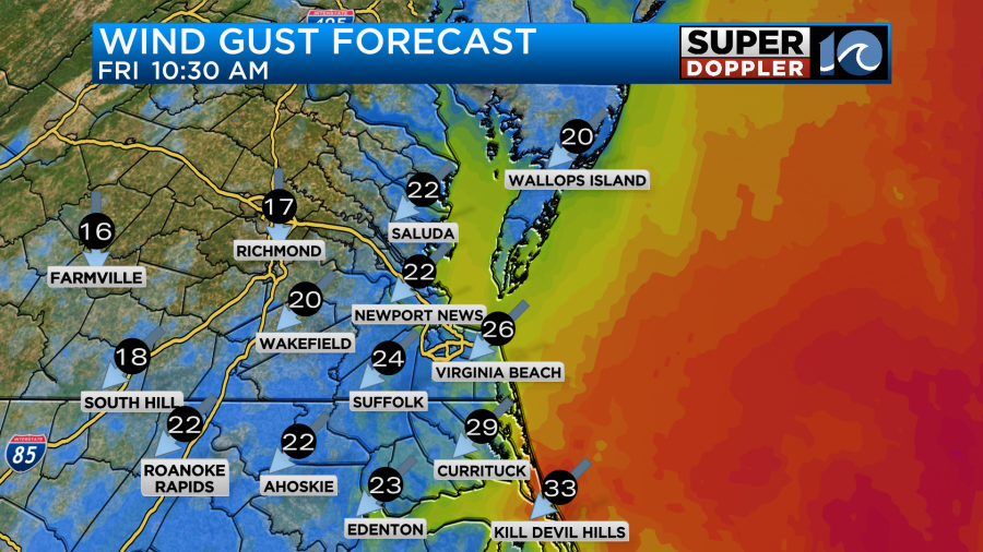
Tomorrow the difference in pressure between Lee offshore and the high building in from the west will create a stronger breeze. We will have some gusts to 25mph with some gusts to 30mph possible at the Virginia Beach oceanfront and near the bay. There may be a few gusts 35-40mph along the Outer Banks.
The increase in wind could lead to some minor tidal flooding tomorrow. It should be low-end minor though.
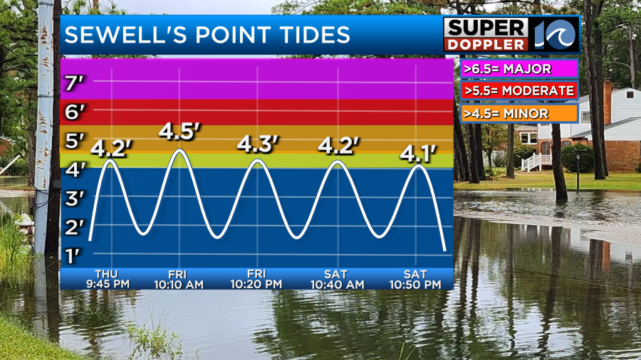
Combined with the large waves there may be some ocean overwash along the Outer Banks, but most of the region should be fine. Again, this is for Friday. The chance for overwash should decrease on Saturday as the waves and tides decrease.
Stay tuned for updates to the forecast.
Meteorologist: Jeremy Wheeler


