Over the last few days we’ve been able to enjoy some very nice weather. After Idalia rolled out to sea some much cooler and drier weather sank into the region. So we had highs in the 70s for about 3 days. Then yesterday we started to heat up into the 80s. It was still a nice day as the humidity was moderate. However, today the heat and humidity will both climb some more. High pressure has shifted around a bit. That will allow for winds to turn out of the west.
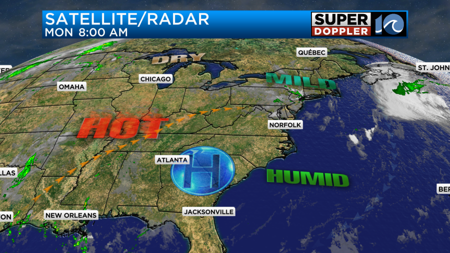
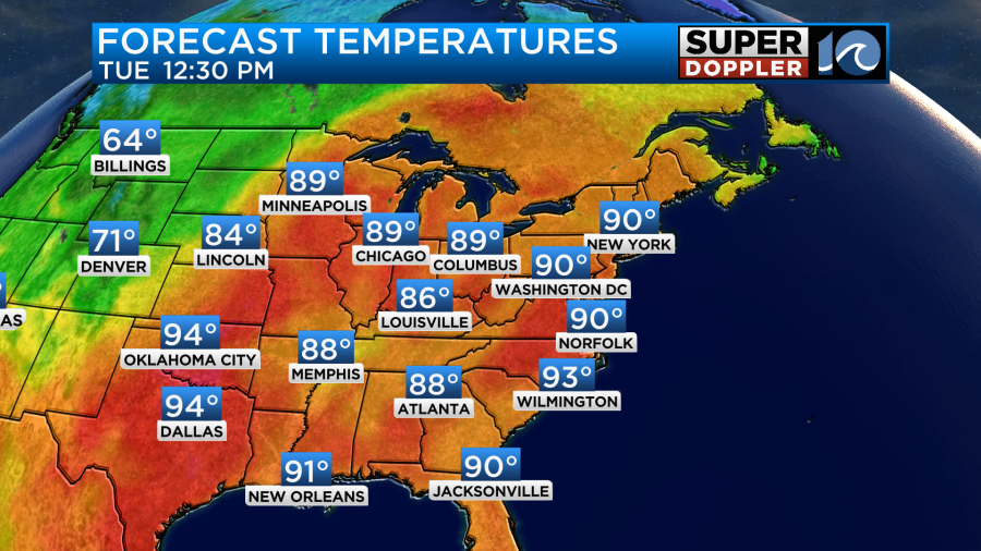
It has been hot for the least few days over the central U.S. Today that heat will slide east some more.
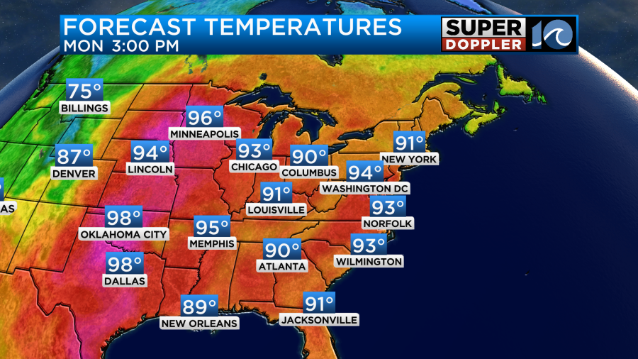
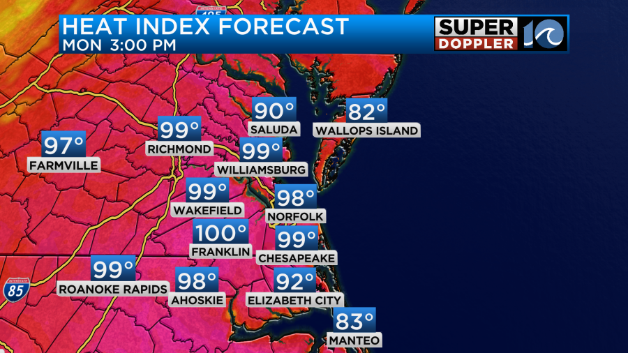
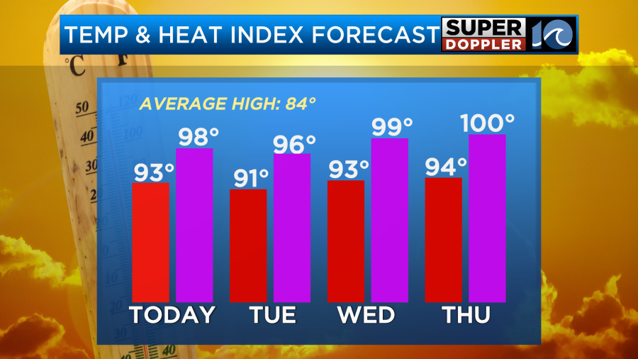
They will likely be breaking records over parts of the Midwest and Canada. Locally we will be in the low-mid 90s. However, the heat index will be in the mid-upper 90s.
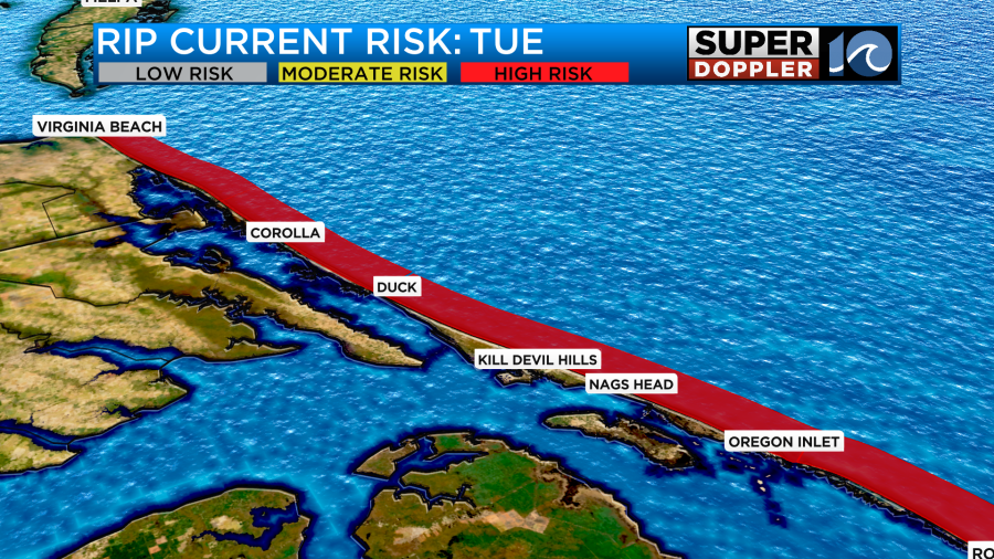
The record high for today is 96 set back in 1985. I’d say that it would be a good beach day, but unfortunately the risk for rip currents is high again along our beaches.
So it may be a better day to head to the pool. We’ll have fair skies through the day with a little more clouds possible around midday. Winds will be light and out of the west/northwest.
Tomorrow we’ll have a bit more of a north/northeast breeze. That may take the temps down a couple of degrees, but that would still put most of the region in the low 90s for temps.
The heat index would still be in the mid-upper 90s. This is going to make it rough for folks heading back to work and the kids heading back to school.
The area of high pressure will stick around for a while. So we’ll have lots of sun through the week with high temps staying in the 90s. The heat index will be in the upper 90s to near 100.
It’s safe to say that the coolness over the last few days was just a tease. Hopefully, we’ll cool down a bit by next weekend. We’ll see.
The tropics have cooled down a little since the weekend. At one point we had 4 named systems that we were tracking. Now it’s down to 2.
Tropical storm Gert and Tropical Depression Katia are both weak, and they should have a short life span. The tracks basically go nowhere.
However, there is a tropical disturbance in the eastern Atlantic that has a high chance of formation over the next few days. This as it moves on a westerly track.
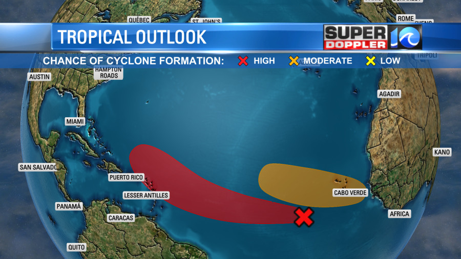
This feature will track west for a few day, but then it may turn to the northwest. Many models do have it staying out to sea in the long run, but not all of them.

This is pretty far out in time. We’ll have to wait a couple of days before we can forecast its track with a decent amount of skill So stay tuned for updates.
Meteorologist: Jeremy Wheeler