Things are looking good on this Labor day 2022. At least in terms of weather. We have high pressure offshore with a cool front to our northwest.
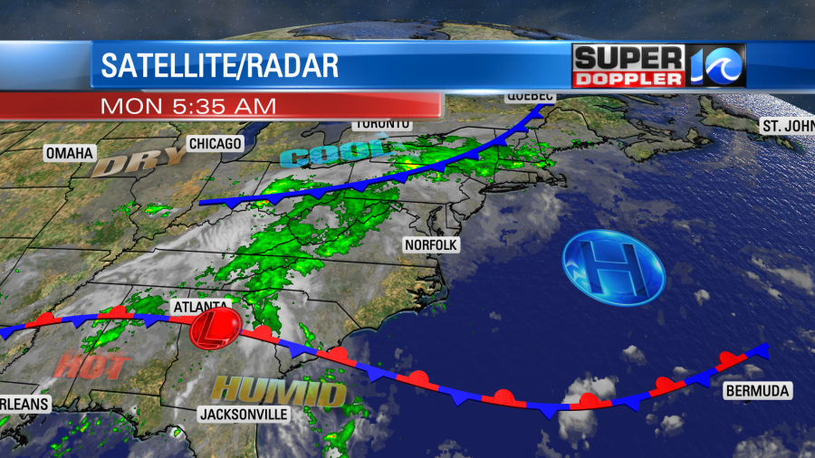
Notice the big area of rain to our west. We REALLY need some rainfall over the region. Luckily, we won’t see much today, but unluckily there will be some rain moving in tomorrow as folks head back work or school.
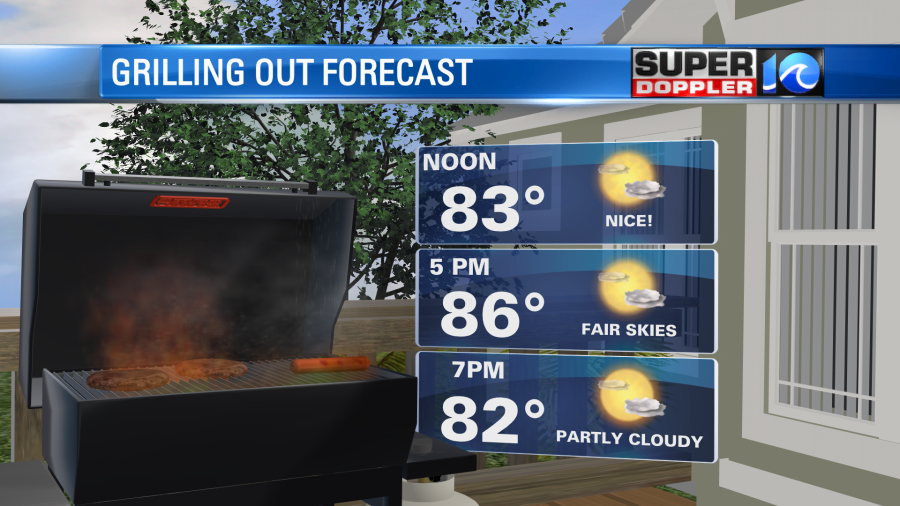
Today we’ll have partly cloudy skies through the day. There will be enough moisture for some isolated pop-up showers this afternoon. However, the chance for rain is only 10-20%. There will be a very light east wind. High temps will run up into the upper 80s with a few 90s inland.
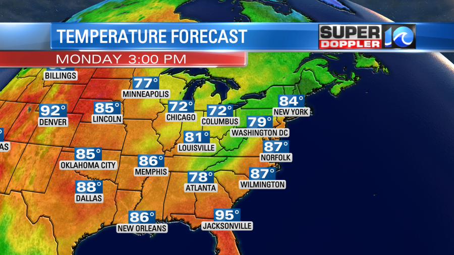
Tomorrow we’ll have mostly cloudy skies. The deeper moisture will stream into our region as the cool front gets closer to southeast Virginia. We’ll still be warm. High temps will be in the mid-upper 80s. The weather shouldn’t be too bad in the morning for the AM bus routes. However, there will be some scattered showers and storms during the afternoon routes.
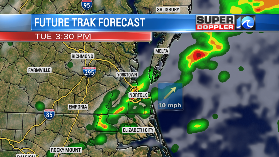
There could be a few heavy downpours between the late afternoon and early evening. Then we’ll probably have another round coming in Tuesday night into Wednesday. High temps will be in the mid 80s Tuesday and Wednesday. Then we’ll be a little cooler and drier Thursday and Friday.
We have 2 systems that we are tracking in the tropics. Both will stay out to sea.
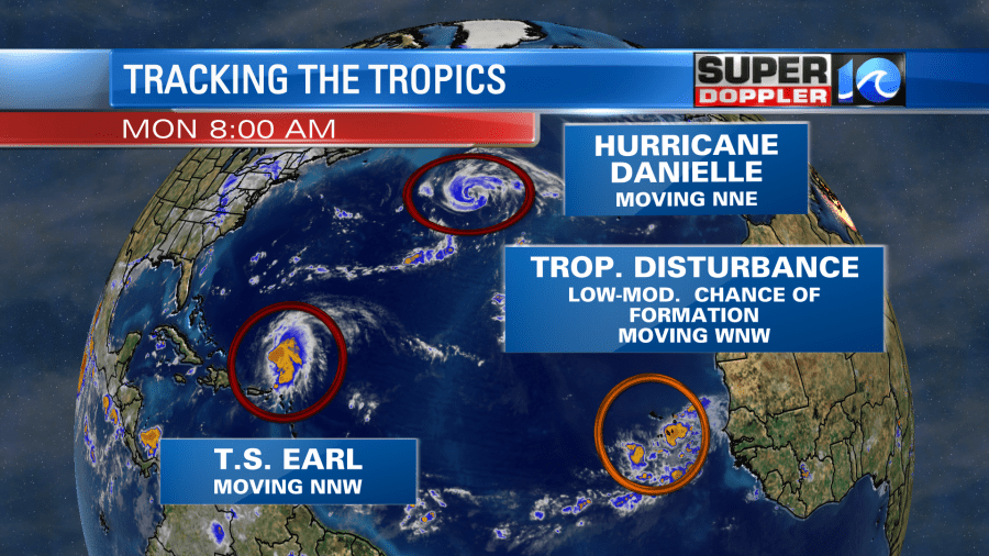
There is a weak tropical disturbance in the eastern Atlantic. That will probably also stay out to sea, but it is moving to the west/northwest.
Hurricane Danielle has been churning for a while. It is a category 1 hurricane over the north central Atlantic. It is forecast to keep moving to the northeast. It is expected to strengthen some more. It could possibly make it to a category 3 storm. Luckily it should stay away from land at that strength.
Eventually, it will become post-tropical. It could affect the U.K. as a weaker nor’easter type storm.
Meanwhile tropical storm Earl is moving slowly to the north/northwest. It is northeast of Puerto Rico. It is now forecast to move northward and then to the north/northeast. The most likely path has it missing Bermuda. However, they are on the edge of the possible path (cone of uncertainty).
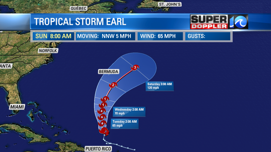
With the slower and more easterly track of Earl our higher waves along the oceanfront have been a little delayed. Today we’ll have waves to 2 ft. We will likely have some higher waves and a higher threat for rip currents later this week. Today there is a low threat at the Virginia Beach oceanfront, but there is a moderate threat along the Outer Banks.

Have a fun and safe Labor Day!
Meteorologist: Jeremy Wheeler