Isaias was a category 1 hurricane yesterday, but has since downgraded to a tropical storm and it looks like it will stay that way. The window of any strengthening is getting smaller. This could mean that impacts will be a little lower in our area but don’t put your guard down just yet!
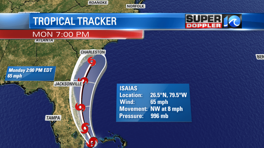
There is a possibility that it makes landfall along the Florida coast but currently it looks like it will stay over the water before making the curve near Georgia.
It will then make landfall in either North or South Carolina. It would remain a tropical storm but still pack a punch with some heavy rainfall!
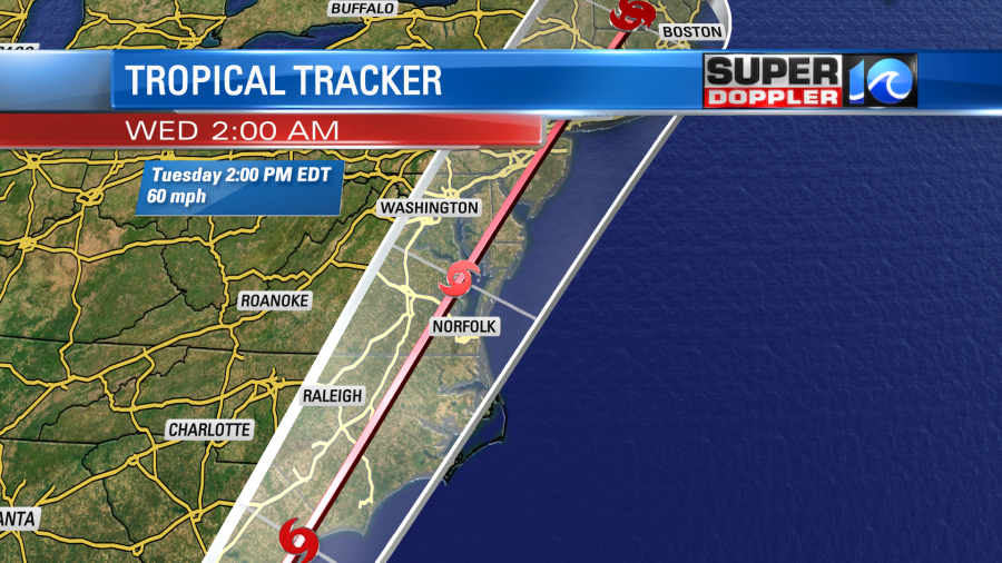
We will start to see impacts Monday night into Tuesday morning. It will start out as scattered showers with the heaviest of the rainfall coming throughout the day on Tuesday!
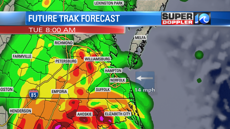
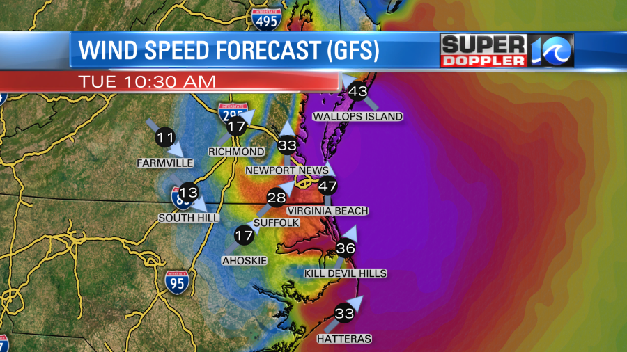
High tide will be around 10:30 AM Tuesday so the tide will be going back down in time for the heaviest of the rain to be stacking up. But totals are varying between models right now and that’s due to the differences in how far inland this storm is expected to go.
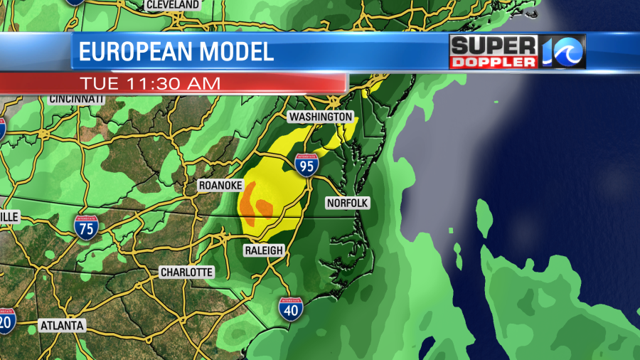
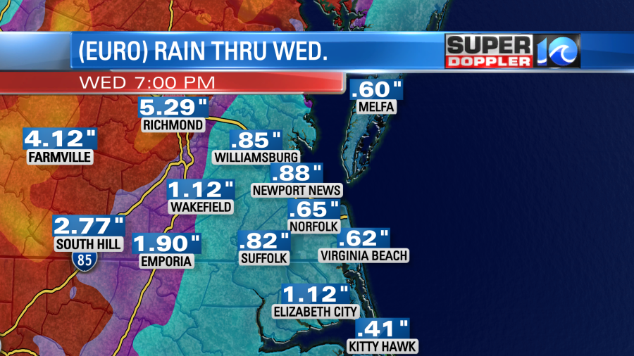
The Euro takes it pretty far west, while the GFS is putting the heaviest rain bands near the I-95 corridor. At this point, I think the GFS solution will be a bit more accurate. But that could change as this storm interacts with land. The Euro has lower rain totals in Hampton Roads with the highest totals to the west of our area.
Meanwhile, the GFS has the heaviest rain set up right over I-95 with more rain across Hampton Roads.
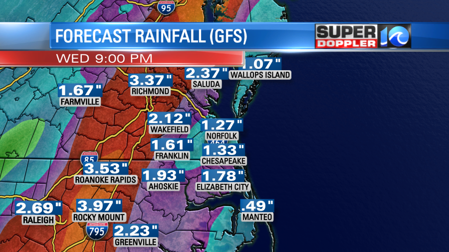
Between several of the other models I think our rain totals across Hampton Roads will be between 1″-2″ with higher amounts the closer you are to I-95.
The other aspect of this storm will be the wind! Secure any loose items in your yard because the winds will be picking up throughout Tuesday. Wind gusts could be up to 50 mph with sustained winds around 30 mph.
When we’re on the eastern side of the center, that leads to an increased risk of tornadoes. That is something we’ll also be keeping an eye on!
Stay updated as changes come in! -Meteorologist Casey Lehecka


