Well….Isaias did cross the island of Hispaniola last night. However, a large portion of it stayed over the water. So it not only held onto some strength. It got even stronger! This morning it was a category 1 hurricane northwest of Haiti.
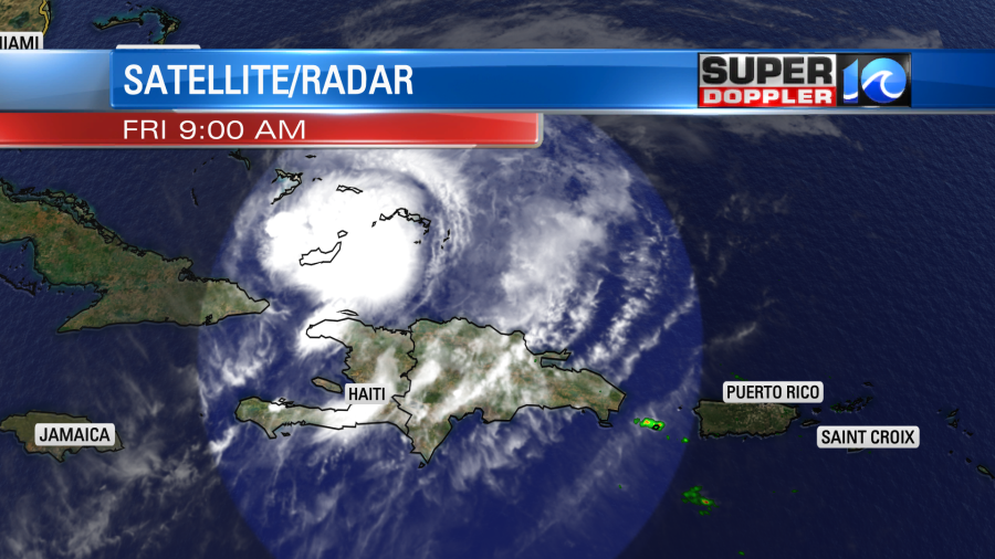
Now that it is on the northern side of Hispaniola, the new information will make it into the models. The latest track sends it through parts of the Bahamas later today. It may move through there as a category 2 hurricane for a time. This is terrible news. They are still recovering from hurricane Dorian which devastated the region last year.
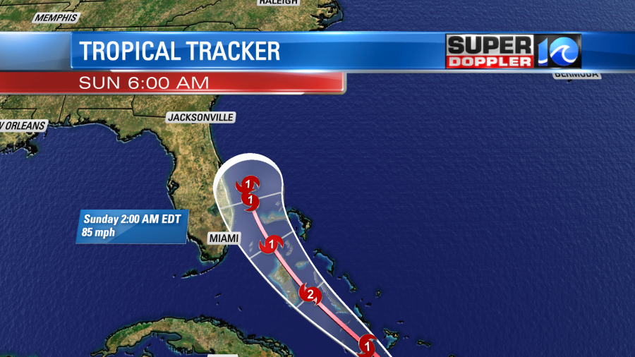
After the Bahamas the storm is forecast to move northward. It may move a little to the northwest. So the latest track has it either just offshore or over the east coast of Florida tomorrow. A very large trough in the upper atmosphere (troposphere) should draw the storm north/northeast between Saturday and Sunday. Then it would move northeast towards our region late Monday into early Tuesday.
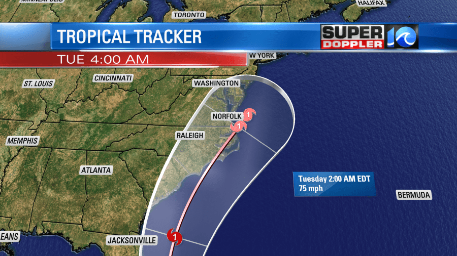
Isaias would then jet away from us during the day Tuesday and move towards the Northeast states.
Now the latest models are starting to get interesting, and a trend is starting to form. There is a new clustering of the tracks over our region since yesterday, but there are still a couple which take it inland, and there are a couple that are offshore.
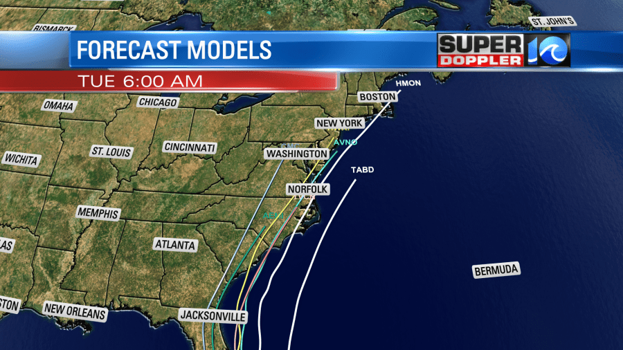
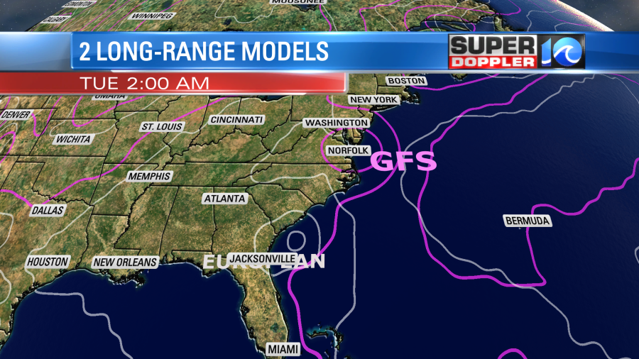
Over the last few days the European model has consistently had the storm going more west than the other models. It still has had that trend overall, but it does have it eventually moving northeast (and slower) early next week. It has the storm going more inland, and that keeps it weaker. According to that model it looks like it would move through our region late Tuesday as a tropical storm. Maybe even a depression.

This would be a fairly good scenario. We’d get a lot of rain, but the wind might not be too bad. The tide also wouldn’t be bad. In contrast the GFS model has been very variable over the last 3 days. However, it is currently stronger and faster than the Euro. I will say that the most recent run trends it closer to the European model. It brings the storm through early Tuesday morning.
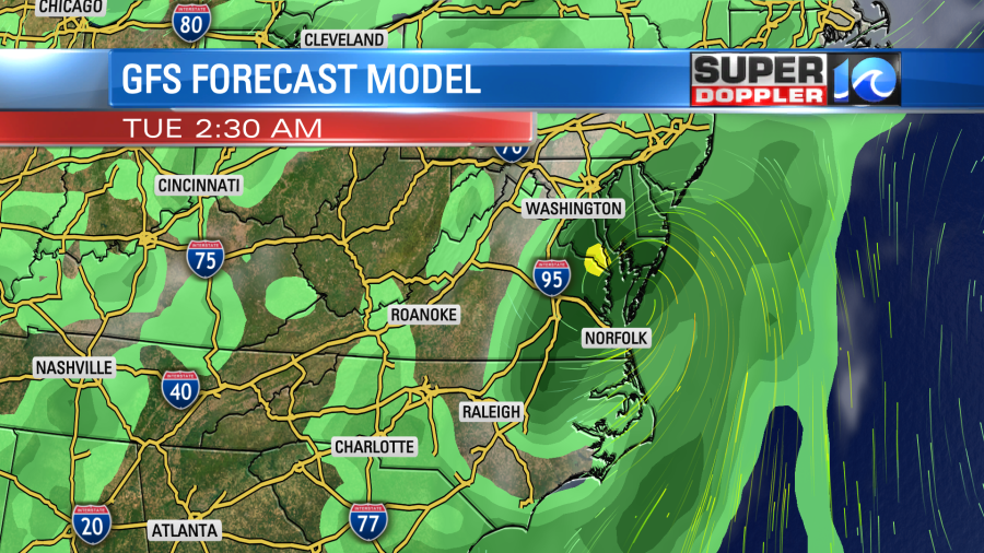
This has it running right through the region. Possibly as a hurricane, but it did slightly weaken compared to the previous run. To show you the contrast better. Here are both the GFS and European forecast on the same graphic.
I used to not use the NAM model for coastal systems. However, over the last few years I’ve learned to appreciate its trends. It is closer to the Euro model than the GFS. It is also much slower to take it northeast.
So if we look at the way the trends are going….It seems to me like Isaias will move onto the east coast of Florida some time tomorrow. It may skirt just the coast, but I do think it will at least get close. Then it will move north. I’m hoping it takes the inland track as that would keep it weaker, but we’ll see. Then it will move northeast. It’s tough to say exactly how far east or west it will travel on its northeast trek.
Worst case…we will have a category 1 hurricane rolling through the region early next week. Best case we get a very weak system bringing us a good amount of rain with lighter winds and minimal tidal flooding. We’ll work out those details in the next 24 hours.
For now you need to do a couple of things:
- Monitor the weather over the weekend. There may be some dramatic changes to the timing and placement of the track. We are talking about a system that still 4-5 days away.
- Check your hurricane kits. What do you need? Will it be easy to stock up on supplies with the COVID crisis happening?
- Keep COVID in mind when planning. Now, we have to make sure there are plenty of masks in the hurricane kits. Plus… will shelters have the same capacity as they had before COVID-19? So keep all that in mind.
There are two other tropical disturbances in the eastern Atlantic. These are moving generally west. The one closer to Africa has a medium chance of formation over the next few days.
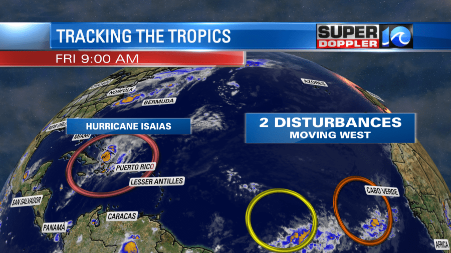
We’ll watch those over the weekend as well.
Locally today there is a cool front sagging to the south. It will stall out over the area this afternoon.
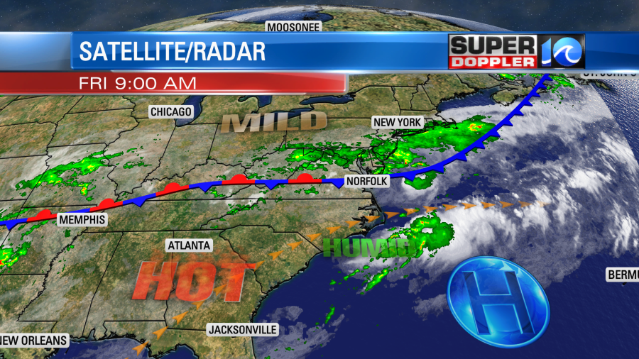
This has already given us more clouds and some scattered showers this morning. As we heat up this afternoon scattered showers and storms will fire up.
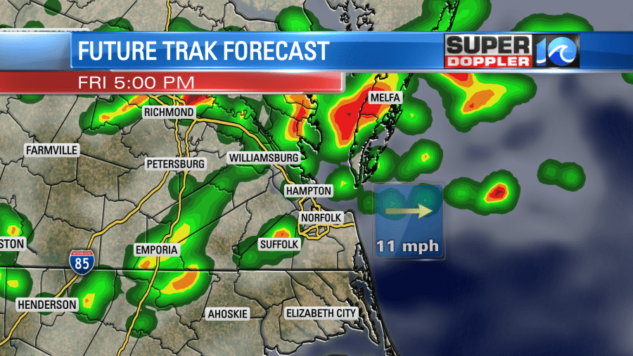
We could have some heavy downpours. There is even a marginal risk for some severe wind gusts. High temps will be in the upper 80s to low 90s. However, the heat index will be in the upper 90s to near 100. Tomorrow the front will drift north a bit. So we’ll have a mix of sun and clouds with a few pm showers and storms. Highs will be near 90. We’ll have a little more sun on Sunday. High temps will be in the mid 90s. The heat index over 100. There will be a few pop up storms. The forecast for early next week will greatly depend on the track of Isaias.
Again…be sure to check back for updates. We’ll have them frequently over the next couple of days.
Meteorologist: Jeremy Wheeler

