We started off this morning with some virga in the region. Virga is when precip falls, but it evaporates before it hits the ground. At one point it looked impressive on radar, but we could barely find any cameras with rain reaching the ground.

There’s no big weather features in our region. There is an area of high pressure offshore. There is also a stationary front to our south. Low pressure is over the Tennessee River Valley.
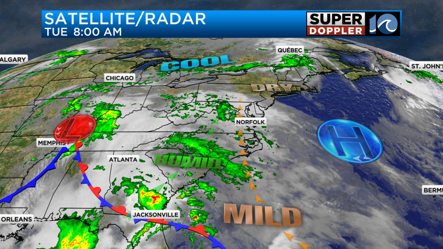
The moisture will keep increasing through the area today as the winds stay steady out of the south.
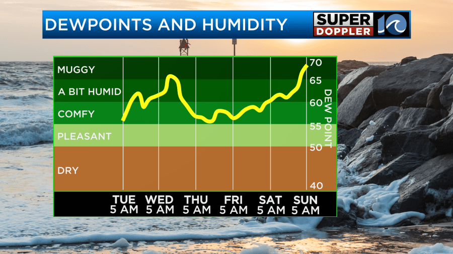
Due to the increasing moisture we’ll have an increasing chance for rain showers. There will be scattered showers by midday. Then the coverage will increase going into the afternoon.
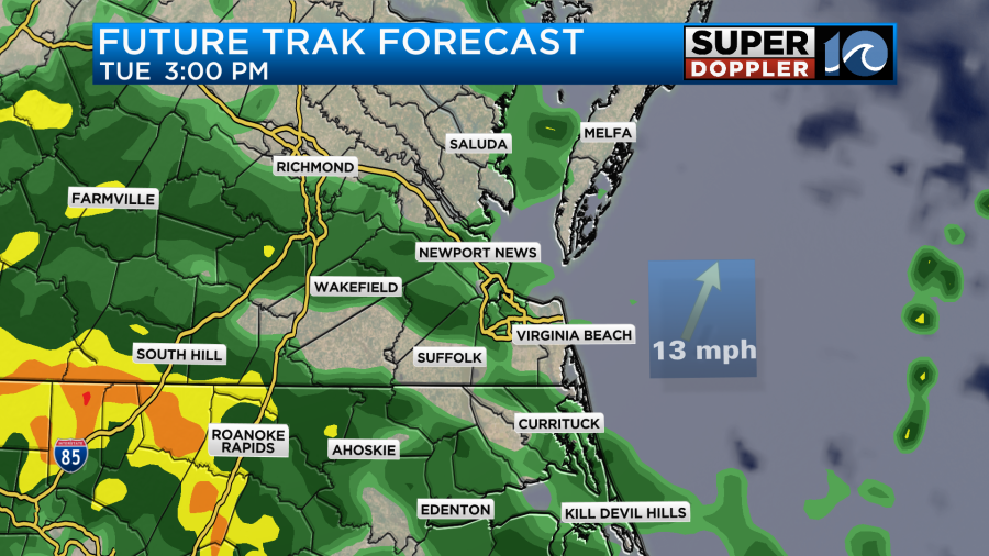
The rain will be almost widespread by the early evening.
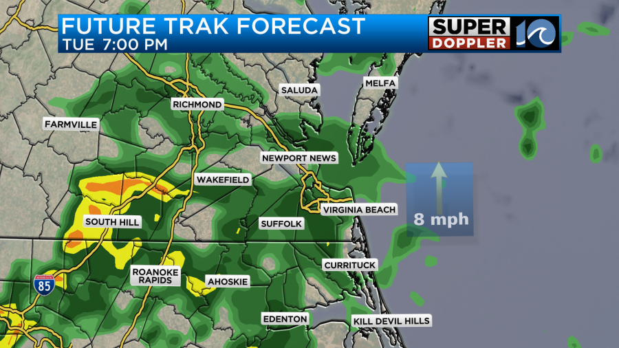
There will even be a few heavier showers. Overnight we’ll have lots of rain. There will be some more heavy rain and possibly a few thunderstorms. The area of low pressure to the west will be getting closer during that time. Tomorrow the low will slowly work out to sea. We’ll have a few showers in the morning. Our model even has some heavy rain on the Eastern Shore between 4 and 8am.

If that comes to fruition, then there may be some isolated flooding. We’ll see. After that there will probably be a break for a while with mostly cloudy skies. Then scattered showers and a few storms will fire back up during the late afternoon into Wednesday evening.

The low will move out to sea by Wednesday night. On the back side there will be some wrap-around moisture. So there will be some isolated showers possible on Thursday. High temps will basically be in the 70s all week.
The update for Saturday is that it looks like an area of low pressure will still move in from the west, but it now looks like it will be later in the day. So the rain may hold off until late in the day. If it keeps trending later, then it could hold off until the evening.

On the flip side of that coin it looks like there will be some scattered rain showers on Sunday. Stay tune for updates to the timing of that rain.
As far as rainfall… We are about three quarters of an inch below average for the month so far.
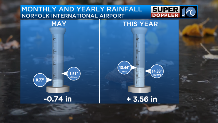
Remember though we finished April over 2 inches below average. So we need some rain. We are up for the year, but that is because we were so wet in March. Going forward we are probably going to get about 0.5 to 1.5″ of rainfall in the next 48 hours.

Meanwhile there was more flooding and more severe weather across the Deep South yesterday. It has been a rough couple of weeks over the central U.S.
Meteorologist: Jeremy Wheeler