Hurricane Laura has strengthened again since yesterday. It was a category 2 earlier in the morning, but now it is up to a category 3 with 115 mph sustained winds. It looked very healthy on satellite. The eye has become very pronounced and symmetric. So the upgrade was no surprise.
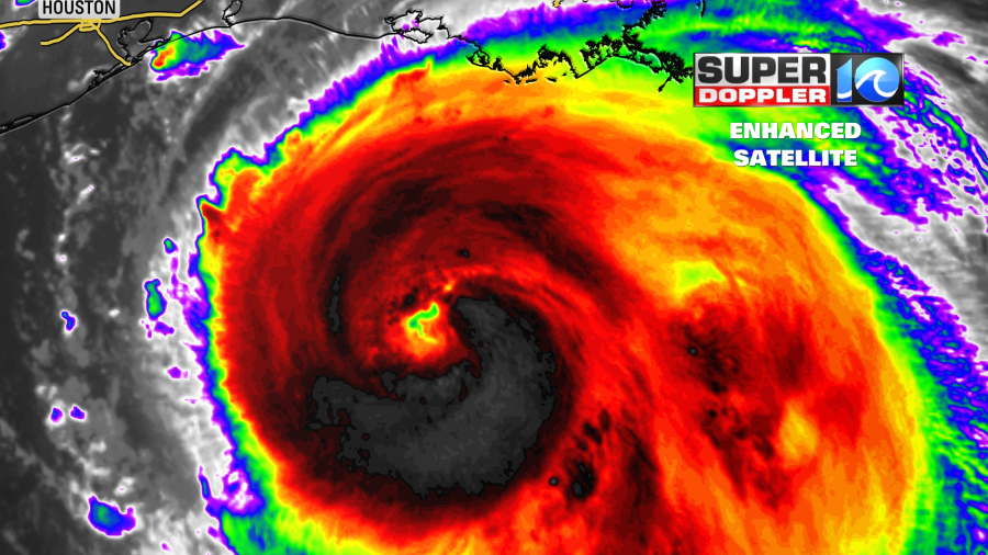
The system is moving over very warm water. Water temps are in the mid-upper 80s. Slightly cooler along Marco’s past path, but only by a couple of degrees. Plus, there is very little shear over its path. So Laura is expected to become a category 4 hurricane this evening.

It is forecast to weaken some right before landfall early tomorrow morning. We’ll see if that actually happens. It will likely be a major hurricane either way. The storm surge over parts of coastal Louisiana could be between 10 and 15ft. Possibly higher in a few locations.
After landfall the system is forecast to quickly weaken over land. It will move north as a tropical storm into the mid-Mississippi River Valley. Then on Friday it will move northeast as a depression through the Tennessee River Valley. It is forecast to be a non-tropical low as it moves into our region. However, that’s not set in stone. More on that in a moment. There is definitely a chance for rain here on Saturday or Saturday night with some breeziness.
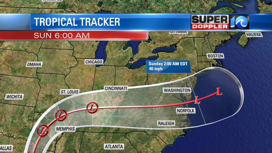
It’s possible that the storm could restrengthen as it moves off the coast. Whether as a tropical or non-tropical system.
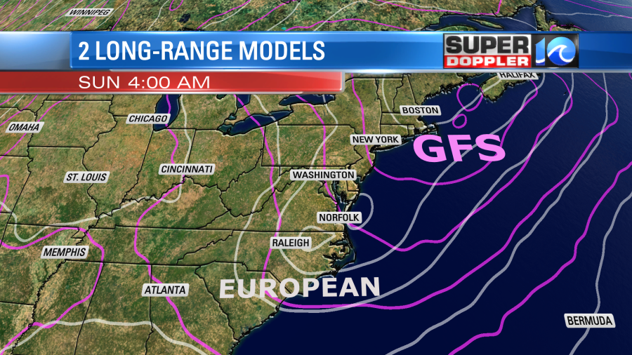
So this leads us into the models. There are basically 2 trains of thought with Laura. In the short-term all the models are in good agreement. They all have it tracking near the TX/LA state line by tonight. Then up into Arkansas on Thursday. However, on Friday there is a split. Some models have Laura falling apart, and merging with a big area of low pressure in the northeast states along with a cold front. That is what the GFS model represents. It has scattered showers and storms ahead of the front on Saturday. Then more showers and a few storms as the front moves through Saturday night.
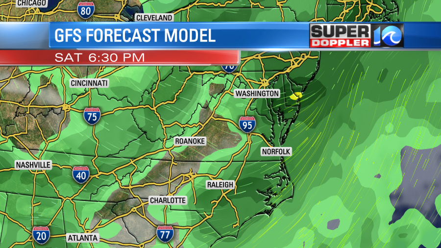
It does have some rain and some breeziness, but that scenario doesn’t look too bad for us. However, the European forecast model has a different scenario. It is dry here for most of Saturday. It has the low remaining intact through our region (though fairly week before arrival). It moves the low through early Sunday morning. It does bring in some heavy rain for a time early Sunday morning. However, it also has some strong gusty winds for a time. It then has the low strengthening as it moves offshore.
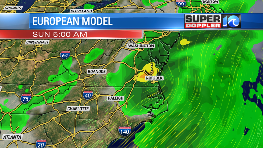
To elaborate the difference between the models. Here is the pressure lines for the GFS vs the Euro model:
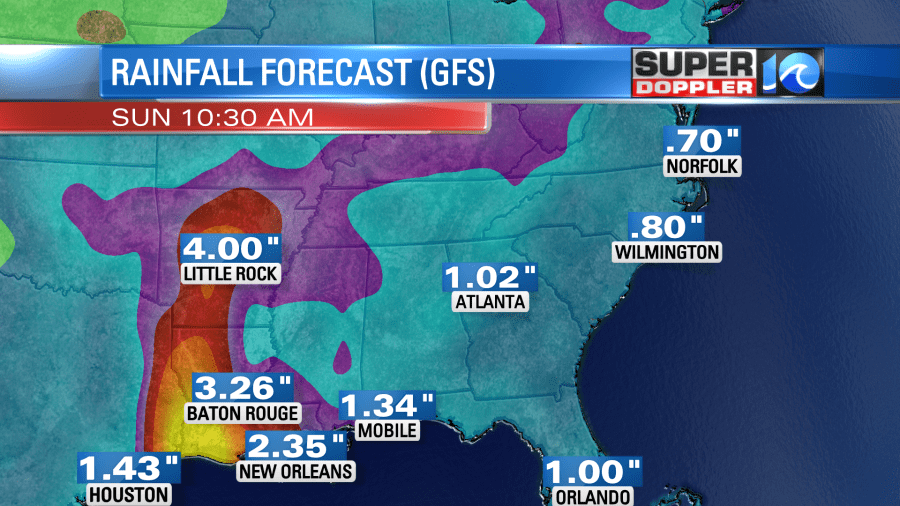
So we’ll have to watch for that 2nd possible scenario, but it’s still too early to go into any specifics. The GFS model isn’t calling for much rain. A bout a half an inch.
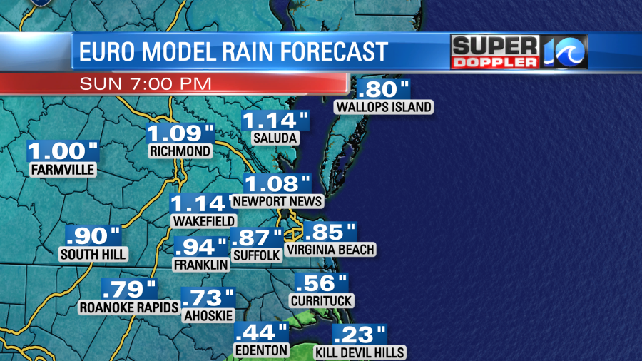
However, the Euro doesn’t bring in much more than that.
One thing that’s worth noting is that the track of Laura is very similar to the track of hurricane Rita form 2005. The headlines from Rita were eclipsed by hurricane Katrina which happened about a month prior. However, Rita caused a lot of damage over Texas and Louisiana. Thousands of homes were damaged or destroyed, and there were several direct deaths.
The highest storm surge with Rita was 15 ft. The highest surge forecast from Laura is about the same.
Luckily our local forecast is nice today. We have a cool front dropping to our south. It will stall out over North Carolina this afternoon.
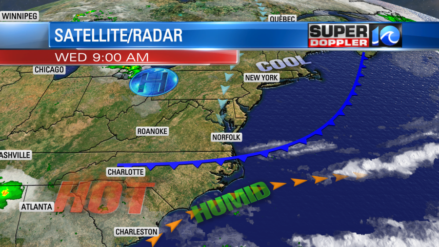
High pressure is to our north. The humidity is dropping already. Dew points will be in the 60s today, an we’ll have a lot of sunshine. The breeze will be out of the north at 8-12mph. The front will move back north tonight. So tomorrow we will be very hot and humid. High temps will be in the mid 90s.

The heat index will be in the upper 90s to lower 100s. It will be rough. We’ll be partly cloudy with some isolated showers or storms late. We’ll have similar weather on Friday. Saturday’s weather will depend on the track of Laura. I talked about the 2 different scenarios above. Typically the actual scenario becomes a blend between the GFS and Euro, but will see which way the models lean toward. So either way I would expect rain either late Saturday or very early Sunday morning. We’ll see about the wind. Stay tuned for updates on all of this throughout the day.
Meteorologist: Jeremy Wheeler
Tracking the Tropics
- How buying a real Christmas tree could aid western NC recovery
- Tracking the Tropics: Hurricane Oscar misses Florida in active October
- Gov. Youngkin establishes Office of Hurricane Helene Recovery and Rebuilding
- Rabies vaccination projects halted in states impacted by Hurricane Helene; here’s why that could be bad
- Three Ahoskie police officers deploy to western NC after Hurricane Helene


