Wednesday Afternoon Update:
As Francine batters Louisiana and Mississippi, the tropical moisture spreads throughout the deep south and eventually throws us some more humidity in the coming days. The tropical system will clash with dry air as it moves into the central U.S. later this week. However, there’s a dying front connected to Francine that could eventually bring us a soggy pattern next week!
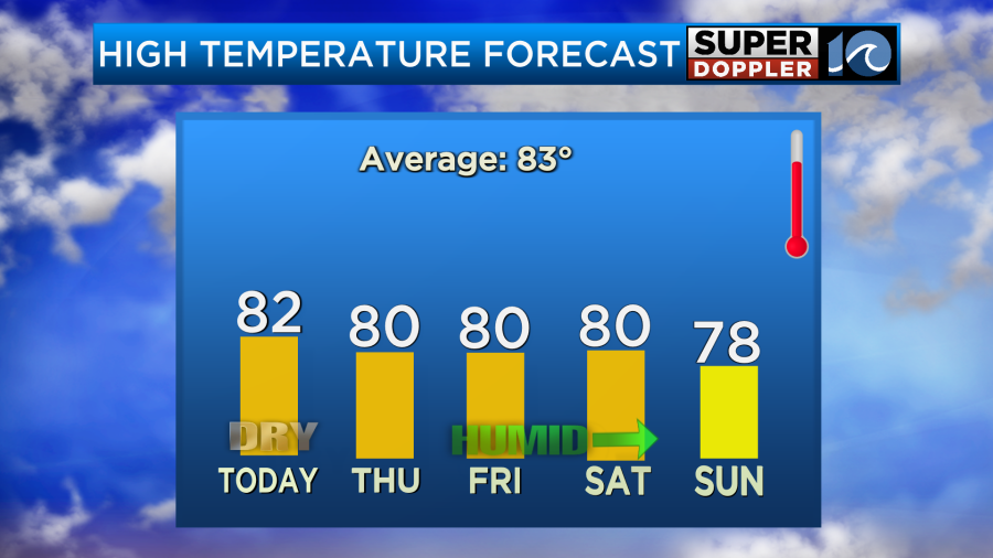
So over the next few days, expect the northeast breeze to slowly pick up, the humidity returns to more noticeable levels, and we’ll see more clouds passing over head. That should be the case from Thursday through Saturday, with temperatures near 80° in the afternoons and only a stray shower possible.
A stalled front connected to what’s left of Francine over the weekend could then stir up our next rain maker. By later this weekend, a broad area of low pressure or area of rain starts to stir up offshore Georgia and South Carolina. Early next week the moisture could move northward into our neck of the woods — you’ll notice rain chances going up early to mid-week next week. We’ll take the rain… but let’s hope it’s not too much of a nuisance.
Stay tuned for updates!
-Steve
______________________________________________________________________________________________________
Yesterday, I went for a long bike ride with my son. I do an occasional bike ride either alone or with my wife. Those are typically at a leisurely pace. My son ended up staying ahead of me about 80% of the time, and now my legs are sore. We took advantage of the nice/dry weather. It felt great! Today we will have similar weather again. It will be one more day of dryness before the humidity starts to increase.
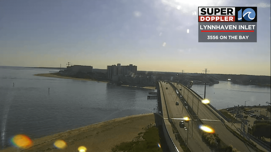
High pressure is still to our north with a stationary front far to our south.
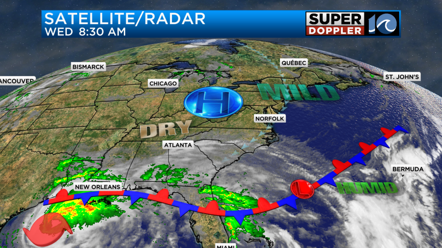
You can see hurricane Francine down in the Gulf of Mexico. I’ll talk more about that in a moment. We’ll have lots of sunshine today. There will be a light east/northeast breeze. High temps will be in the low 80s this afternoon with a few mid 80s inland.
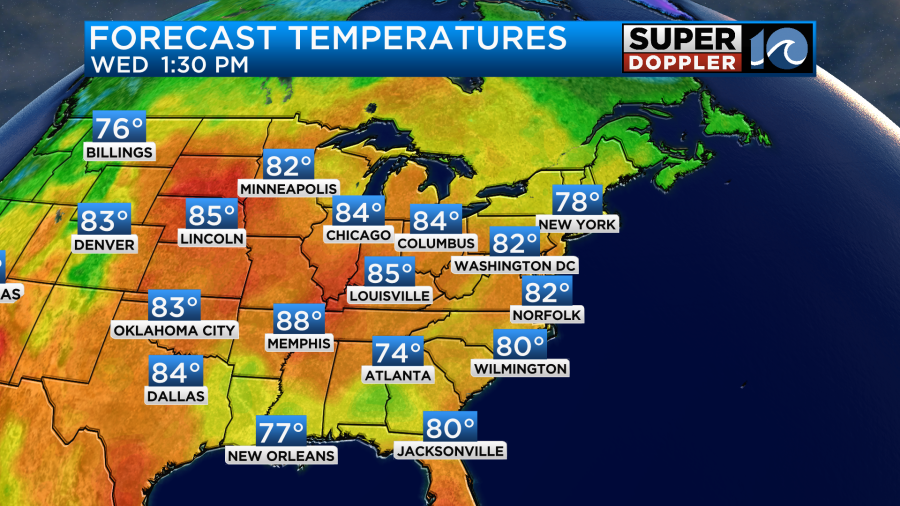
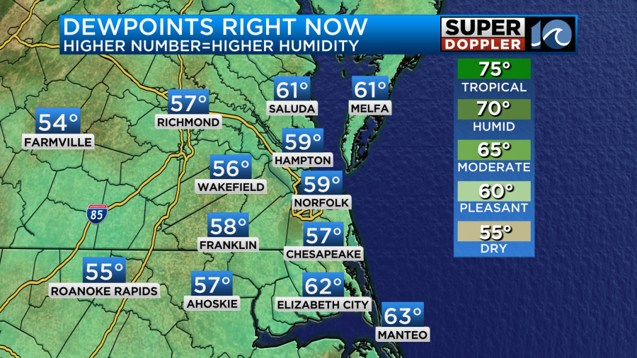
There will be a few upper 70s near the shore. Luckily, dew points are still down in the 50s.
So enjoy the dryness for one more day. By tomorrow the wind will still be light, but it will be more out of the east. This will allow for some more moisture to slowly build into the area. Also, moisture will be increasing in the upper levels. So we’ll be partly cloudy on Thursday. High temps will be near 80 degrees.
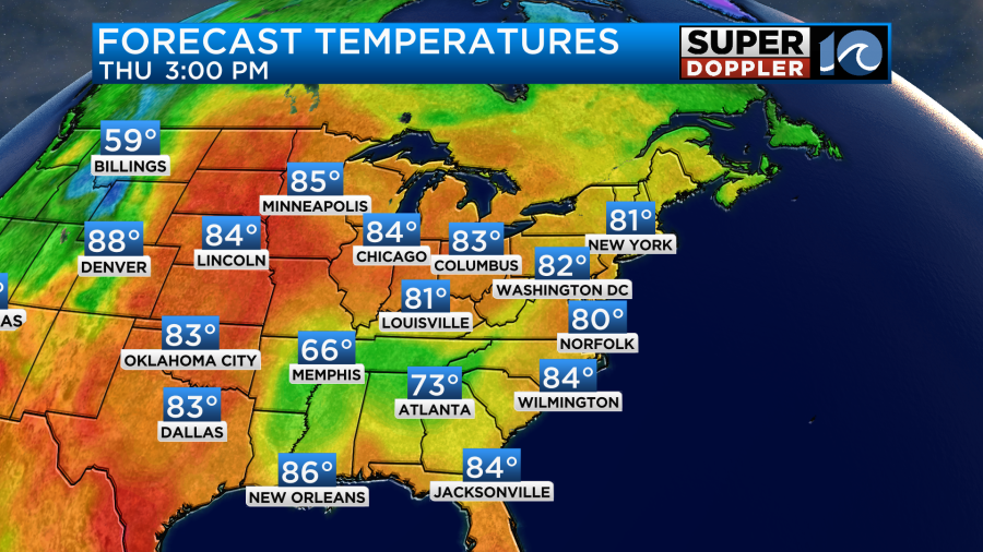
Humidity will increase even more as we go from Thursday into the weekend.
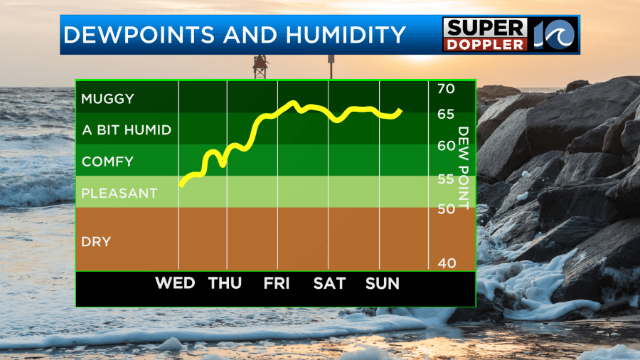
It will be back to the muggies by Friday. At least high temps will hold near 80. They may even be more in the upper 70s for a couple of days.
As far as rain goes… As the moisture increases Friday we may have some isolated rain showers in the area. I’m seeing isolated showers in southeast Virginia on Saturday with more coverage over northeast North Carolina on Saturday.
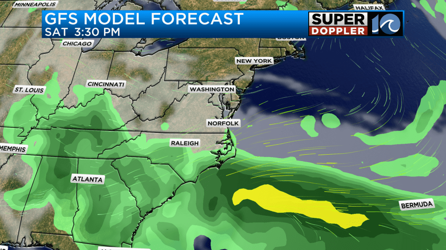
This is important because there are 2 huge football games Saturday. The ODU vs VA Tech game and also the Battle of the Bay (Norfolk State vs Hampton). So I’ll have a more detailed forecast for that in tomorrow’s weather blog. For now it’s looking like we’ll have some more isolated showers on Sunday. I’m going off the grid a bit here, but I do want to talk about early next week a little. The models are showing an area of low pressure forming offshore to our south. They have this moving north Monday into Tuesday.
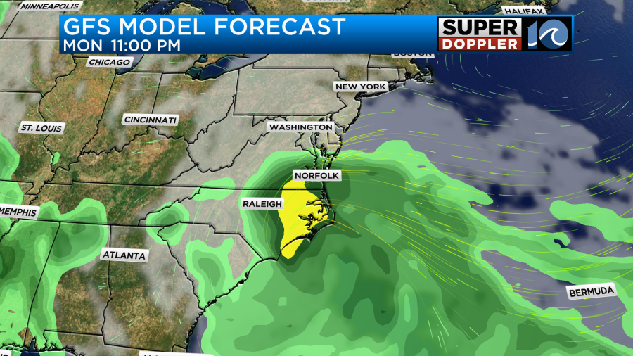
This could bring us a lot of much-needed rainfall to the region. However, it’s also possible that it could become a tropical storm. This is very far out for any good details, but I do have rain from that feature on the 7-Day forecast.
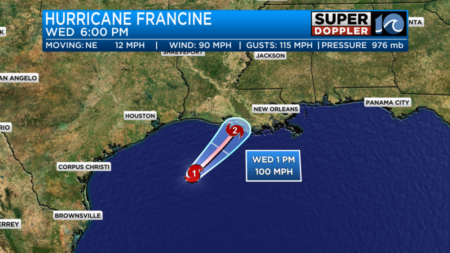
That low is not attached to Francine in any way. Francine is now a hurricane. This morning it was a category 1 in the western Gulf Of Mexico.
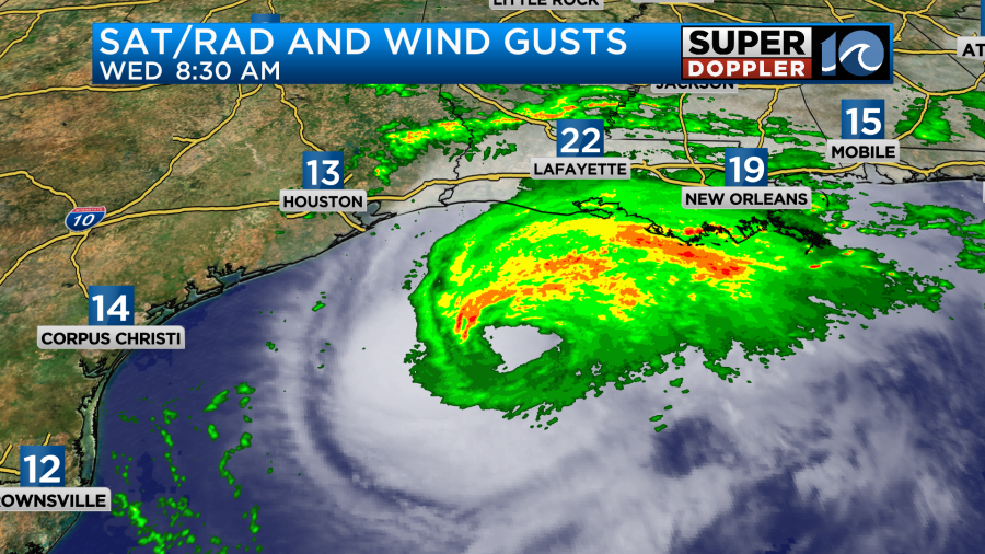
The rain bands have been moving onto land since yesterday. However, today the main rain shield is moving onto the coast of Louisiana. There has been a little dry air and some wind shear affecting the system from the southwest. So that’s why the bulk of the rain is on the northern side of the hurricane. It was a category 1 hurricane this morning with sustained winds of 90mph. The short-term forecast has some slight strengthening by this evening as it moves over some very warm Gulf waters. It could be a low-end category 2 upon landfall this evening.
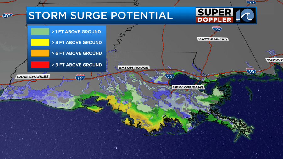
The storm surge forecast has decreased slightly, but there is still a large area with a surge of 6 to 9 feet.
On top of the storm surge there will be heavy downpours that could create flooding itself. After landfall, Francine will quickly weaken to a tropical storm and then a depression.
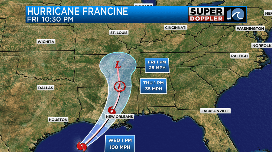
Between Thursday and Friday it will become a heavy rain maker over the area.
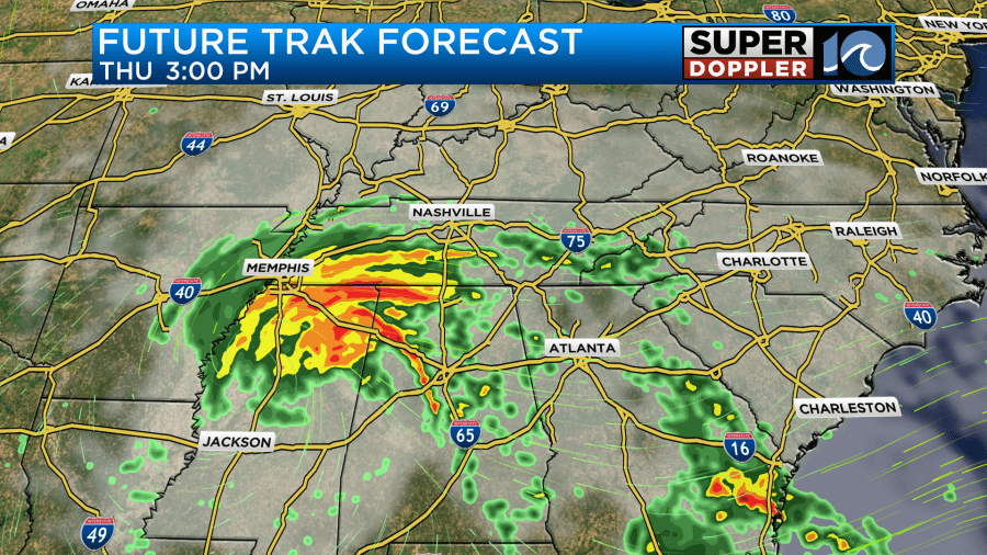
Rainfall over some parts of the region could reach up to a foot. Most locations down there will get about 3-8″ along its track.
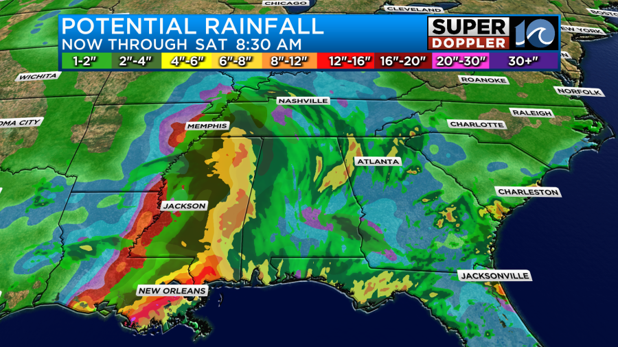
This will be good in the long run as they need rain down there, but it could be too much over southeast Louisiana and southern Mississippi. Francine should be a remnant low by Friday.
There are a few other disturbances in the Atlantic that could form into a system.
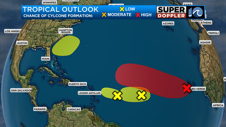
The one in the eastern Atlantic is the one with the highest chance of formation. Luckily, that one would probably stay out to sea.
Update: The National Hurricane Center has deemed the disturbance in the eastern Atlantic as Tropical Depression 7. Here is the track.
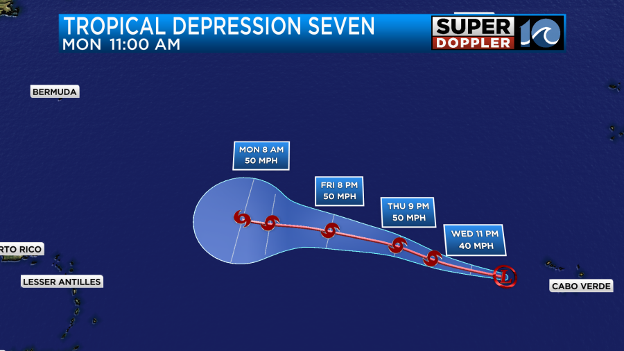
The small patch close to the east coast is that area of low pressure next week that I talked about earlier in the blog. We’ll have to watch the models closely as we go into and through the weekend to see what it does. Stay tuned for updates.
Meteorologist: Jeremy Wheeler


