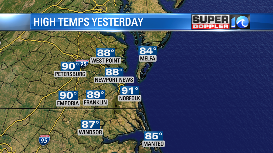
Yesterday was hot and humid for this time of year. The high temps ended up hitting the upper 80s to low 90s, but the heat indices were in the mid 90s.
We didn’t break any records, but it was hot for early-to-mid September. Today a cool front will be slowly sinking to the southeast.
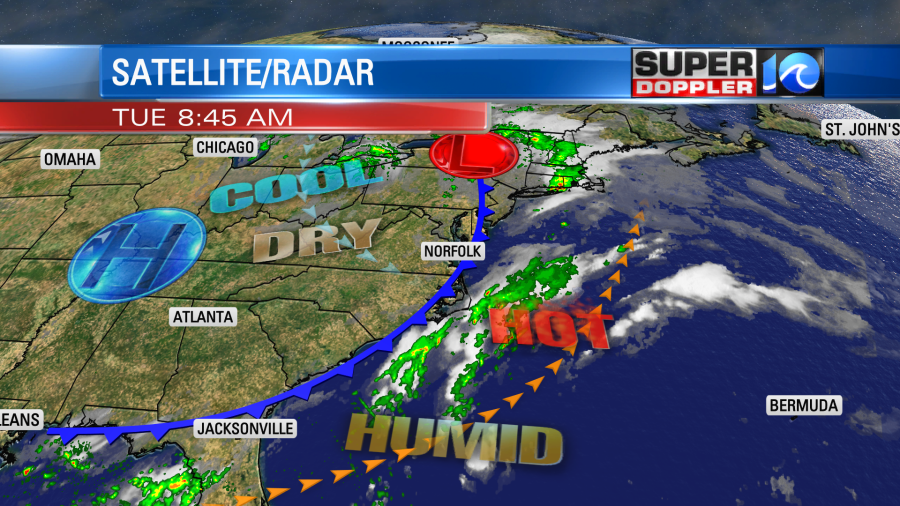
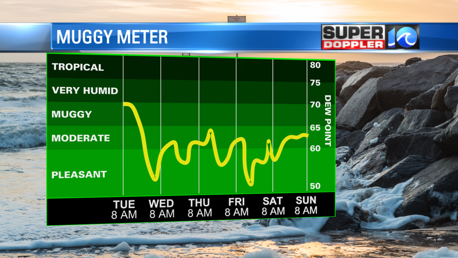
We’ll dry things out nicely through the day. Dew points were near 70 this morning. They will drop to the 50s by the end of the day. That will feel awesome!
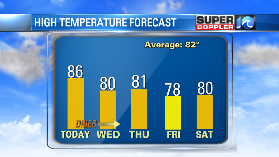
Temperatures will cool down a little. High temps will be in the mid-upper 80s this afternoon.

It will feel much better once that drier air moves in. We’ll have a steady west then northwest wind at 8-12mph. There will only be a stray shower in the region as the front slips southward.
After that we are looking at some great weather for a few days. Humidity will stay down. High temps will be in the upper 70s to low 80s, and we’ll have fair skies.
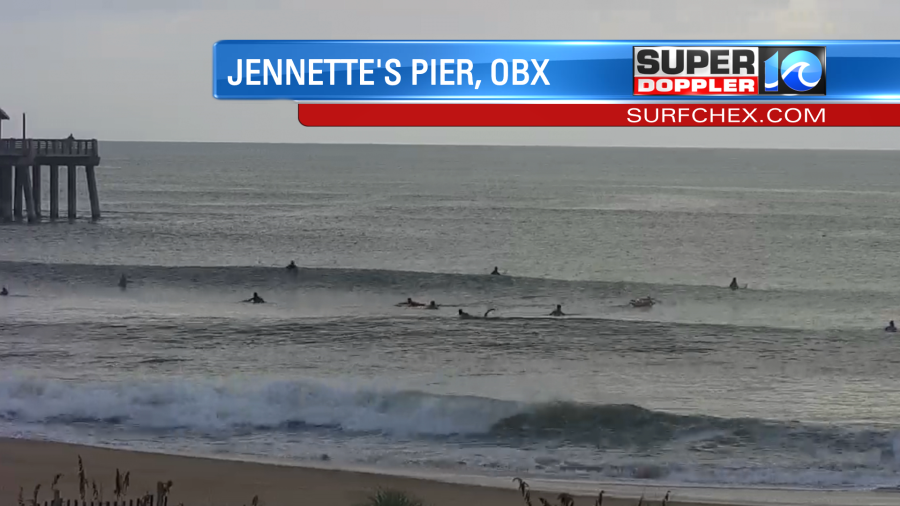
More good news…Sort of. The surf is up. This morning there were some really nice waves for surfers across the Outer Banks. Waves looked like they were running at about 4-6 ft. There were some nice sets with a lot of curls. Here is what it looked like on the cameras from Surfchex.com. This was Jennette’s Pier around 8:30am.
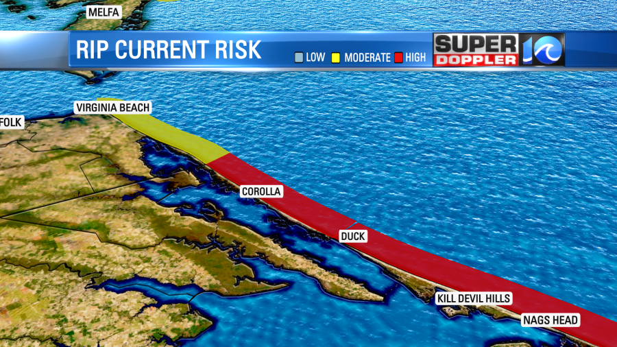
The problem is that there is a high threat for rip currents along the Outer Banks. The rough surf will be too dangerous for swimmers. Experienced surfers only. The rip current threat is moderate in Virginia Beach.
There are no named storms in the Atlantic basin right now. However, there are two tropical disturbances that we are watching. There is one in the middle of the Atlantic and one in the eastern Atlantic. They are both moving to the west/northwest.
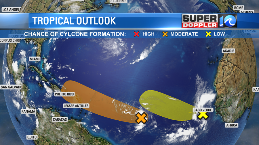
The one in the eastern Atlantic has some dry/dusty air just to the north of it. So it has a low chance of formation. However, the one in the middle of the Atlantic is not encountering that. It has gained a little strength and organization since yesterday. So it has a medium chance of formation over the next 2-4 days. The European and GFS model don’t do much with it. However, we’ll have to watch it as it could get close to Puerto Rico, and possibly closer to the U.S. down the road.
Meteorologist: Jeremy Wheeler


