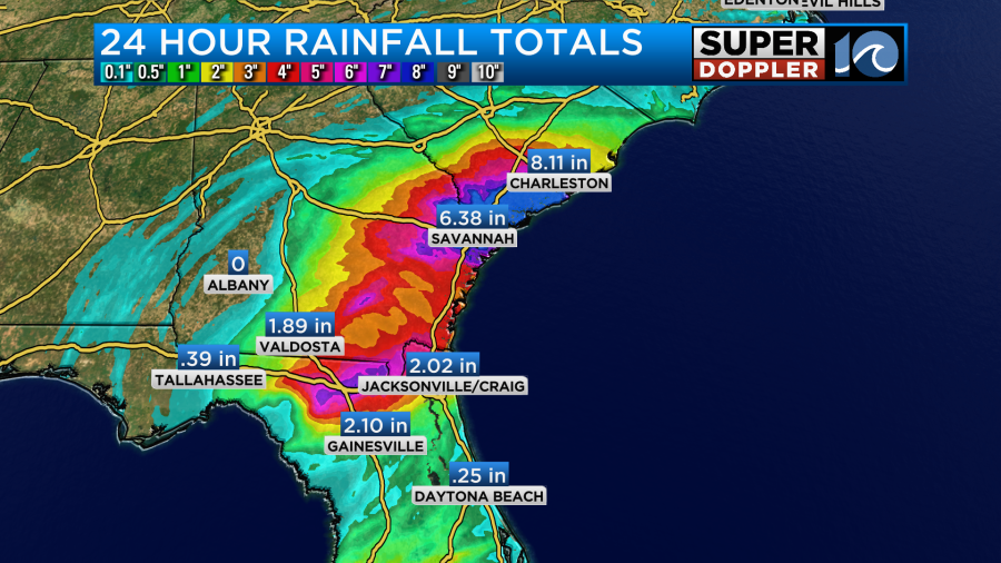
So far Debby’s winds have created some damage across the Florida Coast, and there has been some tidal flooding and general flooding from its rainfall over parts of the Southeast. Debby has dropped about 5-10 inches of rainfall so far in areas from north Florida up to coastal South Carolina.
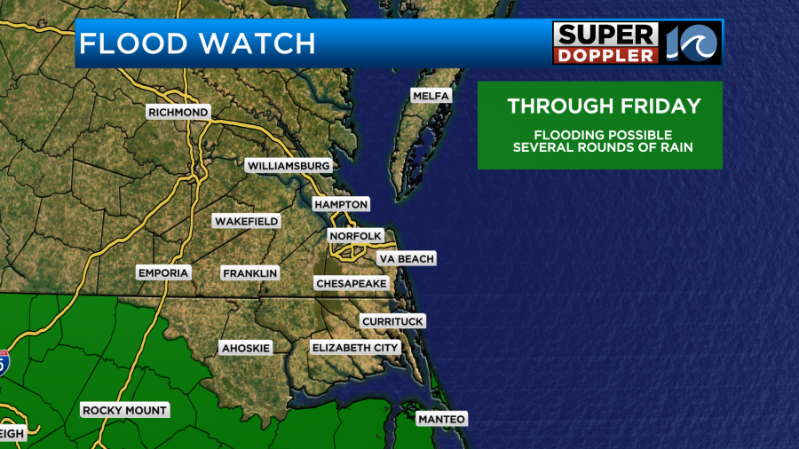
Before it’s all said and done, Debby may drop up to 30 inches of rainfall over coastal South Carolina. Our rainfall up this way could be heavy at times, but we won’t see anything close to those amounts. There may be some isolated flooding up this way though. There is already a Flood Watch in effect for Mainland Dare county and Outer Banks Dare between today and Friday.
While the center of Debby is all the way down towards coastal Georgia the rain (and heavy rain) extend far from the center.
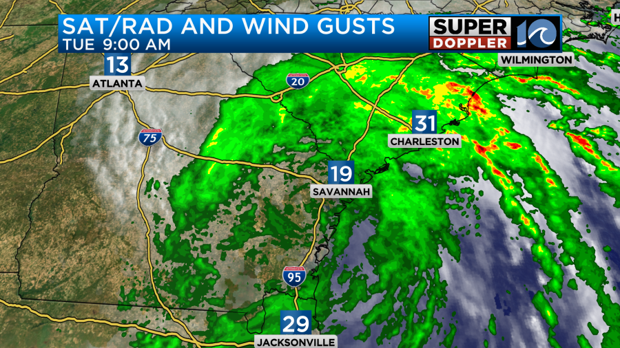
This is why we may still have quite a bit of rain in our region over the next couple of days. Debby is forecast to track offshore for a short time. Then it will move back to the northwest late Thursday into early Friday.
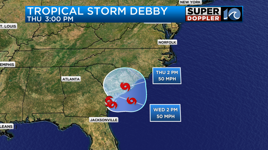
During that time Debby should increase in strength a little bit. It’s doubtful that it would get back up to hurricane status, but the chance isn’t zero. After it moves back inland it should begin to weaken again. It will be cut off from its fuel source. Plus, it should start to move over some higher terrain Thursday into Friday. At that point it will also start interacting with a stalled out cool front. This is likely why the system should weaken. However, heavy rain could continue to fall. It may even be enhanced near the front for a time. Debby should move faster to the northeast between Friday and Saturday as it turns into a weak non-tropical low.
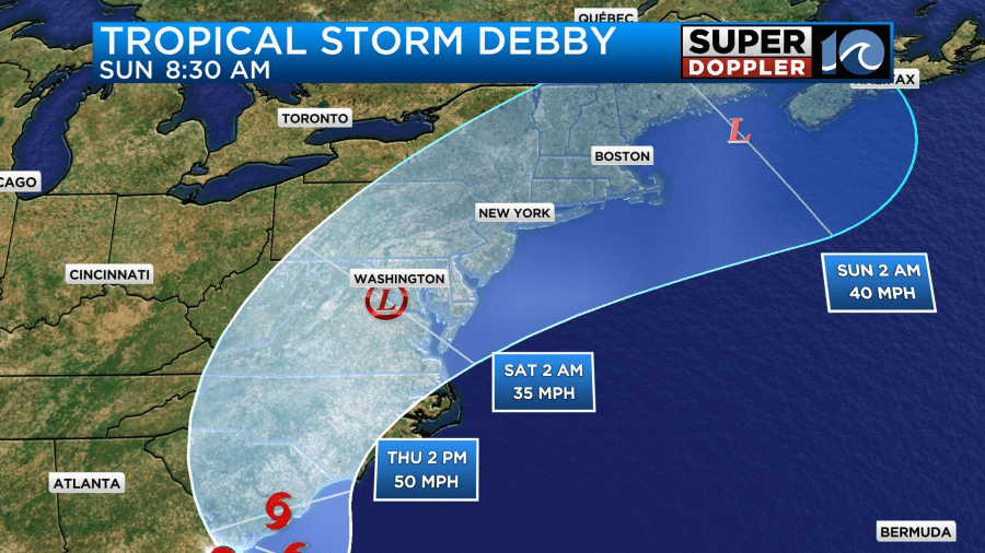
The latest models still have a lot of disagreement, but they are starting to come together a bit. Plus, the themes are solidifying. Here are some of the track models.
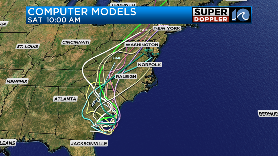
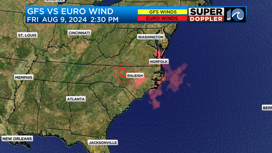
They all tend to have the trend of east over the water and then northwest over land. Then they move Debby to the northeast. There are still a few exceptions. The GFS model still has it staying mainly to our southwest before falling apart. Let’s look at that model and compare it to the European model. They are still in good agreement in the short-term.
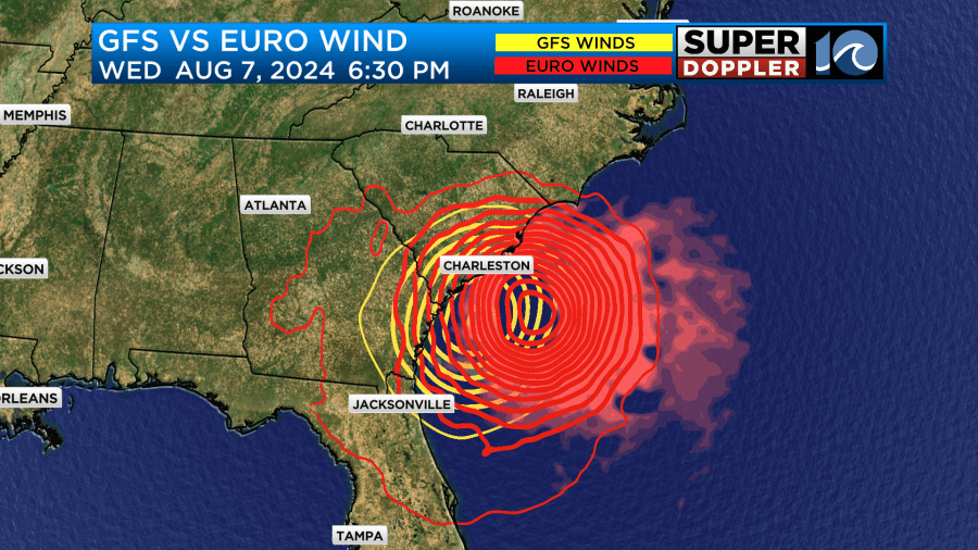
They start to split though by Thursday. Then the split is more pronounced by Thursday evening.
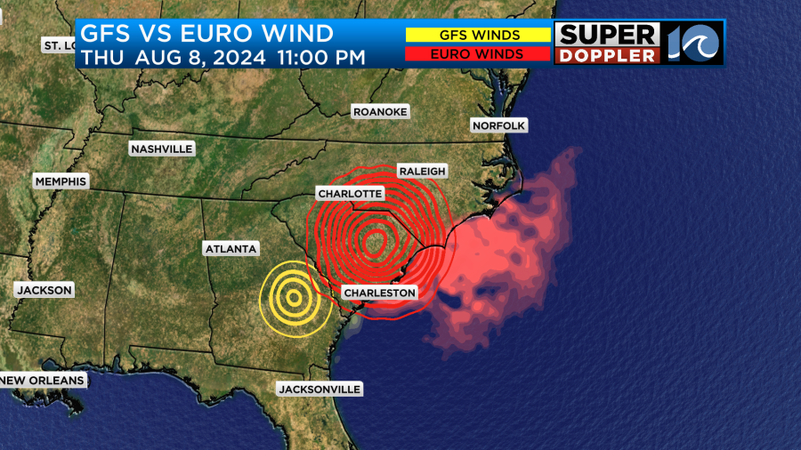
The GFS basically kills off the system down to our southwest as it gets absorbed into the cool front. The Euro has it stronger and closer for a time, but rapidly weakens the low by early Saturday.
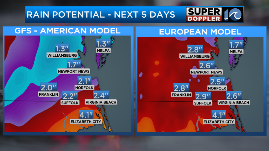
There is still a difference in the rainfall between the two, but it’s not as polarized as yesterday.
I think the tides should be pretty normal overall. The winds shouldn’t be too strong, and they won’t be from the north or northeast (probably). However, the winds will be out of the south for a time. This may set us up for some minor tidal flooding across the north end of the Albemarle Sound up into southern Virginia Beach. However, there will be some rough surf over the southern Outer Banks today and probably for the next 3-4 days.
Locally we have high pressure offshore. There is a cool front over the Midwest.
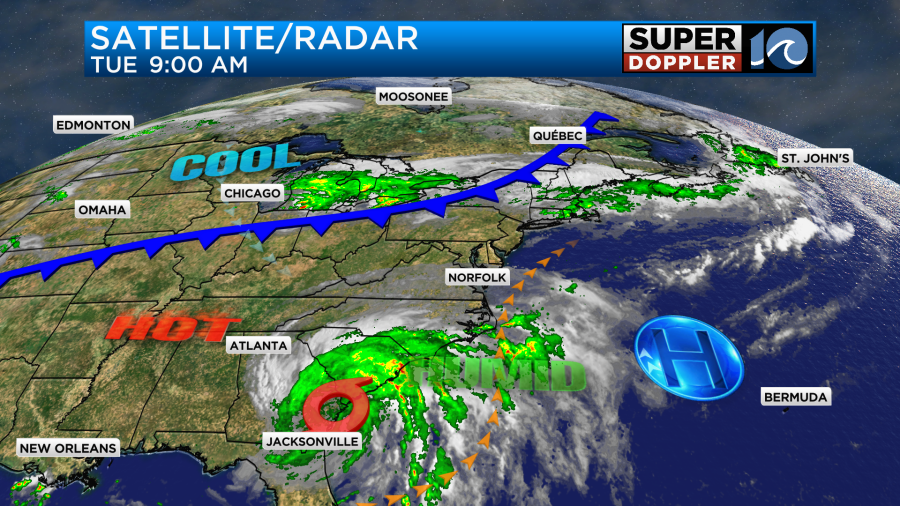
We’ll have a mix of sun and clouds today. There will be some scattered showers and storms coming up from the south. This could start as early as the late morning over North Carolina, but it should be more in the afternoon for southeast Virginia.
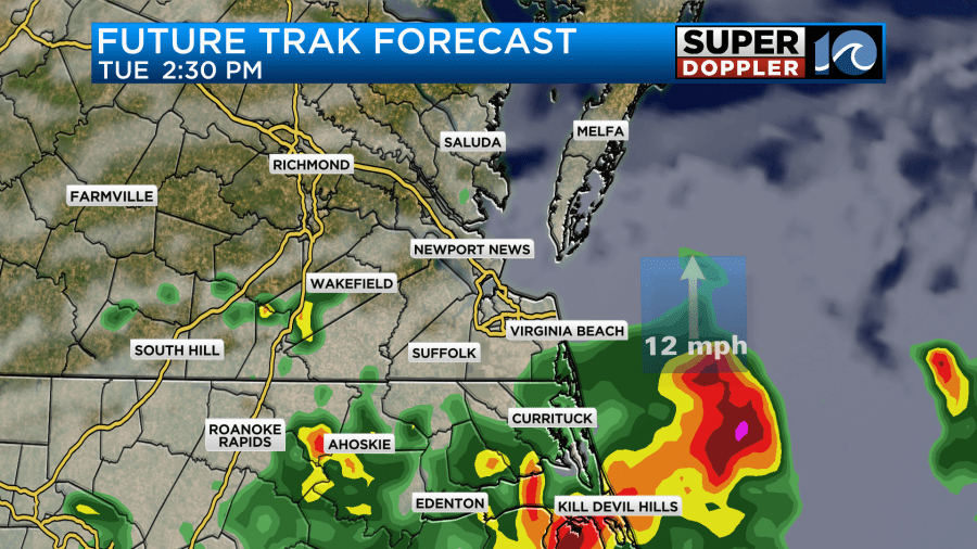
There is a higher chance for rain today over North Carolina with less of a chance north of the metro.
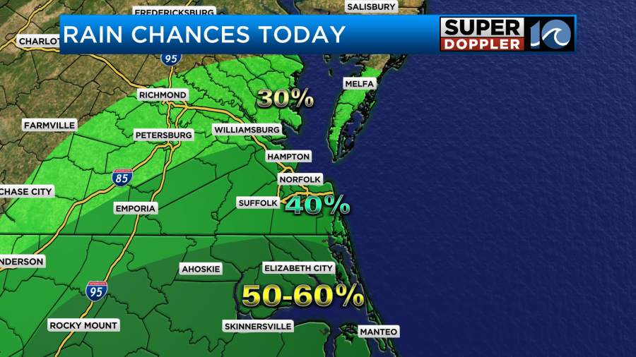
There will be some more scattered showers into the evening. High temps will be in the mid-upper 80s, but the heat index will still be in the low-mid 90s.
We’ll have a light south wind at 5-10mph.
We’ll have similar weather tomorrow. There will be more rounds of showers and storms coming up from the south form time to time.
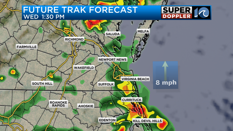
Heavy rain will again be possible. There should be more cloud cover overall. So I only have the high temps in the low-mid 80s. It likely won’t feel refreshing though as the humidity stays up for a few more days.
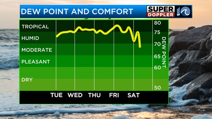
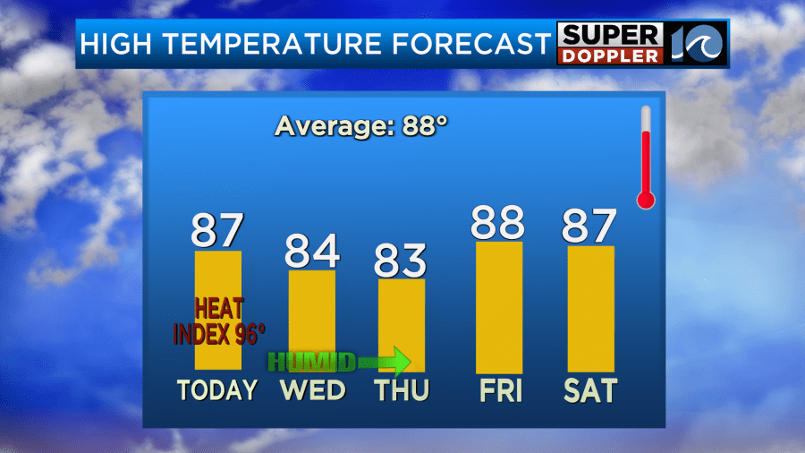
Friday’s forecast is a bit up in the air. There is a decent chance for rain still, but that chance will depend on the track of Debby. For now I have a high chance for rain with lots of clouds, but we’ll have to wait for updates to see the finer details. It also looks wet for part of Saturday, but it’s possible that Debby or the remnants of Debby will start moving out of the area. We should start drying out by Sunday. Literally.
We’ll have plenty of updates on Debby over the next 24-48 hours. Stay tuned.
Meteorologist: Jeremy Wheeler


