Busy, busy… That’s how the weather was this morning. We’ve had some real downpours in the last 24 hours over parts of the area. We’ve also been tracking hurricane Beryl and tropical storm Chris. Let’s talk about it.
We were very hot and humid for the last 2 days. Before the rain and storms arrived yesterday we ended up hitting 97 degrees. Then the storms fired up during the afternoon. There were some strong winds and heavy rain.
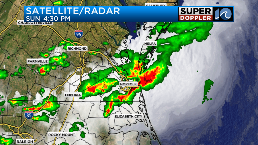
The rain tapered off for a while last night. Then the rain picked up again early this morning.

The downpours created a lot of slow downs and some accidents. The rain lightened up by 8am, but there were still some scattered showers. Aside from that the beneficial rain has added up in the rain gauges. We have had about 1-3″ over a lot of the metro area in the last 24 hours. Some locations have had about 4-5″ in that time.
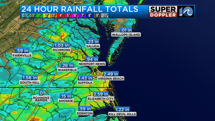
Norfolk has had about 2.9″ so far.
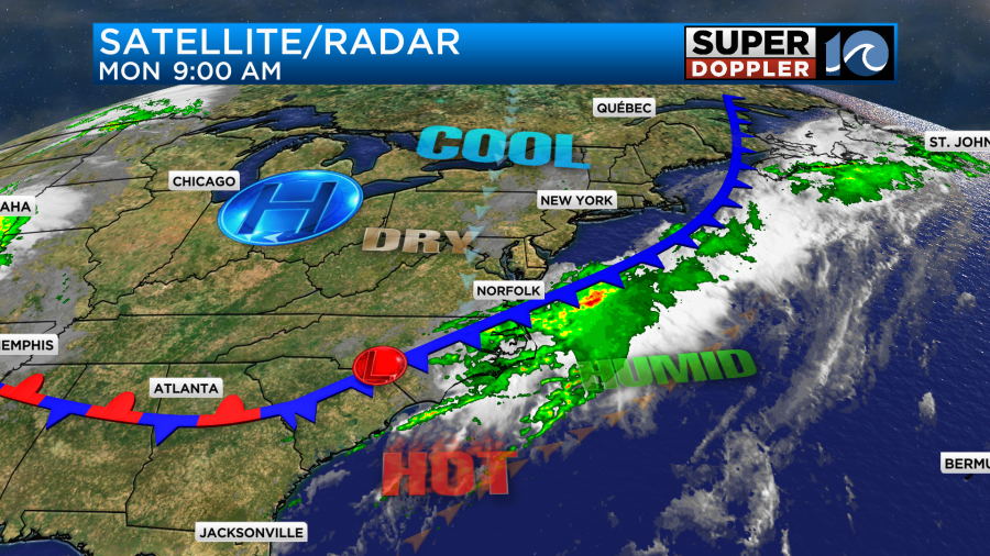
These showers will steadily drop to the south as we go into the midday hours. Then we’ll be partly sunny this afternoon. It is going to be much cooler today. A cold front will sink into North Carolina soon.
High temps will only be in the upper 70s to low 80s this afternoon.
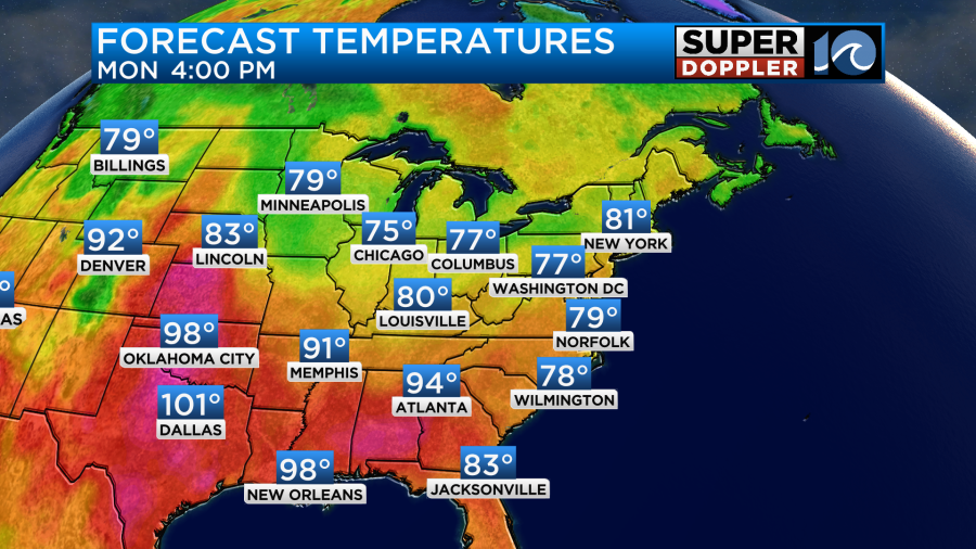
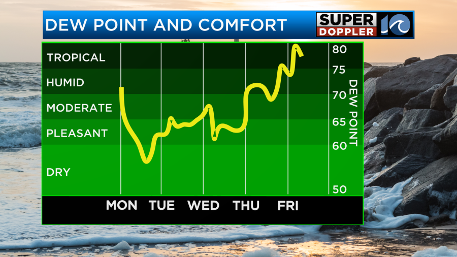
This is a big drop compared to yesterday. The humidity is also going to drop sharply behind the front. Dew points are already dropping into the low 60s. They will fall to the 50s by this evening.
Winds will be strong at times. They will run at 10-15mph with gusts to 20mph. There will be some gusts to 25mph near the shore.

Things will settle down by this evening. It should be pleasant for dinner outside and for the evening commuters. Overnight we’ll drop down to the 60s with mostly clear skies. There might be a few 50s inland.
Tomorrow will be awesome! We’ll be mostly sunny as high pressure builds into the region. There will be a light northeast breeze with high temps in the low 80s.
It will probably feel like a late Spring day! Dew points will be in the 50s. Enjoy!
We’ll have more nice weather on Wednesday. High temps will rise to the mid 80s. We’ll still be fairly dry with a good amount of sunshine.
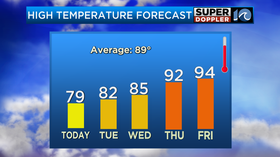
We will heat up by the 4th of July. High temps will return to the low 90s. The weather is looking quiet during the day, but there may be some isolated showers or storms by the evening. We’ll see. I’ll have more on that in tomorrow’s weather blog.
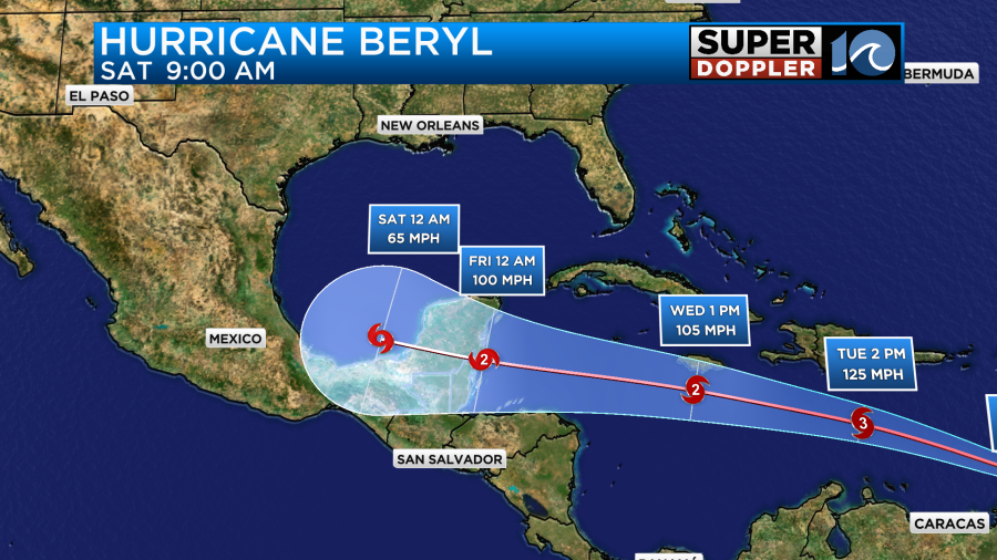
The tropics are heating up. Tropical Depression Chris is falling apart, but it is still bringing heavy rain and some flooding to the east coast of Mexico. Meanwhile hurricane Beryl is a major hurricane near the Lesser Antilles.

Hurricane Beryl became the earliest hurricane to reach category 4 status on record. It did briefly weaken to a category 3 this morning, but then it went back up to a cat 4 as it underwent an eyewall replacement cycle. The hurricane will affect the islands of Barbados and Grenada today. Then it will move west.
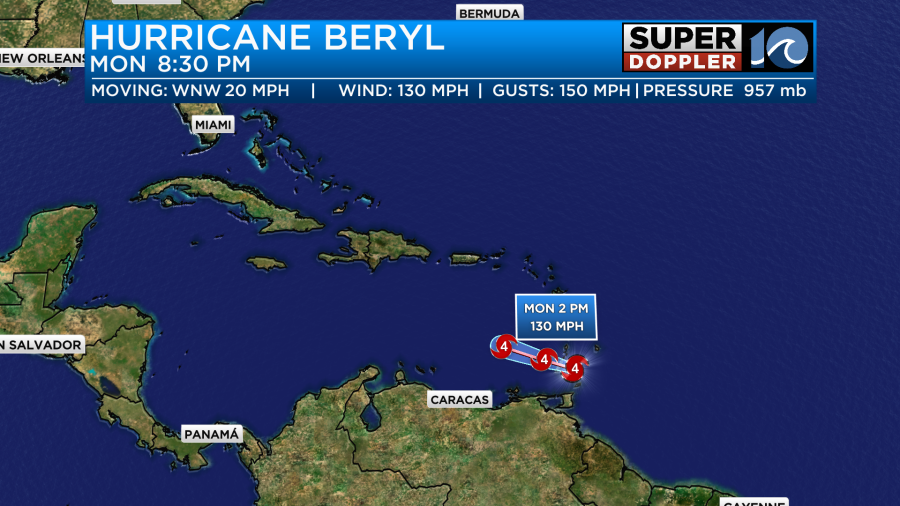
It is forecast to pass south of Jamaica around Wednesday. It should pass south enough of the island that they will be spared the hurricane forced winds.
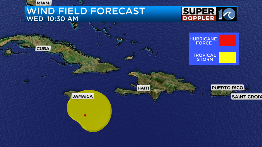
However, there is still some uncertainty in the models at that point.
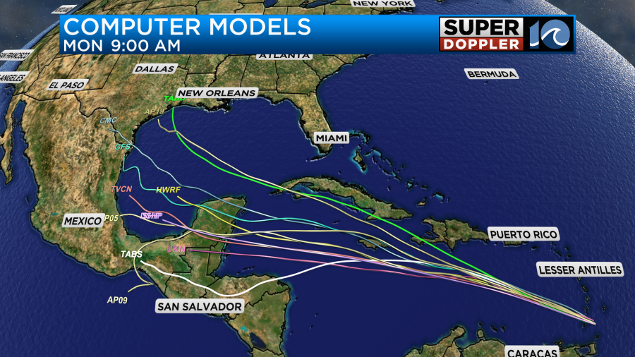
It is then forecast to move towards the Yucatan Peninsula in a few days.
We’ll keep an eye on the tropics over the next few days.
Meteorologist: Jeremy Wheeler